Extended Description of the Vector Map
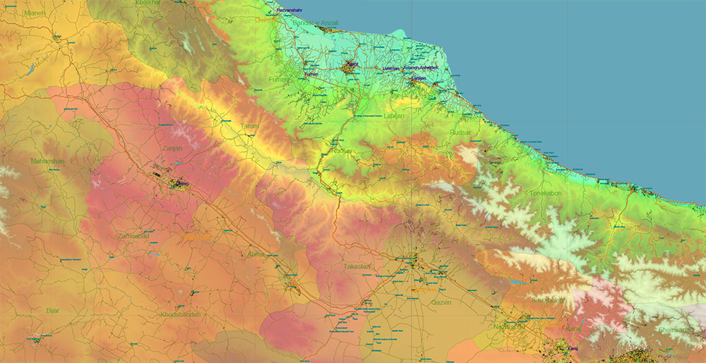
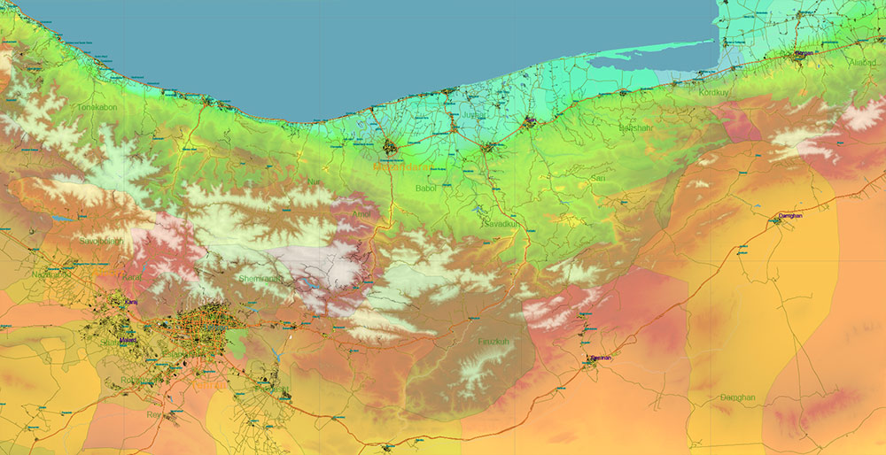
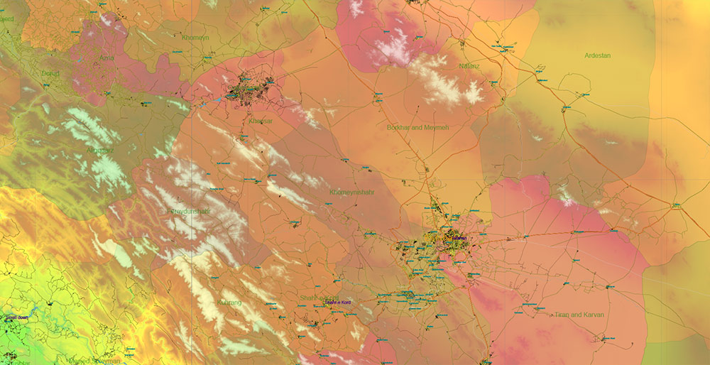
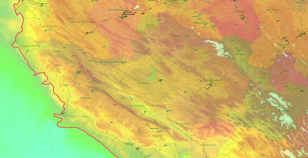
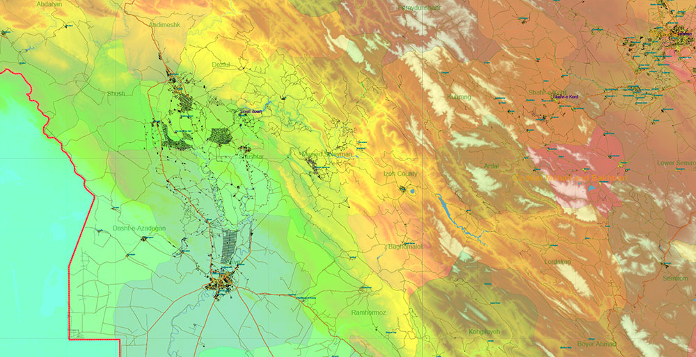
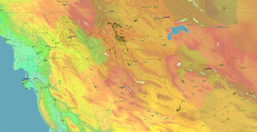
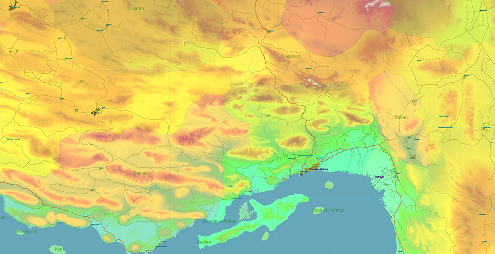
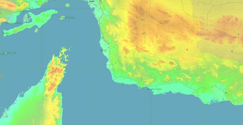
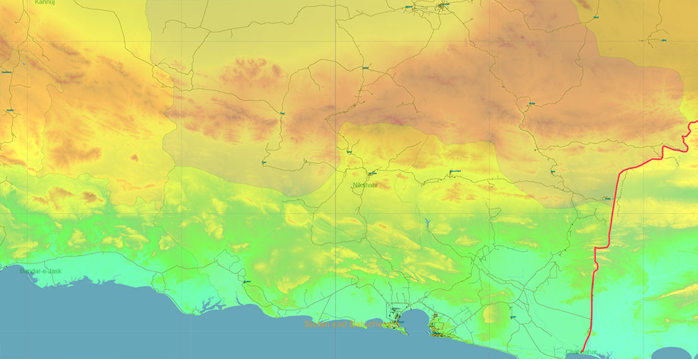
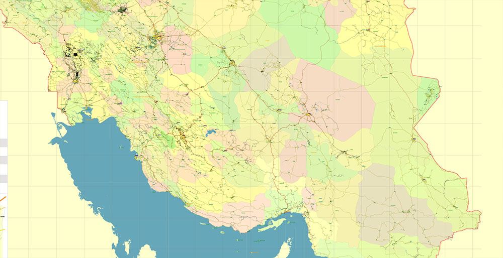
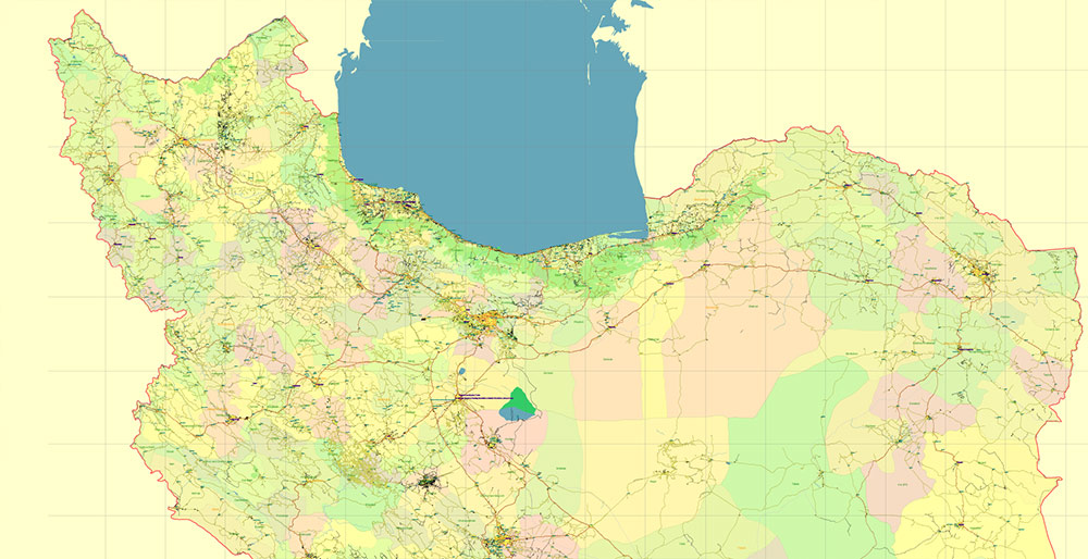
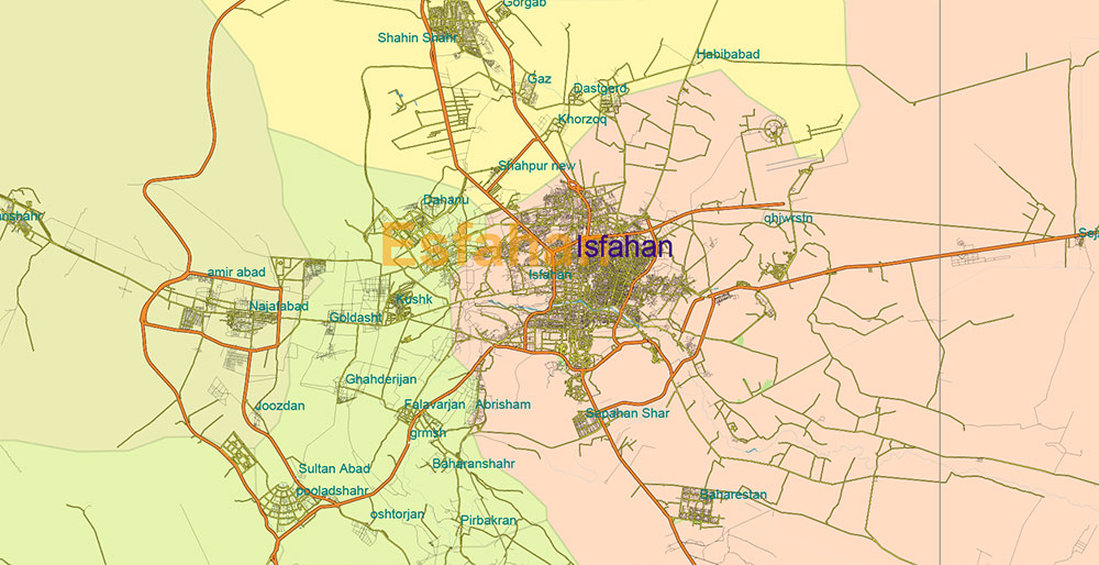
Printable Colored Relief Vector Map of Iran, High Detailed Plan full editable Adobe Illustrator Road Admin Map in layers, scalable, text format all names, 216 MB ZIP
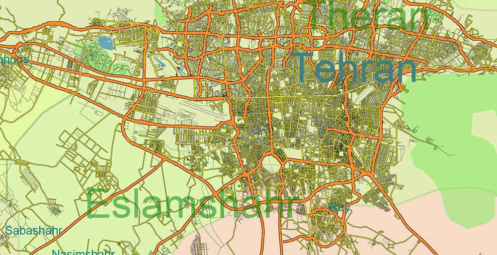
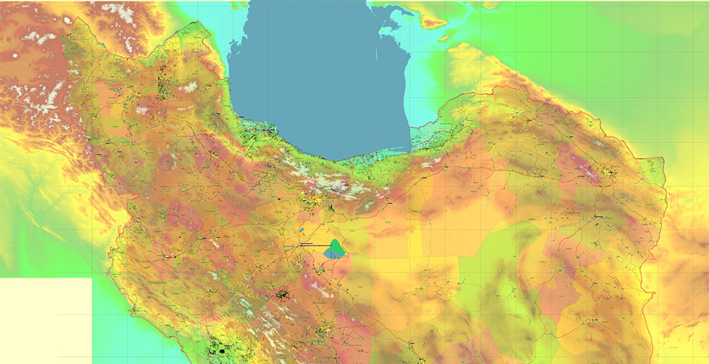
All streets and roads, Principal Roads and Main Streets, Main Cities and Towns, Main Objects, Admin areas 1, Admin areas 2, raster Colored Relief HD. Map for design, printing, arts, projects, presentations, for architects, designers, and builders, business, logistics.
The most exact and detailed map of the state in scale.
For Editing and High-Quality Printing, Royalty free
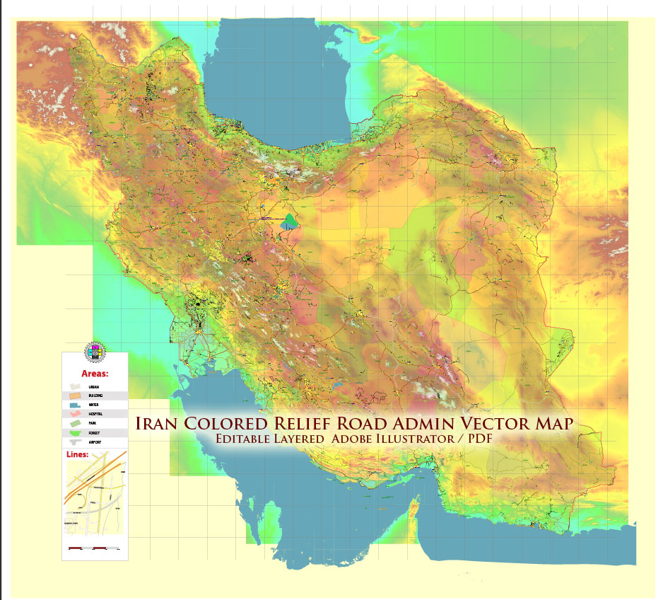
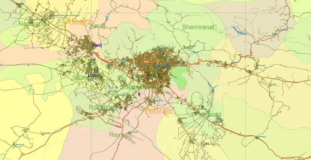
Iran Map Vector Exact Colored Relief and Roads High Detailed Map Admin areas levels 1,2, editable Adobe Illustrator in layers
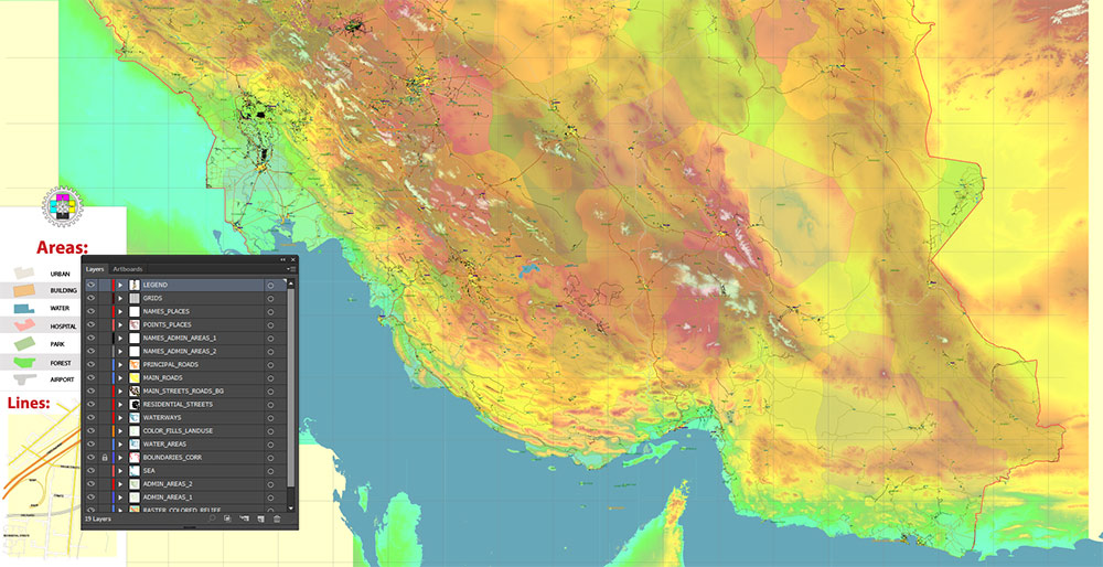
Layers list:
- Legend
- Grids
- Names of places (city, town, etc.)
- Points of the Cities and Towns
- Names of Admin areas level 1
- Names of Admin areas level 2
- Principal Streets and Main Roads 2
- Residential streets and roads
- Water objects (rivers, lakes, ponds)
- Waterways
- Color fills (parks, hospital areas, school areas, land use, etc.)
- Admin Areas level 2
- Admin Areas level 1
- Colored Relief Raster PNG HD Tiles
- Background
Iran Map Vector Exact Colored Relief and Roads High Detailed Map Admin areas levels 1,2, editable Adobe Illustrator in layers
IRAN — STATISTICAL / CARTOGRAPHIC AO BRIEF
1) Location & Spatial Identity
| Parameter |
Value |
| Official name |
Islamic Republic of Iran |
| Region |
Western Asia / Middle East |
| Coordinates (center approx.) |
32° N, 53° E |
| Total area |
~1,648,000 km² |
| Global rank by area |
~17th |
| Coastline length |
~2,400 km (Persian Gulf + Gulf of Oman + Caspian Sea) |
| Land borders |
~5,900 km |
Bordering states (7): Iraq, Turkey, Armenia, Azerbaijan, Turkmenistan, Afghanistan, Pakistan
2) Relief & Physical Geography
| Feature |
Data |
| Elevation range |
−28 m (Caspian depression) to ~5,610 m (Mount Damavand) |
| Major mountain systems |
Zagros, Alborz, Kopet Dag |
| Central terrain |
High plateau (1,000–1,500 m avg) |
| Deserts |
Dasht-e Kavir, Dasht-e Lut |
| % mountainous terrain |
~55% |
| % arid/semi-arid land |
>70% |
Cartographic character: Mountain-ringed plateau with desert core and coastal lowlands.
3) Hydrography
| Element |
Notes |
| Permanent large rivers |
Few (Karun most significant) |
| Drainage type |
Mostly endorheic basins |
| Major water body north |
Caspian Sea |
| Major water body south |
Persian Gulf / Gulf of Oman |
| Water scarcity |
Structural national constraint |
4) Population & Demography
| Indicator |
Value |
| Population |
~88–90 million |
| Global rank |
~17th |
| Urbanization rate |
~75% |
| Median age |
~32 years |
| Population density |
~55 people/km² |
| Annual growth rate |
Low–moderate (~1%) |
Largest cities (metro populations approx.):
| City |
Population |
| Tehran (capital) |
9–14 million metro |
| Mashhad |
~3.5 million |
| Isfahan |
~2 million |
| Karaj |
~2 million |
| Shiraz |
~1.8 million |
| Tabriz |
~1.7 million |
| Ahvaz |
~1.3 million |
5) Ethnic Composition (Approx.)
| Group |
Share |
| Persians |
~60–65% |
| Azeris |
~15–20% |
| Kurds |
~10% |
| Lurs, Baloch, Arabs, Turkmen, others |
remainder |
6) Religion
| Religion |
Share |
| Shia Islam |
~90%+ |
| Sunni Islam |
~5–10% |
| Others (Christian, Jewish, Zoroastrian, etc.) |
small minorities |
Religion is a major structural component of governance and law.
7) Political Structure
| Element |
Description |
| System |
Theocratic republic |
| Supreme authority |
Supreme Leader |
| Executive |
President + cabinet |
| Legislature |
Islamic Consultative Assembly |
| Administrative divisions |
31 provinces |
8) Transportation Network — Quantitative
Roads
| Metric |
Value |
| Total road network |
~220,000 km |
| Expressways/highways |
Expanding national network |
| Major corridors |
Tehran–Isfahan–Shiraz; Tehran–Tabriz; Tehran–Mashhad; Tehran–Ahvaz |
Rail
| Metric |
Value |
| Rail network length |
~14,000 km |
| Major nodes |
Tehran, Mashhad, Isfahan, Tabriz, Bandar Abbas |
| International connections |
Turkey, Turkmenistan, Pakistan |
Air
| Metric |
Value |
| Major international airports |
Tehran (IKA), Mashhad, Shiraz, Isfahan |
| Total airports |
50+ civil fields |
Maritime
| Ports (major) | Bandar Abbas, Bushehr, Khorramshahr |
| Strategic waterway | Strait of Hormuz (south) |
9) Economy — Structural Overview
| Sector |
Role |
| Oil & gas |
Core export sector |
| Manufacturing |
Automobiles, steel, cement |
| Agriculture |
Wheat, pistachios, fruits |
| Services |
Growing urban sector |
10) Climate & Environmental Zones
| Zone |
Coverage |
| Arid desert |
Central plateau |
| Mountain alpine |
Zagros/Alborz highlands |
| Mediterranean-type |
NW regions |
| Humid subtropical |
Caspian coast |
| Climate fact |
Data |
| Avg annual rainfall |
~250 mm (high variation) |
| Temperature range |
−20°C mountains to >45°C deserts |
11) Strategic Geography
| Factor |
Significance |
| Controls north side of Persian Gulf |
Energy shipping proximity |
| Strait of Hormuz access |
Global oil chokepoint |
| Mountain barriers |
Natural defense lines |
| Central plateau |
Internal transport funneling |
12) Cartographic Summary
Iran maps as:
A large, mountain-framed plateau state with dense population clusters along transport corridors and resource-rich southern lowlands, structured around a strong central capital and regional urban nodes.
Defining map traits:
-
Large area with high relief contrast
-
Sparse central deserts vs dense urban corridors
-
Strong highway and rail axes radiating from Tehran
-
Dual maritime orientation (Caspian north, Persian Gulf south)
Iran Map Vector Exact Colored Relief and Roads High Detailed Map Admin areas levels 1,2, editable Adobe Illustrator in layers
Iran Map Vector Exact Colored Relief and Roads High Detailed Map Admin areas levels 1,2, editable Adobe Illustrator in layers
Iran Map Vector Exact Colored Relief and Roads High Detailed Map Admin areas levels 1,2, editable Adobe Illustrator in layers
Iran Map Vector Exact Colored Relief and Roads High Detailed Map Admin areas levels 1,2, editable Adobe Illustrator in layers
Iran Map Vector Exact Colored Relief and Roads High Detailed Map Admin areas levels 1,2, editable Adobe Illustrator in layers
Iran Map Vector Exact Colored Relief and Roads High Detailed Map Admin areas levels 1,2, editable Adobe Illustrator in layers
Iran Map Vector Exact Colored Relief and Roads High Detailed Map Admin areas levels 1,2, editable Adobe Illustrator in layers
Iran Map Vector Exact Colored Relief and Roads High Detailed Map Admin areas levels 1,2, editable Adobe Illustrator in layers
Iran Map Vector Exact Colored Relief and Roads High Detailed Map Admin areas levels 1,2, editable Adobe Illustrator in layers
Iran Map Vector Exact Colored Relief and Roads High Detailed Map Admin areas levels 1,2, editable Adobe Illustrator in layers
Iran Map Vector Exact Colored Relief and Roads High Detailed Map Admin areas levels 1,2, editable Adobe Illustrator in layers
Iran Map Vector Exact Colored Relief and Roads High Detailed Map Admin areas levels 1,2, editable Adobe Illustrator in layers
Iran Map Vector Exact Colored Relief and Roads High Detailed Map Admin areas levels 1,2, editable Adobe Illustrator in layers
Iran Map Vector Exact Colored Relief and Roads High Detailed Map Admin areas levels 1,2, editable Adobe Illustrator in layers
Iran Map Vector Exact Colored Relief and Roads High Detailed Map Admin areas levels 1,2, editable Adobe Illustrator in layers

 Author: Kirill Shrayber, Ph.D. FRGS
