Extended Description of the Vector Map
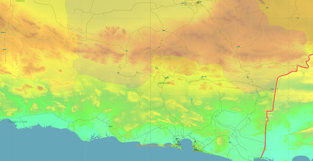
Printable Colored Relief PDF Vector Map of Iran, High Detailed Plan full editable Adobe PDF Road Admin Map in layers, scalable, text format all names, 493 MB ZIP
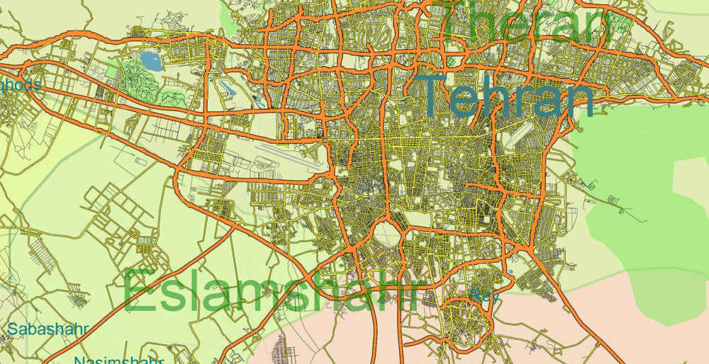
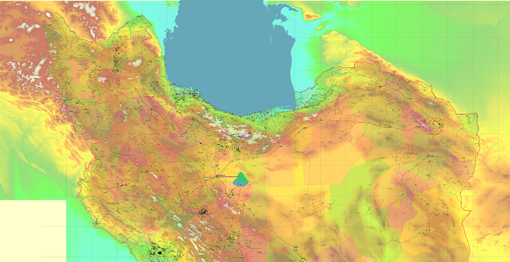
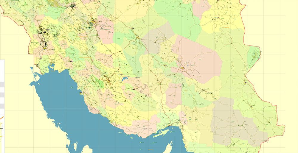
All streets and roads, Principal Roads and Main Streets, Main Cities and Towns, Main Objects, Admin areas 1, Admin areas 2, raster Colored Relief HD. Map for design, printing, arts, projects, presentations, for architects, designers, and builders, business, logistics.
The most exact and detailed map of the state in scale.
For Editing and High-Quality Printing, Royalty free
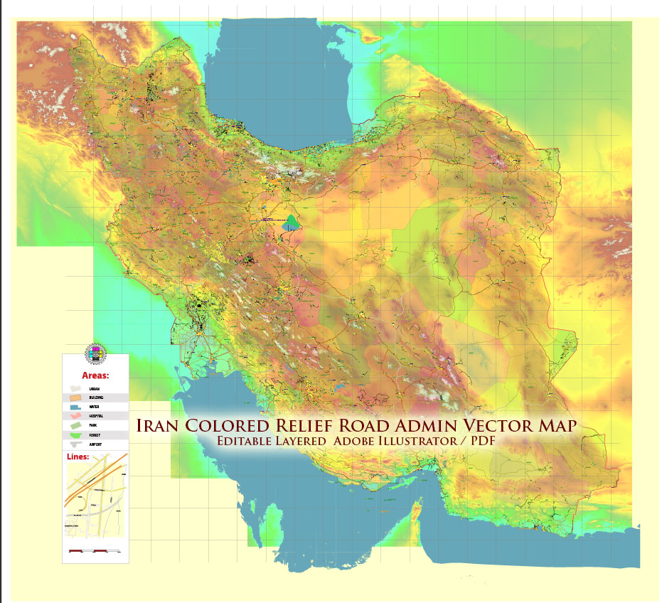
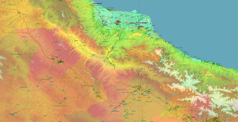
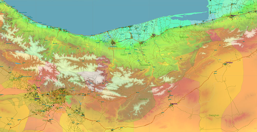
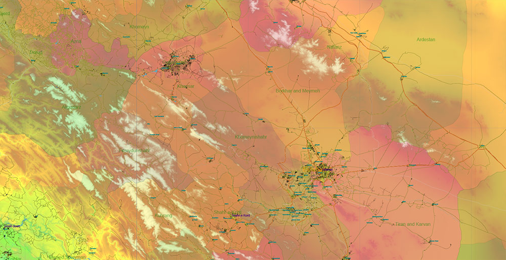
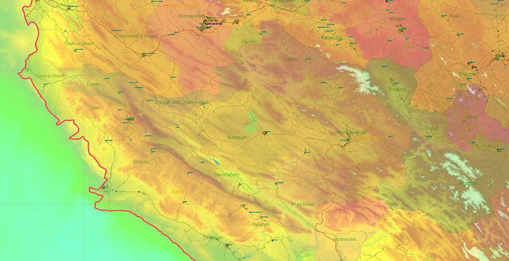
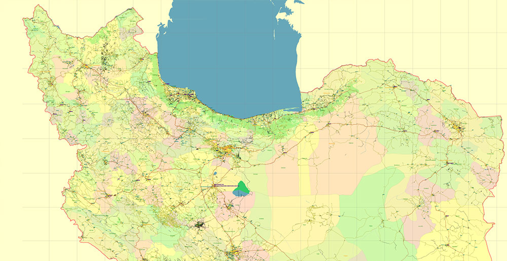
Iran Map Vector Exact Colored Relief and Roads High Detailed Map Admin areas levels 1,2, editable Adobe Illustrator in layers
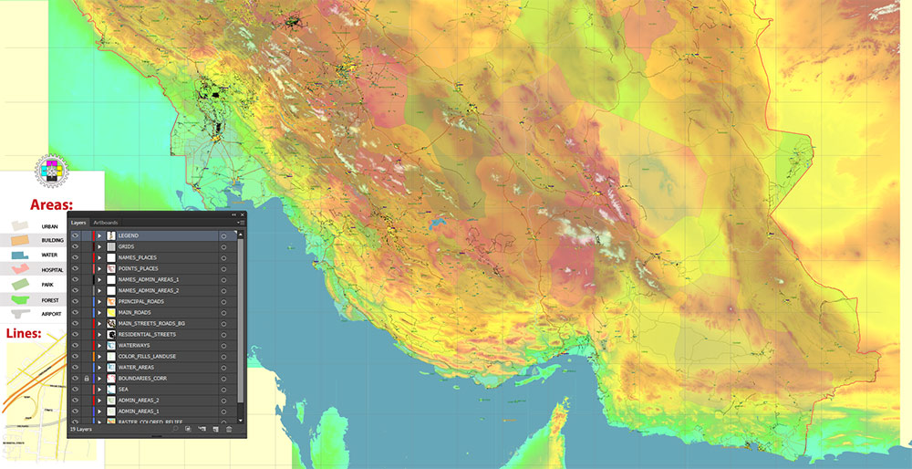
Layers list:
- Legend
- Grids
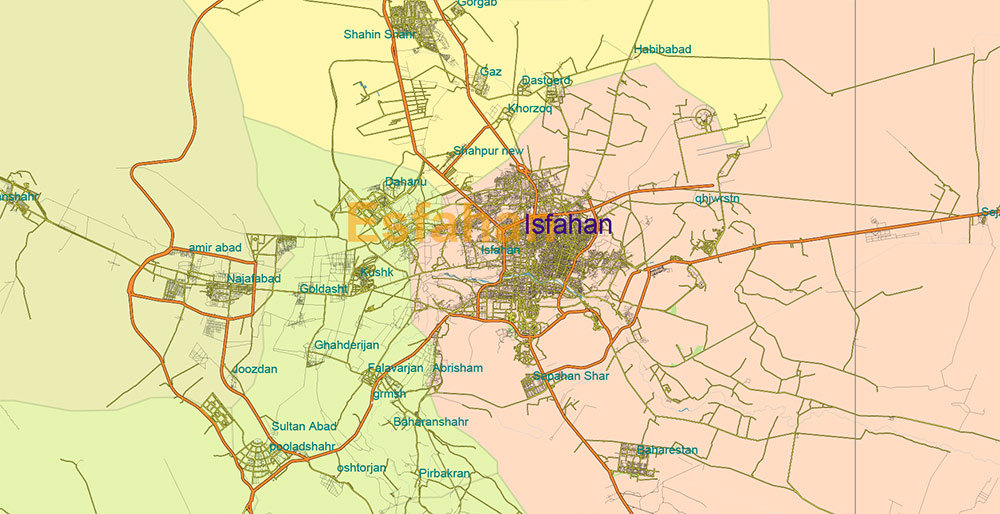
- Names of places (city, town, etc.)
- Points of the Cities and Towns
- Names of Admin areas level 1
- Names of Admin areas level 2
- Principal Streets and Main Roads 2
- Residential streets and roads
- Water objects (rivers, lakes, ponds)
- Waterways
- Color fills (parks, hospital areas, school areas, land use, etc.)
- Admin Areas level 2
- Admin Areas level 1
- Colored Relief Raster PNG HD Tiles
- Background
Iran Map PDF Vector Exact Colored Relief and Roads High Detailed Map Admin areas levels 1,2, editable Adobe PDF in layers
IRAN — MILITARY-GEOGRAPHIC AO BRIEF
1) Strategic Position
-
Region: Western Asia, central position between Middle East, Caucasus, Central Asia, and South Asia
-
Area: ~1.65 million km²
-
Operational Identity: Large plateau state protected by mountain barriers, with critical maritime frontage on global energy routes
Iran occupies a bridge position between:
-
Persian Gulf energy basin
-
Caucasus corridor
-
Central Asian land routes
-
Indian Ocean access via Gulf of Oman
2) Terrain Structure (Operational Geography)
| Zone |
Military Significance |
| Zagros Mountains (W/SW) |
Natural defensive wall along Iraq border |
| Alborz Mountains (N) |
Barrier protecting Tehran corridor from Caspian side |
| Central Plateau |
Open but harsh desert basin; movement constrained by water and infrastructure |
| Caspian Lowlands |
Narrow, humid coastal strip; dense settlement |
| Persian Gulf Coast |
Flat, strategic maritime frontage |
| Southeast deserts (Lut/Kavir) |
Extremely inhospitable; low mobility |
Key Point: Movement corridors are forced through mountain passes and transport axes, not across open terrain.
3) Strategic Urban Centers
| City |
Role |
| Tehran |
Political, military command, industrial core |
| Mashhad |
Northeast anchor; regional logistics hub |
| Isfahan |
Industrial and manufacturing center |
| Shiraz |
Southern regional hub |
| Tabriz |
Northwestern gateway toward Turkey/Caucasus |
| Ahvaz |
Oil-rich southwest, near Iraqi border |
| Karaj |
Industrial extension of Tehran |
| Qom |
Religious and political influence center |
Urban pattern: Population and industry cluster in transport-accessible corridors, not deserts.
4) Strategic Regions & Chokepoints
| Area |
Importance |
| Strait of Hormuz (south) |
One of world’s most critical maritime oil chokepoints |
| Khuzestan Province |
Oil and gas concentration; flat terrain near Iraq |
| Tehran Corridor |
Political and command concentration |
| Northwest Corridor (Tabriz–Urmia) |
Access toward Turkey, Caucasus |
| Eastern Frontier |
Sparse, long border with Afghanistan/Pakistan |
| Caspian Coast |
Limited military maneuver depth due to narrow strip |
5) Maritime & Port Infrastructure
| Port |
Location |
Role |
| Bandar Abbas |
Strait of Hormuz |
Primary naval/commercial hub |
| Bushehr |
Persian Gulf |
Energy and port facilities |
| Khorramshahr |
Near Iraq border |
Inland Gulf port |
| Chabahar |
Gulf of Oman |
Indian Ocean access outside Hormuz chokepoint |
Iran has dual maritime frontage:
6) Industrial & Energy Centers
| Sector |
Key Areas |
| Oil & Gas |
Khuzestan, Persian Gulf coast |
| Petrochemicals |
Gulf coastal zones |
| Heavy industry |
Isfahan, Tehran, Karaj |
| Manufacturing |
Major urban corridors |
Energy infrastructure forms a strategic backbone of the southern region.
7) Transportation Network (Strategic Lines)
Roads
Rail
Air
Transport routes follow mountain passes and plateau corridors — these define mobility.
8) Demographic Structure
| Indicator |
Value |
| Population |
~90 million |
| Urbanization |
~75% |
| Population concentration |
Western and northern corridors |
High population density aligns with transport and industrial zones.
9) Environmental Constraints
| Factor |
Impact |
| Mountains |
Restrict maneuver, channel movement |
| Deserts |
Limit off-road logistics |
| Climate extremes |
Heat in south, snow in mountains |
| Water scarcity |
Limits sustained operations in central regions |
10) Strategic Geographic Summary
Iran’s military-geographic profile is defined by:
-
Mountain defensive rings
-
Central plateau funneling movement into corridors
-
Southern energy coastline
-
Critical maritime chokepoint proximity
-
Urban–industrial concentration around Tehran and major axes
Map Interpretation:
Iran is not an open maneuver state — it is a corridor-controlled plateau power with maritime leverage at a global energy gateway.
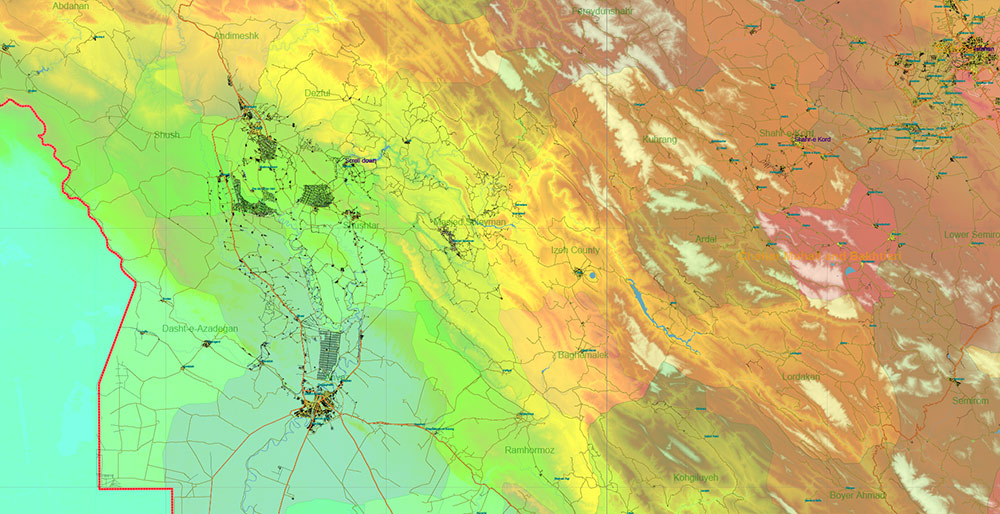
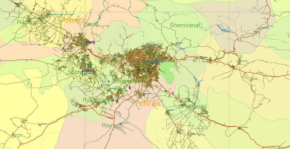
Iran Map PDF Vector Exact Colored Relief and Roads High Detailed Map Admin areas levels 1,2, editable Adobe PDF in layers
Iran Map PDF Vector Exact Colored Relief and Roads High Detailed Map Admin areas levels 1,2, editable Adobe PDF in layers
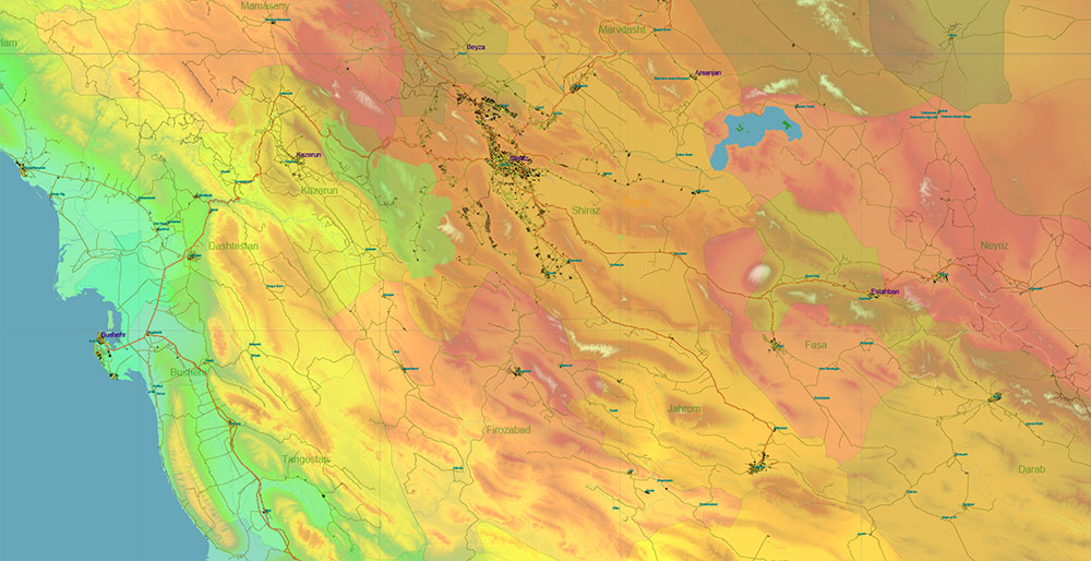
Iran Map PDF Vector Exact Colored Relief and Roads High Detailed Map Admin areas levels 1,2, editable Adobe PDF in layers
Iran Map PDF Vector Exact Colored Relief and Roads High Detailed Map Admin areas levels 1,2, editable Adobe PDF in layers
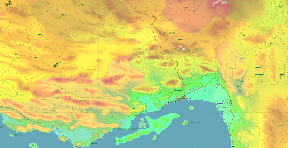
Iran Map PDF Vector Exact Colored Relief and Roads High Detailed Map Admin areas levels 1,2, editable Adobe PDF in layers
Iran Map PDF Vector Exact Colored Relief and Roads High Detailed Map Admin areas levels 1,2, editable Adobe PDF in layers
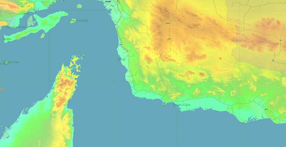
Iran Map PDF Vector Exact Colored Relief and Roads High Detailed Map Admin areas levels 1,2, editable Adobe PDF in layers
Iran Map PDF Vector Exact Colored Relief and Roads High Detailed Map Admin areas levels 1,2, editable Adobe PDF in layers
Iran Map PDF Vector Exact Colored Relief and Roads High Detailed Map Admin areas levels 1,2, editable Adobe PDF in layers
Iran Map PDF Vector Exact Colored Relief and Roads High Detailed Map Admin areas levels 1,2, editable Adobe PDF in layers
Iran Map PDF Vector Exact Colored Relief and Roads High Detailed Map Admin areas levels 1,2, editable Adobe PDF in layers
Iran Map PDF Vector Exact Colored Relief and Roads High Detailed Map Admin areas levels 1,2, editable Adobe PDF in layers
Iran Map PDF Vector Exact Colored Relief and Roads High Detailed Map Admin areas levels 1,2, editable Adobe PDF in layers
Iran Map PDF Vector Exact Colored Relief and Roads High Detailed Map Admin areas levels 1,2, editable Adobe PDF in layers
Iran Map PDF Vector Exact Colored Relief and Roads High Detailed Map Admin areas levels 1,2, editable Adobe PDF in layers

 Author: Kirill Shrayber, Ph.D. FRGS
