Extended Description of the Vector Map
Printable PDF Vector Map of 70 Mile House Area British Columbia Canada high detailed scale 1:2934 fully editable Adobe PDF Road Map in layers, scalable, text format all names, 5 MB ZIP
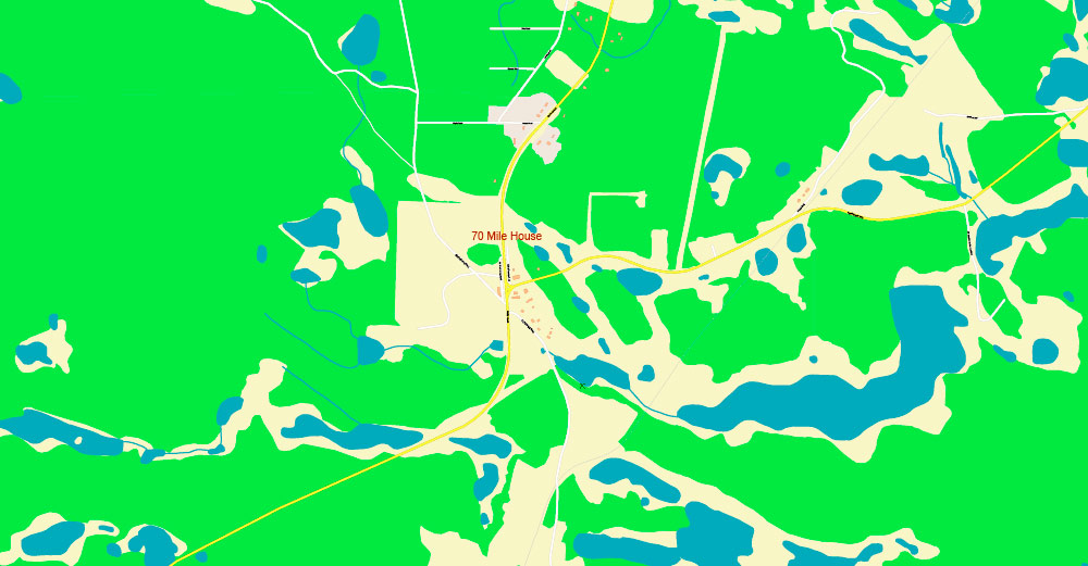
All street names, Main Objects, Buildings. Map for design, printing, arts, projects, presentations, for architects, designers, and builders, business, logistics.
The most exact and detailed map of this area in scale.
For Editing and High-Quality Printing
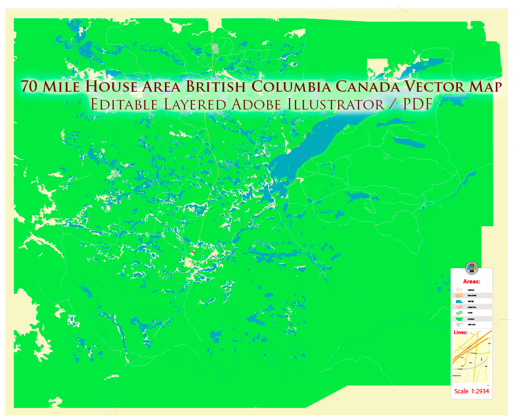
70 Mile House Area British Columbia Canada PDF Map Vector Exact detailed Road Map editable Adobe PDF in layers
Layers list:
- Legend
- Names of places (city, hamlet, etc.)
- Names of objects (parks, hospital, water)
- Names of main streets
- Names of residential streets
- Main Streets, roads
- Residential streets
- Railroads
- Buildings
- Water objects (rivers, lakes, ponds)
- Waterways
- Color fills (parks, land use, etc.)
- Background
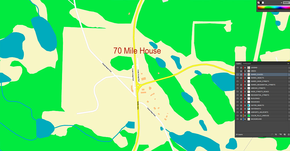
70 Mile House Area British Columbia Canada PDF Map Vector Exact detailed Road Map editable Adobe PDF in layers
AO BRIEF — 70 Mile House Area (British Columbia, Canada)
Mission context: Rural plateau AO on the historic Cariboo corridor. Low-density population, high mobility along one dominant ground line of communication (GLOC). Terrain favors dispersed movement, concealment in timber, and lake-to-lake micro-AOs.
1) AO LOCATION & ORIENTATION
-
AO Center: Community of 70 Mile House on the BC Highway 97 corridor.
-
Regional setting: South Cariboo / Bonaparte Plateau zone of BC’s Interior Plateau—between the Fraser drainage to the west and higher plateaus/lake country to the east.
-
Nearest service hubs: 100 Mile House (north) and Clinton (south). Expect 70 Mile House itself to function as a small service node (fuel/food/basic lodging), not a logistics base.
2) KEY ROUTES / GLOC (GROUND LINES OF COMMUNICATION)
Primary artery (decisive terrain):
-
BC Highway 97 (Cariboo Highway): The AO’s spine. Controls movement, commerce, and response time. Most traffic—civilian, freight, emergency—funnels here.
Secondary network (supporting mobility, low signature):
-
Rural collector roads branching off 97 to ranches, lakefront properties, and forestry access. Often narrow, gravel, dust-producing, with seasonal washboarding and frost heaves.
-
Forestry roads (FSRs): Grid of logging access routes enabling dispersed maneuver and flank approaches—also high risk for navigation errors, dead-ends, and soft shoulders.
-
Operational note: In wet shoulder seasons and spring breakup, off-highway mobility degrades fast; tracked/ATV capability becomes decisive.
3) TERRAIN / RELIEF (WHERE YOU CAN LAND, MOVE, HIDE)
-
Macro-relief: Rolling plateau—broad, gently undulating uplands with local knobs and shallow valleys rather than sharp mountains.
-
Elevation band (typical): Roughly ~900–1,200 m class plateau country (varies locally).
-
Key terrain features:
-
Timbered ridges and inter-lake rises provide observation and concealment.
-
Open ranchlands/meadows create exposure corridors—great for speed, bad for stealth.
-
Wetlands and muskeg pockets can appear deceptively firm; treat as mobility traps.
-
Aerial insertion suitability: Multiple potential LZs in open pasture/meadow and some lake-adjacent flats; rotor wash and dust signature will be high in dry periods.
4) HYDROGRAPHY (WATER, OBSTACLES, RESUPPLY)
-
AO character: “Lake country” — numerous small-to-medium lakes, ponds, and wetland systems.
-
Tactical effects:
-
Lakes create compartmented terrain: many small AOs separated by water and marsh—forces channeling to bridges/causeways or long detours.
-
Shorelines and outlets become natural choke points for surveillance/ambush/control.
-
Water supply: Freshwater is abundant, but treat all surface water (wildlife + seasonal algae blooms possible). Winter ice is not guaranteed safe early/late season.
5) FOREST & NATURAL RESOURCES (COVER, MATERIAL, FIRE RISK)
-
Dominant vegetation: Typical Interior Plateau conifer forest—commonly lodgepole pine, spruce, subalpine fir, with Douglas-fir in warmer/drier exposures; mixed understory and cutblocks.
-
Resource footprint: Active or legacy forestry presence—expect cutblocks, slash piles, replant zones, and industrial traffic on FSRs.
-
Cover & concealment:
-
Wildfire reality: Summers can be very high fire danger. Smoke can rapidly reduce visibility/aviation; fires can close highways and FSRs with little warning.
6) GEOLOGY & GROUND CONDITIONS (WHAT THE AO IS MADE OF)
7) BUILT FEATURES / OBJECTS (WHAT’S ON THE MAP)
-
Settlement pattern: Scattered rural residences, ranches, small clusters near services; few multi-story structures.
-
Critical objects:
-
Highway services (fuel, store, lodging) = civilian gravity wells and observation nodes.
-
Bridges/culverts on the highway and lake outlets = mobility control points.
-
Powerlines and telecom towers (where present) = key infrastructure; limited redundancy in rural AO.
-
Healthcare/emergency: Typically limited locally; serious response relies on larger towns up and down the corridor.
8) DEMOGRAPHIC / HUMAN TERRAIN (WHO LIVES HERE, WHAT THEY DO)
-
Population density: Low. Expect a small local community plus dispersed rural properties.
-
Economy & activity patterns: Ranching, forestry, highway services, seasonal tourism and recreation.
-
Indigenous context: The wider region lies within Secwepemc (Shuswap) traditional territory; nearby First Nations communities and interests influence land use, cultural sites, and consultation realities.
-
Human-terrain implications: Outsiders are noticeable. Vehicle movements, campfires, and unusual flight activity are rapidly observed and reported.
9) TOURISM / RECREATIONAL ATTRACTIVENESS (WHY PEOPLE COME)
10) OPERATIONAL SUMMARY (SPACEBORNE ASSAULT LENS)
-
Decisive terrain: BC Hwy 97 — control it, and you control tempo.
-
Mobility: High on highway; moderate on gravel/FSRs; poor in wetlands and shoulder seasons.
-
Concealment: Strong in timber; weak in open ranchlands and cutblocks.
-
Observation: Local high points and cutblocks provide eyes; smoke/fog can collapse ISR.
-
Sustainment: Water is plentiful; fuel/food nodes are sparse—plan resupply around highway services or external hubs.
-
Civil considerations: Low population but high visibility—assume rapid reporting of anomalies.
70 Mile House Area British Columbia Canada PDF Map Vector Exact detailed Road Map editable Adobe PDF in layers

 Author: Kirill Shrayber, Ph.D. FRGS