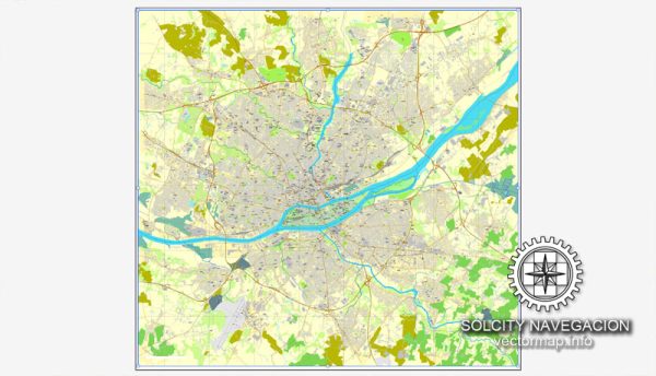
Nantes, a vibrant city in western France, is known for its rich history, cultural heritage, and well-organized urban layout.
Vectormap.Net provide you with the most accurate and up-to-date vector maps in Adobe Illustrator, PDF and other formats, designed for editing and printing. Please read the vector map descriptions carefully.
Here’s a detailed description of its districts, communities, and street system:
Districts and Communities
**1. Centre-ville (City Center)
- Description:
- The heart of Nantes, featuring a mix of historical and modern architecture, bustling streets, and major commercial areas.
- Key Features:
- Place Royale: A historic square surrounded by elegant buildings and home to the famous statue of Louis XVI.
- Place Graslin: Known for the Théâtre Graslin and its lively atmosphere, with cafes, shops, and cultural venues.
- Château des Ducs de Bretagne: A historic castle that houses the Nantes History Museum and is a major landmark in the city center.
**2. Île de Nantes
- Description:
- An island in the Loire River, this area has undergone significant redevelopment and is a hub for modern architecture and cultural projects.
- Key Features:
- Les Machines de l’île: An amusement park and artistic project featuring mechanical animals and interactive exhibits.
- La Cité des Congrès: A major convention center hosting various events and conferences.
- Quartier de la Création: A creative district known for its innovative projects and artistic spaces.
**3. Quartier Dobrée
- Description:
- A residential district located to the north of the city center, known for its peaceful environment and historical buildings.
- Key Features:
- Jardin des Plantes: A large botanical garden offering green space and tranquility in the heart of the city.
- Eglise Saint-Denis: A historic church that adds to the architectural charm of the area.
**4. Saint-Félix
- Description:
- Located to the south of the city center, this residential area is known for its family-friendly environment and local amenities.
- Key Features:
- Parc de Procé: A large park providing recreational facilities and green space for residents.
**5. Erdre
- Description:
- A district situated along the Erdre River, offering a blend of residential, recreational, and natural spaces.
- Key Features:
- Parc du Grand-Blottereau: A large park with gardens, walking paths, and recreational areas.
- Erdre River: A picturesque waterway providing opportunities for boating and riverside walks.
Main Streets
**1. Boulevard Gabriel-Guist’hau
- Description:
- A major thoroughfare running through the city center, connecting various districts and featuring commercial establishments and office buildings.
- Key Features:
- Shopping and Dining: Lined with shops, restaurants, and cafes, offering a lively urban experience.
**2. Rue Crébillon
- Description:
- A prominent street known for its elegant buildings and high-end shopping options.
- Key Features:
- Luxury Shops: Home to various boutiques and luxury stores.
- Cafés and Restaurants: Offers a range of dining options in a stylish setting.
**3. Rue de la Barillerie
- Description:
- A historic street in the city center, characterized by its charming architecture and local businesses.
- Key Features:
- Local Shops: Featuring a mix of artisanal and specialty stores.
- Historic Buildings: Adds to the historical ambiance of the city center.
**4. Avenue Jean-Baptiste-Dulion
- Description:
- A major avenue connecting different parts of the city and providing access to various amenities and public services.
- Key Features:
- Commercial and Residential Areas: A blend of residential properties and commercial establishments.
**5. Rue de la Poudrière
- Description:
- Located near the historical center, this street is known for its historical significance and architectural heritage.
- Key Features:
- Historic Sites: Close to various historic landmarks and attractions.
Transportation and Urban Layout
- Public Transportation:
- Tram Network: Nantes has an extensive tram network that connects key areas of the city and surrounding suburbs.
- Bus Services: A comprehensive bus system complements the tram network, providing access to various districts and neighborhoods.
- Bicycle Infrastructure: The city promotes cycling with dedicated bike lanes and rental services.
- Road Network:
- Major Roads: Nantes is well-connected by major roads and highways, including the A11 motorway, which links the city to other major French cities.
- City Streets: The city streets are organized to facilitate both pedestrian and vehicular traffic, with a focus on accessibility and urban mobility.
Summary
Nantes features a diverse range of districts and communities, from the historic city center to the modern Île de Nantes and the residential areas of Saint-Félix and Erdre. The main streets, including Boulevard Gabriel-Guist’hau, Rue Crébillon, and Rue de la Barillerie, reflect the city’s blend of historical charm and modern vibrancy. Nantes’ transportation infrastructure includes a well-connected tram and bus network, extensive bicycle facilities, and a well-organized road system, making it a dynamic and accessible city.


 Author: Kirill Shrayber, Ph.D. FRGS