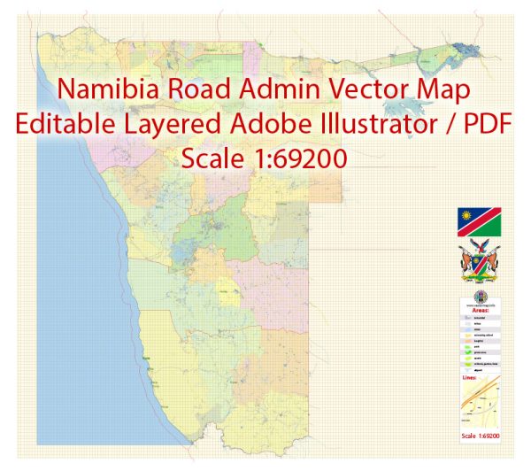
Namibia, located in southwestern Africa, has a rich political history and several key cities.
Vectormap.Net provide you with the most accurate and up-to-date vector maps in Adobe Illustrator, PDF and other formats, designed for editing and printing. Please read the vector map descriptions carefully.
Here’s a detailed description of its political history and main cities:
Political History of Namibia
Pre-Colonial Era
- Early Inhabitants:
- Namibia has been inhabited for thousands of years by various indigenous groups, including the San, Nama, and Herero peoples. These groups had distinct cultures and social structures.
Colonial Era
- German South West Africa (1884-1915):
- Namibia was colonized by Germany in 1884, becoming known as German South West Africa. The German colonial administration established a presence in the region, but their rule was met with resistance from local groups.
- The Herero and Namaqua people led major uprisings against German rule, most notably the Herero Wars (1904-1907), which resulted in significant loss of life and is considered one of the first genocides of the 20th century.
- South African Administration (1915-1990):
- During World War I, South African forces occupied Namibia, and in 1920, the League of Nations granted South Africa a mandate to administer the territory. The administration was characterized by policies of segregation and discrimination.
- South Africa’s rule over Namibia was marked by the implementation of apartheid policies, similar to those enforced within South Africa.
Struggle for Independence
- Liberation Movement:
- The struggle for independence began in the 1960s, led by various liberation movements, notably the South West Africa People’s Organization (SWAPO), which became the dominant force in the fight for independence.
- The Namibian War of Independence, also known as the South African Border War, involved prolonged conflict between SWAPO guerrillas and South African forces.
- International Pressure and Negotiations:
- International pressure, combined with the internal cost of the conflict, led to negotiations for Namibia’s independence. The United Nations played a significant role in these negotiations.
- The 1988 New York Agreement between South Africa, Angola, and Cuba laid the groundwork for Namibian independence. In 1990, Namibia achieved full sovereignty and independence from South Africa.
Post-Independence Era
- Early Years of Independence:
- Namibia’s first President, Sam Nujoma of SWAPO, was inaugurated in 1990. The country adopted a democratic constitution, and SWAPO emerged as the ruling party.
- The early years of independence focused on rebuilding the nation and addressing the socio-economic challenges inherited from colonial rule.
- Modern Era:
- Namibia has maintained a relatively stable political environment since independence. It continues to work on economic development, social progress, and addressing issues related to inequality and poverty.
- The country holds regular democratic elections, with SWAPO having remained a dominant political force, although opposition parties have gained ground over time.
Main Cities of Namibia
1. Windhoek
- Description:
- The capital and largest city of Namibia, located in the central part of the country. It is the political, economic, and cultural center of Namibia.
- Key Features:
- Government and Administrative Hub: Houses the central government offices, including the Presidential Palace and the National Assembly.
- Cultural and Economic Center: Home to a variety of cultural institutions, businesses, and shopping centers. Windhoek hosts events and festivals that reflect Namibia’s diverse heritage.
2. Swakopmund
- Description:
- A coastal city located in the western part of Namibia, along the Atlantic Ocean. It is known for its historical architecture and as a tourist destination.
- Key Features:
- Tourist Attractions: Popular for its beaches, colonial-era buildings, and recreational activities such as sandboarding and dolphin tours.
- Economic Role: Serves as a port and has a growing tourism and hospitality industry.
3. Walvis Bay
- Description:
- A major port city located along the Namibian coast, southwest of Windhoek. It is crucial for the country’s trade and maritime activities.
- Key Features:
- Port Facilities: One of Namibia’s primary seaports, handling a significant portion of the country’s imports and exports.
- Industrial and Commercial Hub: Home to various industrial and commercial enterprises, supporting the region’s economic development.
4. Oshakati
- Description:
- A key city in northern Namibia, situated in the Oshana Region. It serves as a commercial and administrative center for the northern part of the country.
- Key Features:
- Regional Significance: Acts as a hub for trade and services in the northern regions and is a key center for the local Herero and Owambo cultures.
5. Rundu
- Description:
- Located in the northeastern part of Namibia, along the Zambezi River. It serves as a key city for the Kavango Region.
- Key Features:
- Cross-Border Trade: Plays a role in cross-border trade with neighboring countries and supports regional economic activities.
- Cultural Diversity: Reflects the cultural diversity of the northeastern region of Namibia.
Summary
Namibia’s political history is marked by its colonial past under German and South African rule, the struggle for independence led by SWAPO, and its subsequent journey as a sovereign nation. The key cities of Namibia—Windhoek, Swakopmund, Walvis Bay, Oshakati, and Rundu—each play distinct roles in the country’s political, economic, and cultural landscape. Windhoek stands as the capital and administrative center, while Swakopmund and Walvis Bay are important for tourism and trade. Oshakati and Rundu serve as regional hubs, contributing to Namibia’s economic and social fabric.


 Author: Kirill Shrayber, Ph.D. FRGS