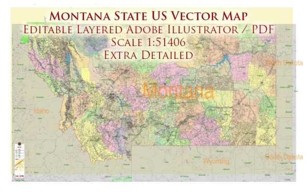
Montana is renowned for its stunning natural landscapes and offers a variety of state parks that showcase the state’s diverse ecosystems.
Vectormap.Net provide you with the most accurate and up-to-date vector maps in Adobe Illustrator, PDF and other formats, designed for editing and printing. Please read the vector map descriptions carefully.
Here’s a description of some notable Montana state parks:
1. Glacier National Park
- Description: Often considered one of the most spectacular national parks in the U.S., Glacier National Park is known for its rugged mountains, pristine lakes, and over 25 glaciers. The park features over 700 miles of hiking trails, the historic Going-to-the-Sun Road, and diverse wildlife, including grizzly bears, mountain goats, and bighorn sheep.
- Location: Located in northwestern Montana along the Canadian border.
2. Yellowstone National Park
- Description: Although primarily known as a national park, the Montana portion of Yellowstone offers dramatic landscapes, geothermal features, and abundant wildlife. The park encompasses parts of southwestern Montana and features attractions like the Lamar Valley and the Yellowstone River.
- Location: Extends into Montana from Wyoming and Idaho.
3. Beartooth Scenic Byway
- Description: This scenic drive, often included in discussions about Montana’s natural beauty, is one of the highest paved roads in North America. It traverses the Beartooth Mountains and offers breathtaking views of alpine lakes, rugged peaks, and expansive vistas.
- Location: Runs from Red Lodge, Montana, to the Northeast Entrance of Yellowstone National Park.
4. Makoshika State Park
- Description: Known for its striking badlands and rich fossil beds, Makoshika State Park offers a glimpse into prehistoric times. Visitors can explore unique rock formations, hike on various trails, and view dinosaur fossils.
- Location: Situated in southeastern Montana near Glendive.
5. Lewis and Clark Caverns State Park
- Description: This park is famous for its stunning limestone caverns, which feature intricate formations like stalactites and stalagmites. Guided tours take visitors through the caverns, while the park also offers hiking trails with panoramic views of the surrounding countryside.
- Location: Located in southwestern Montana, near the town of Whitehall.
6. Kootenai Falls
- Description: Known for its dramatic waterfall and scenic surroundings, Kootenai Falls is one of Montana’s most beautiful natural attractions. The park features a suspension bridge that offers a unique vantage point for viewing the falls and the surrounding area.
- Location: Located in northwestern Montana, near the town of Libby.
7. Pictograph Cave State Park
- Description: This park features ancient rock art created by Native American cultures thousands of years ago. The cave paintings, along with interpretive trails and exhibits, provide insight into the region’s cultural and historical heritage.
- Location: Near Billings, Montana.
8. Wild Horse Island State Park
- Description: Located on Flathead Lake, this park is known for its wild horses, which roam freely on the island. The park offers opportunities for hiking, wildlife viewing, and boating, with beautiful views of the lake and surrounding mountains.
- Location: Situated on Flathead Lake in northwestern Montana.
9. Black Sandy State Park
- Description: This park is located on the western shore of Canyon Ferry Lake and offers recreational opportunities like swimming, boating, and picnicking. It’s a popular spot for water sports and fishing.
- Location: Near Townsend, Montana.
10. Holter Lake
- Description: Holter Lake is known for its scenic beauty and recreational opportunities, including fishing, boating, and camping. The lake is surrounded by forests and mountains, providing a serene setting for outdoor activities.
- Location: Located near the town of Helena.
Montana’s state parks offer diverse natural experiences, from rugged mountain landscapes and unique geological formations to historical sites and serene lakes. Each park provides opportunities for outdoor recreation and exploration, reflecting the state’s rich natural heritage.


 Author: Kirill Shrayber, Ph.D. FRGS