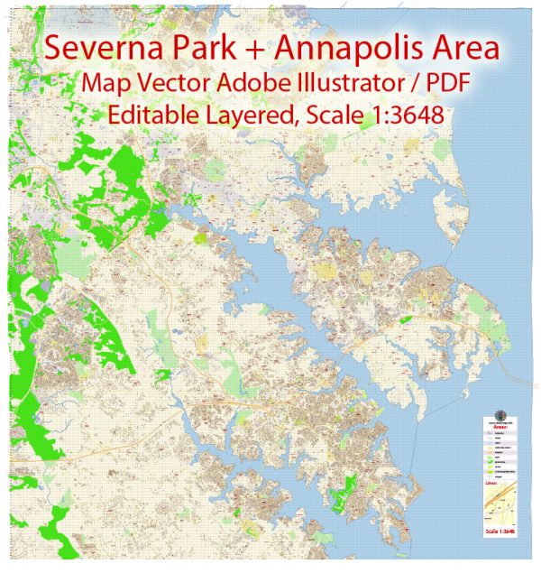
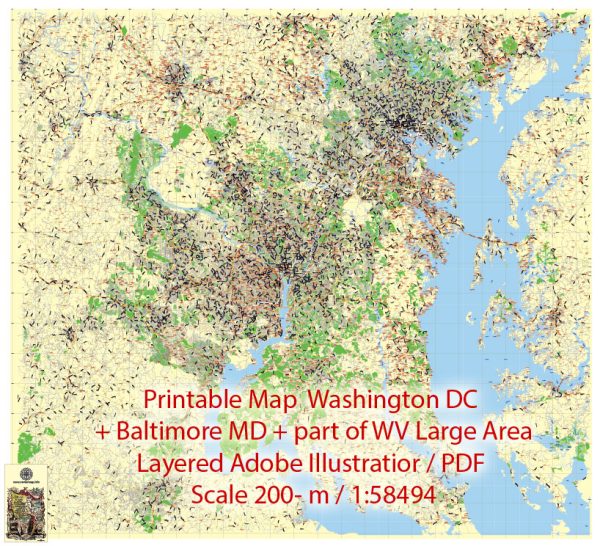
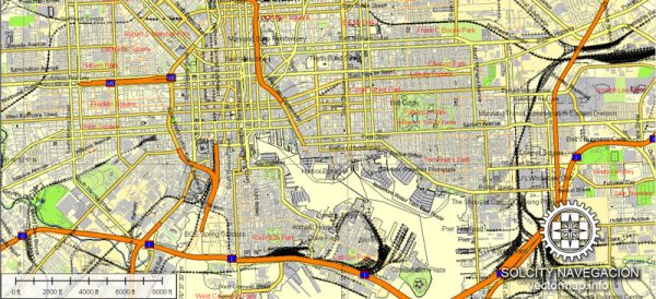
List of ready-made Vector Maps of the state of Maryland:Annapolis, Maryland = 4 map
|
Vector Maps of the Maryland : Mid-Atlantic state that’s defined by its abundant waterways and coastlines on the Chesapeake Bay and Atlantic Ocean. Its largest city, Baltimore, has a long history as a major seaport. Fort McHenry, birthplace of the U.S. national anthem, sits at the mouth of Baltimore’s Inner Harbor, home to the National Aquarium and Maryland Science Center.
Capital: Annapolis
Largest city: Baltimore
Largest metro and urban areas: Baltimore–Washington (combined)
Baltimore (metro and urban)
Area
• Total 12,407 sq mi (32,133 km2)
• Land 9,776 sq mi (25,314 km2)
• Water 2,633 sq mi (6,819 km2) 21%
Area rank 42nd
Dimensions
• Length 119 mi (192 km)
• Width 196 mi (315 km)
Elevation 350 ft (110 m)
Highest elevation Hoye-Crest 3,360 ft (1,024 m)
Lowest elevation Atlantic Ocean 0 ft (0 m)
Population
• Total 6,383,426
• Rank 18th
• Density 619/sq mi (238/km2)
Vectormap.Net provide you with the most accurate and up-to-date vector maps in Adobe Illustrator, PDF and other formats, designed for editing and printing. Please read the vector map descriptions carefully.
Instant download archives: royalty free, editable vector maps of Maryland US in high resolution digital PDF and Adobe Illustrator format.
All of our editable Maryland US vector maps are digital files,
which can be instantly downloaded in editable PDF or Adobe Illustrator format.
Objects on maps are usually divided into layers according to their types – lines, polygons, street names, object names (see map description!!!!)
Each of our Maryland US digital maps is available in Adobe Illustrator or editable PDF format, (or on request in any other known format for the same price)
which use a vector approach to display images,
you can easily enlarge any part of our maps without compromising text, line or graphic quality,
with any increase or decrease ratio.
Using a vector graphics editor such as Adobe Illustrator, CorelDraw, Inkscape, or Freehand
you can easily crop parts of the map, add custom characters, and change colors and font attributes as needed.
We have a variety of Maryland US vector maps with different levels of detail, from simple empty paths to highly detailed maps with roads and terrain layers.
List of Maryland counties |
List of Cities and towns by counties |
|
|---|---|---|
Allegany County MDAllegheny County is a county in western Maryland. The county seat is Cumberland. Allegheny County borders Pennsylvania to the north, West Virginia to the south, Garrett County to the west, and Washington County to the east. |
Barton Corriganville Cumberland Eckhart Mines Ellerslie Flintstone Frostburg Little Orleans Lonaconing Luke Midland Midlothian Mount Savage Oldtown Pinto Rawlings Spring Gap Westernport |
|
Anne Arundel County MDAnn Arundel is a county in central Maryland. The county seat is also the state capital, Annapolis. It borders Baltimore City and Baltimore County to the north, Howard County to the northwest, Prince Georges County to the west, Calvert County to the south, and Chesapeake Bay to the east. |
Annapolis Arnold Baltimore Churchton Crofton Crownsville Curtis Bay Davidsonville Deale Edgewater Fort George G Meade Friendship Galesville Gambrills Gibson Island Glen Burnie Hanover Harmans Harwood Laurel Linthicum Heights Lothian Mayo Millersville Odenton Pasadena Riva Severn Severna Park Shady Side Tracys Landing West River |
|
Baltimore County MDBaltimore County is a county in northern Maryland. From an administrative point of view, present-day Baltimore County is not related to the City of Baltimore. The county seat is Towson. |
Baldwin Boring Brooklandville Butler Catonsville Cockeysville Dundalk Essex Fork Fort Howard Freeland Glen Arm Glyndon Gwynn Oak Halethorpe Hunt Valley Hydes Kingsville Long Green Lutherville Timonium Maryland Line Middle River Monkton Nottingham Owings Mills Parkton Parkville Perry Hall Phoenix Pikesville Randallstown Reisterstown Rosedale Sparks Glencoe Sparrows Point Stevenson Towson Upper Falls Upperco White Marsh Windsor Mill |
|
Baltimore City County MDBaltimore is a major city in Maryland and has been an important seaport for many years. Fort McHenry is located at the mouth of Inner Harbor. It was here that the US national anthem “The Star Spangled Banner” was coined. Today, the harbor is home to shops, upmarket crab restaurants, and attractions such as the USS Constellation and the National Aquarium, which houses thousands of marine life. |
Baltimore Brooklyn |
|
Calvert County MDCalvert County is a county in southern Maryland. The county seat is Prince Frederick. Calvert County is bordered by Ann Arundel County to the north, Prince George’s County to the northwest, the Patuxent River Estuary to the south, and the Chesapeake Bay to the east. In 2000, the county had a population of 74,563. |
Barstow Broomes Island Chesapeake Beach Dowell Dunkirk Huntingtown Lusby North Beach Owings Port Republic Prince Frederick Saint Leonard Solomons Sunderland |
|
Caroline County MDCaroline County is a predominantly rural county in eastern Maryland. The county seat is Denton Township. Caroline County borders Delaware to the east, Dorchester County to the south, Talbot County to the west, and Queen Anse County to the north. |
Bethlehem Denton Federalsburg Goldsboro Greensboro Henderson Hillsboro Marydel Preston Ridgely |
|
Carroll County MDCarroll County is a predominantly rural county in northern Maryland. The county seat is Westminster. Carroll County borders Pennsylvania to the north, Baltimore County to the east, Howard County to the south, and Frederick County to the west. |
Finksburg Hampstead Keymar Lineboro Manchester Marriottsville New Windsor Sykesville Taneytown Union Bridge Westminster |
|
Cecil County MDCecil County is a county in northern Maryland; is part of the Philadelphia metropolitan area. The county seat is Elkton. Cecil County borders Pennsylvania to the north, Delaware to the east, Kent County to the south, Harford County to the west, and Chesapeake Bay to the southwest. |
Cecilton Charlestown Chesapeake City Childs Colora Conowingo Earleville Elk Mills Elkton Georgetown North East Perry Point Perryville Port Deposit Rising Sun Warwick |
|
Charles County MDCharles County is a county in southern Maryland. The county seat is La Plaita. Charles County is bordered by Virginia to the south and west, Prince George’s County to the north, the Patuxent Estuary to the east, and St. Mary’s County to the southeast. |
Bel Alton Benedict Bryans Road Bryantown Cobb Island Faulkner Hughesville Indian Head Ironsides Issue La Plata Marbury Mount Victoria Nanjemoy Newburg Pomfret Port Tobacco Rock Point Waldorf Welcome White Plains |
|
Dorchester County MDDorchester County is a county on the Eastern Shore of Maryland. The county seat is Cambridge. Dorchester County borders Delaware to the northeast, Wicomico County to the southeast, Caroline County to the north, and Chesapeake Bay to the west. |
Cambridge Church Creek Crapo Crocheron East New Market Fishing Creek Hurlock Linkwood Madison Rhodesdale Secretary Taylors Island Toddville Vienna Wingate Woolford |
|
Frederick County MDFrederick County is a county in northern Maryland. The administrative center of the district in the city of the same name. Frederick County borders Pennsylvania to the north, Virginia to the south, Washington County to the west, Carroll County to the east, and Howard and Montgomery counties to the southeast. |
Adamstown Braddock Heights Brunswick Buckeystown Burkittsville Emmitsburg Frederick Ijamsville Jefferson Knoxville Ladiesburg Libertytown Middletown Monrovia Mount Airy Myersville New Market New Midway Point of Rocks Rocky Ridge Sabillasville Thurmont Tuscarora Walkersville Woodsboro |
|
Garrett County MDGarrett County is the westernmost county in Maryland. The county seat is the city of Auckland. Garrett County borders Pennsylvania to the north, West Virginia to the west and south, and Allegheny County to the northeast. |
Accident Bittinger Bloomington Friendsville Grantsville Kitzmiller Mc Henry Oakland Swanton |
|
Harford County MDHarford County is a county in northern Maryland. The county seat is Bel-Air. Harford County borders Pennsylvania to the north, Cecil County to the east, Baltimore County to the west, and Chesapeake Bay to the south. |
Aberdeen Aberdeen Proving Ground Abingdon Bel Air Belcamp Benson Churchville Darlington Edgewood Fallston Forest Hill Gunpowder Havre De Grace Jarrettsville Joppa Perryman Pylesville Street White Hall Whiteford |
|
Howard County MDHoward County is a county in central Maryland, between Washington and Baltimore. Part of the Washington-Baltimore metropolitan area. 1st among Maryland counties and 3rd nationally by median household income. The county seat is Ellicott. |
Annapolis Junction Clarksville Columbia Cooksville Dayton Elkridge Ellicott City Fulton Glenelg Glenwood Highland Jessup Laurel Lisbon Savage West Friendship Woodbine Woodstock |
|
Kent County MDKent County is a county on the Eastern Shore of Maryland. The county seat is Chestertown. Kent County is bordered by Delaware to the east, Queen’s Anse County to the south, Cecil County to the north, and the Chesapeake Bay to the west. |
Betterton Chestertown Galena Kennedyville Massey Millington Rock Hall Still Pond Worton |
|
Montgomery County MDMontgomery County is a county in central Maryland, immediately north of Washington. Part of the Washington-Baltimore metropolitan area. One of the wealthiest counties in the country. The county seat is Rockville. The largest settlement is Silver Spring. |
Ashton Barnesville Beallsville Bethesda Boyds Brinklow Brookeville Burtonsville Cabin John Chevy Chase Clarksburg Damascus Derwood Dickerson Gaithersburg Garrett Park Germantown Glen Echo Kensington Montgomery Village Olney Poolesville Potomac Rockville Sandy Spring Silver Spring Spencerville Takoma Park Washington Grove |
|
Prince George’s County MDPrince George’s County is a county in central Maryland, immediately east of Washington. Part of the Washington-Baltimore metropolitan area. Wealthiest among American counties with an African American majority. Colloquially, the county’s name is usually shortened to P.G. |
Accokeek Aquasco Beltsville Bladensburg Bowie Brandywine Brentwood Capitol Heights Cheltenham Clinton College Park District Heights Fort Washington Glenn Dale Greenbelt Hyattsville Lanham Laurel Mount Rainier Oxon Hill Riverdale Suitland Temple Hills Upper Marlboro |
|
Queen Anne’s County MDQueen Anne’s County is a county on the Eastern Shore of Maryland. Connected to the mainland by a bridge across the Chesapeake Bay. The county seat is Centerville. |
Barclay Centreville Chester Church Hill Crumpton Grasonville Ingleside Queen Anne Queenstown Stevensville Sudlersville |
|
Somerset County MDSomerset County is a county on the east coast of the Chesapeake Bay in the state of Maryland, the southernmost county in the state. The county seat is Princess Anne Township. St. Mary’s County borders Virginia to the south, Chesapeake Bay to the west, Wicomico County to the north, and Worcester County to the east. |
Crisfield Deal Island Ewell Manokin Marion Station Princess Anne Tylerton Upper Fairmount Westover |
|
St. Mary’s County MDSaint Mary’s County is a county in southern Maryland, United States. The colonization of Maryland began with the construction of a settlement in what is now Saint Mary’s County in 1634. |
Abell Avenue Bushwood California Callaway Chaptico Charlotte Hall Clements Coltons Point Compton Dameron Drayden Great Mills Hollywood Leonardtown Lexington Park Loveville Mechanicsville Morganza Park Hall Patuxent River Piney Point Ridge Saint Inigoes Saint Marys City Scotland Tall Timbers Valley Lee |
|
Talbot County MDTalbot is a county in Maryland, United States. The administrative center is Easton. |
Bozman Claiborne Cordova Easton Mcdaniel Neavitt Newcomb Oxford Royal Oak Saint Michaels Sherwood Tilghman Trappe Wittman Wye Mills |
|
Washington County MDWashington County is a county in western Maryland. The county seat is Hagerstown. Washington County is bordered by Pennsylvania to the north, West Virginia and Virginia to the south, Frederick County to the east, and Allegheny County to the west. |
Big Pool Boonsboro Brownsville Cascade Cavetown Chewsville Clear Spring Fairplay Funkstown Hagerstown Hancock Keedysville Maugansville Rohrersville Saint James Sharpsburg Smithsburg Williamsport |
|
Wicomico County MDWicomico County is a county on the Eastern Shore of Maryland. In some Russian-language sources, there is a transcription of Vikomiko, which does not correspond to the local pronunciation. The county seat is Salisbury, the main commercial center of the Delmarva Peninsula. |
Allen Bivalve Delmar Fruitland Hebron Mardela Springs Nanticoke Parsonsburg Pittsville Powellville Quantico Salisbury Sharptown Tyaskin Willards |
|
Worcester County MDWorcester County is a county on the Eastern Shore of Maryland. The extreme eastern district of the state and the only one with an Atlantic coast. The county seat is Snow Hill. On the shores of the Atlantic is a large resort town of Ocean City. |
Berlin Bishopville Eden Girdletree Newark Ocean City Pocomoke City Showell Snow Hill Stockton Whaleyville |
|
Don’t see exactly what you’re looking for? Contact us to receive a special offer for an individual Maryland US map for your project.


 Author: Kirill Shrayber, Ph.D.