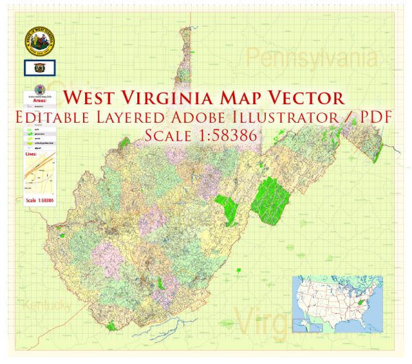
West Virginia, located in the Appalachian region of the United States, is known for its picturesque landscapes, historical sites, and vibrant communities.
Vectormap.Net provide you with the most accurate and up-to-date vector maps in Adobe Illustrator, PDF and other formats, designed for editing and printing. Please read the vector map descriptions carefully.
Here’s a detailed overview of some of the main cities, towns, airports, and principal roads in the state:
Main Cities:
- Charleston:
- Description: The capital and largest city of West Virginia, Charleston, is situated along the Kanawha River. It serves as the political, cultural, and economic hub of the state. Visitors can explore the State Capitol, the Clay Center for the Arts and Sciences, and the Capitol Market.
- Huntington:
- Description: Located along the Ohio River, Huntington is known for its educational institutions, including Marshall University. The city also has a vibrant arts scene, with the Huntington Museum of Art and the Keith-Albee Theatre.
- Morgantown:
- Description: Home to West Virginia University, Morgantown is a college town with a lively atmosphere. It is situated along the Monongahela River and offers outdoor recreational opportunities, such as hiking and biking trails.
- Parkersburg:
- Description: Nestled along the Ohio River, Parkersburg is known for its historic architecture, including the Blennerhassett Hotel. The Blennerhassett Island Historical State Park is a popular attraction.
- Wheeling:
- Description: Once an industrial hub, Wheeling is now a city with a rich history. Visitors can explore the Victorian Old Town district, visit the Wheeling Island Casino, or enjoy outdoor activities along the Ohio River.
Towns:
- Beckley:
- Description: Beckley is known for its coal mining history. The Beckley Exhibition Coal Mine and Tamarack, an artisan center, are popular attractions.
- Martinsburg:
- Description: Located in the eastern part of the state, Martinsburg has a historic downtown area. It’s known for its Civil War history and the Martinsburg Roundhouse.
- Clarksburg:
- Description: Clarksburg is a city with a strong Italian heritage. It hosts the West Virginia Italian Heritage Festival, celebrating the contributions of Italian-Americans to the state.
Airports:
- Yeager Airport (CRW):
- Description: Located near Charleston, Yeager Airport is the primary airport serving the state’s capital and surrounding areas.
- Tri-State Airport (HTS):
- Description: Serving Huntington and the surrounding region, Tri-State Airport is located near Kenova.
- North Central West Virginia Airport (CKB):
- Description: Situated near Bridgeport, this airport serves the north-central part of the state, including Clarksburg and Fairmont.
Principal Roads:
- Interstate 64 (I-64):
- Description: Running east-west, I-64 connects Huntington, Charleston, Beckley, and Lewisburg.
- Interstate 77 (I-77):
- Description: I-77 runs north-south, connecting Charleston with Parkersburg and the Ohio border.
- Interstate 79 (I-79):
- Description: Running north-south, I-79 connects Charleston with Morgantown and the Pennsylvania border.
- U.S. Route 50:
- Description: Known as the “George Washington Highway,” U.S. Route 50 crosses the state from east to west, passing through Clarksburg and Parkersburg.
- U.S. Route 119:
- Description: Running north-south, U.S. Route 119 connects Charleston with Morgantown and the Pennsylvania border.
These are just a few highlights of the cities, towns, airports, and principal roads in West Virginia. The state’s natural beauty and historical significance make it a unique and fascinating part of the United States.


 Author: Kirill Shrayber, Ph.D. FRGS