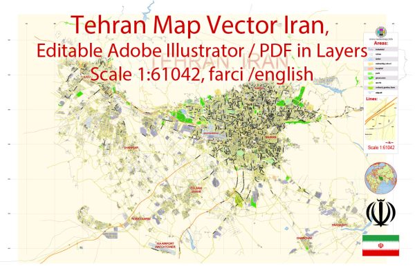
Tehran, the capital of Iran, is a sprawling metropolis with a rich history and a diverse array of districts, communities, and main streets.
Vectormap.Net provide you with the most accurate and up-to-date vector maps in Adobe Illustrator, PDF and other formats, designed for editing and printing. Please read the vector map descriptions carefully.
Here is a detailed description of some key areas in Tehran:
Districts:
- Tehran Central District: This area is the heart of the city and includes important landmarks such as the Grand Bazaar, Golestan Palace, and the National Museum of Iran. It is a historical district with a mix of traditional and modern elements.
- Tajrish: Located in the northern part of Tehran, Tajrish is known for its bustling bazaar, the Imamzadeh Saleh shrine, and proximity to the beautiful Darband hiking trail. It’s a more affluent and residential area with a blend of modern and traditional architecture.
- Saadat Abad: A wealthy residential district, Saadat Abad is known for its upscale neighborhoods, embassies, and luxury villas. Many expatriates and diplomats reside in this area.
- Vanak Square: This commercial and shopping district is situated in the northern part of Tehran and is known for its modern shopping centers, high-end boutiques, and entertainment venues.
- Shahrak-e Gharb: An affluent residential area in western Tehran, Shahrak-e Gharb is characterized by modern apartment complexes, shopping centers, and recreational facilities.
- Valiasr Street: One of the longest streets in Tehran, Valiasr Street stretches from the south to the north, passing through various districts. It is a major commercial and cultural artery, lined with shops, cafes, and cultural institutions.
Communities:
- Darband: Nestled at the foothills of the Alborz Mountains, Darband is a picturesque area known for its hiking trails, traditional teahouses, and restaurants. It’s a popular destination, especially on weekends.
- Jamaran: Located in the north, Jamaran is known for the mausoleum of Ayatollah Khomeini and the adjacent residence of the late Ayatollah Khamenei. The area is significant for its religious and political importance.
Main Streets:
- Valiasr Avenue: This is the longest street in Tehran and a major commercial and cultural hub. It spans various districts, offering a mix of shops, restaurants, and cultural institutions.
- Enqelab Street: Running parallel to Valiasr Avenue, Enqelab Street is known for its historical significance and is home to Tehran University. It has a vibrant atmosphere with bookstores, cafes, and cultural centers.
- Motahari Street: Connecting central Tehran to the northern districts, Motahari Street is a busy thoroughfare with commercial activities, including shops, restaurants, and cultural venues.
- Keshavarz Boulevard: Situated in central Tehran, this boulevard is known for government buildings, including the Ministry of Foreign Affairs, and is surrounded by parks and green spaces.
- Jordan Street: In the northern part of Tehran, Jordan Street is famous for its high-end shops, boutiques, and restaurants, making it a popular destination for shopping and entertainment.
Keep in mind that Tehran is a dynamic city with ongoing developments, so it’s always a good idea to check for the latest information if you plan to visit or need up-to-date details.


 Author: Kirill Shrayber, Ph.D. FRGS