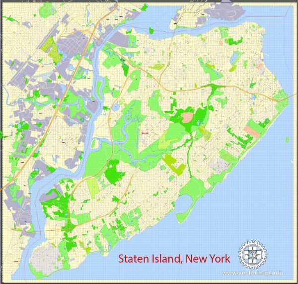
Staten Island, one of the five boroughs of New York City, has a rich urban history that spans centuries. Its development and evolution have been shaped by various factors, including its geography, economic activities, transportation infrastructure, and cultural influences.
Vectormap.Net provide you with the most accurate and up-to-date vector maps in Adobe Illustrator, PDF and other formats, designed for editing and printing. Please read the vector map descriptions carefully.
Here is a detailed overview of the urban history and street system of Staten Island:
Early History:
- Native American Presence: Before European colonization, the Lenape Native Americans inhabited Staten Island. They were part of the larger Algonquian-speaking Native American groups in the northeastern United States.
- Dutch and English Colonization: The Dutch were the first Europeans to settle on Staten Island in the early 17th century. In 1664, the English took control of the area, leading to its incorporation into the English colonies.
Agricultural and Rural Period:
- Farming Community: For much of its early history, Staten Island was primarily an agricultural community. Farms and estates dominated the landscape, and the island maintained a rural character.
Industrialization and Urban Growth:
- 19th Century Development: The mid-19th century saw the beginnings of industrialization and urbanization on Staten Island. The construction of the Staten Island Railroad in the 1860s facilitated transportation and contributed to economic growth.
- Growth of Urban Centers: Urban centers like St. George began to develop, and the island saw an increase in population as people were attracted to the job opportunities created by industrialization.
20th Century:
- Suburbanization: After World War II, Staten Island experienced a wave of suburbanization. The completion of the Verrazzano-Narrows Bridge in 1964 connected Staten Island to Brooklyn, leading to increased accessibility and further population growth.
- Housing Boom: The latter half of the 20th century witnessed a significant housing boom. Subdivisions and housing developments replaced many farms and open spaces.
Street System:
- Grid Pattern: The street system of Staten Island, especially in urbanized areas, follows a grid pattern. This is a common feature in many parts of New York City.
- Borough-Wide Streets: Major thoroughfares, such as Hylan Boulevard and Richmond Avenue, traverse the borough, connecting various neighborhoods. They serve as important transportation arteries.
- Neighborhood Streets: Residential neighborhoods often feature a mix of local streets, avenues, and boulevards. Some neighborhoods have distinct characteristics influenced by their historical development.
Contemporary Development:
- Infrastructure Improvements: In recent years, Staten Island has seen ongoing infrastructure improvements, including the expansion of public transportation options and road upgrades.
- Waterfront Development: Efforts have been made to revitalize the waterfront areas, providing recreational spaces and amenities for residents.
- Cultural Diversity: The borough is known for its cultural diversity, with different neighborhoods reflecting a blend of ethnicities and traditions.
Staten Island’s urban history and street system continue to evolve, shaped by the interplay of economic, social, and cultural factors. As part of New York City, it remains a distinctive and dynamic borough with a unique character within the larger urban landscape.


 Author: Kirill Shrayber, Ph.D. FRGS