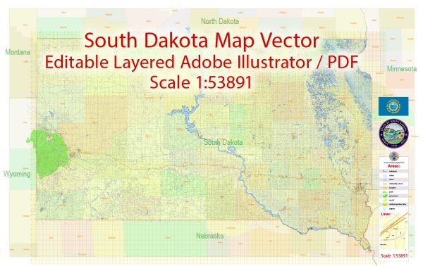
South Dakota is a state located in the Midwestern region of the United States. It is known for its vast prairies, Badlands National Park, the Black Hills, and the iconic Mount Rushmore. The state is sparsely populated, and its cities and towns are often smaller compared to those in more densely populated states.
Vectormap.Net provide you with the most accurate and up-to-date vector maps in Adobe Illustrator, PDF and other formats, designed for editing and printing. Please read the vector map descriptions carefully.
Here is an overview of some of the main cities and towns, as well as principal roads in South Dakota:
Main Cities and Towns:
- Sioux Falls:
- Largest city in South Dakota.
- Located in the southeastern part of the state.
- Major economic and cultural hub.
- Falls Park is a popular attraction.
- Rapid City:
- Gateway to the Black Hills.
- Close to Mount Rushmore.
- Home to the South Dakota School of Mines and Technology.
- Aberdeen:
- Located in the northeastern part of the state.
- Known for its agricultural and manufacturing industries.
- Home to Northern State University.
- Brookings:
- Home to South Dakota State University.
- Located in the eastern part of the state.
- Known for its educational institutions and research facilities.
- Watertown:
- Located in the northeastern part of South Dakota.
- Known for its scenic lakes and outdoor recreation opportunities.
- Mitchell:
- Famous for the Corn Palace, a building decorated with corn and grains.
- Located in the southeastern part of the state.
Principal Roads:
- Interstate 90 (I-90):
- Major east-west highway that crosses the state.
- Connects cities like Sioux Falls and Rapid City.
- Interstate 29 (I-29):
- Runs along the eastern edge of the state, connecting cities like Sioux Falls and Brookings.
- U.S. Route 14:
- Travels from the Minnesota border in the east to the Wyoming border in the west.
- Passes through cities like Brookings and Pierre.
- U.S. Route 212:
- Connects the Minnesota border to the Wyoming border, passing through Watertown and connecting with I-90.
- U.S. Route 83:
- North-south highway that passes through central South Dakota.
- Connects cities like Pierre and Murdo.
- South Dakota Highway 34:
- East-west state highway connecting cities like Pierre and Sturgis.
These are just a few examples, and there are several other state and local roads that contribute to the transportation network in South Dakota. The state’s road system plays a crucial role in connecting its cities, towns, and rural areas, facilitating transportation, commerce, and tourism.


 Author: Kirill Shrayber, Ph.D. FRGS