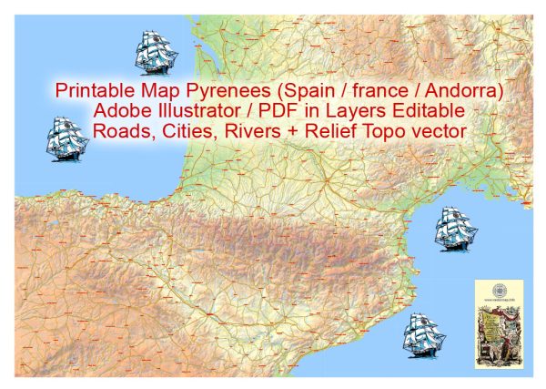
The Pyrenees is a mountain range in southwestern Europe that forms a natural border between Spain and France. The region is known for its stunning landscapes, rich cultural heritage, and outdoor recreational opportunities. While the Pyrenees are primarily a mountainous region, there are several cities, towns, and roads of significance in and around the area.
Vectormap.Net provide you with the most accurate and up-to-date vector maps in Adobe Illustrator, PDF and other formats, designed for editing and printing. Please read the vector map descriptions carefully.
Here’s a description of some of the main cities and towns along with principal roads in the Pyrenees:
Cities and Towns:
- Andorra la Vella (Andorra):
- Andorra la Vella is the capital of the Principality of Andorra, a small landlocked country nestled in the eastern part of the Pyrenees.
- The city is known for its duty-free shopping, medieval architecture, and as a gateway to the surrounding mountains for outdoor activities.
- Lourdes (France):
- Lourdes is a town in the Hautes-Pyrénées department in southwestern France.
- It is famous for the Sanctuary of Our Lady of Lourdes, a major Catholic pilgrimage site where the Virgin Mary is said to have appeared to a local girl.
- Pau (France):
- Pau is a historic city in the Pyrénées-Atlantiques department of southwestern France.
- The city is known for its beautiful château, boulevards, and as the birthplace of Henry IV.
- Tarbes (France):
- Tarbes is another city in the Hautes-Pyrénées department of France, located to the east of Pau.
- The city has historical significance and is known for its gardens, squares, and the Jardin Massey.
- Huesca (Spain):
- Huesca is a city in northeastern Spain, situated on the southern edge of the Pyrenees.
- It has a rich history, including Roman and Moorish influences, and features landmarks like the Huesca Cathedral.
Principal Roads:
- E9 (European Route E9):
- The E9 is a European coastal route that runs along the western and southern coasts of Europe, connecting cities like Lisbon, Barcelona, and Toulouse.
- In the Pyrenees region, it provides a scenic drive along the coast, offering breathtaking views.
- A64 (Autoroute A64):
- The A64 is a major toll highway in southwestern France, connecting Toulouse to Bayonne and passing through the Pyrenees.
- It is an essential route for traveling between the Atlantic coast and the cities in the southwest of France.
- N-260 (Carretera Nacional N-260):
- The N-260 is a national road in Spain that traverses the Pyrenees, connecting the Mediterranean coast with the Atlantic coast.
- It offers a picturesque drive through the mountains, passing by charming villages and natural landscapes.
- D117 (Route Départementale D117):
- The D117 is a French departmental road that crosses the Pyrenees from east to west.
- It provides access to several mountain passes and is a popular route for exploring the diverse landscapes of the region.
Exploring the Pyrenees by road allows travelers to experience the natural beauty of the mountains, visit historic towns, and enjoy outdoor activities such as hiking, skiing, and mountaineering. Keep in mind that the region is vast, and there are many smaller towns and villages worth exploring along the way.


 Author: Kirill Shrayber, Ph.D.