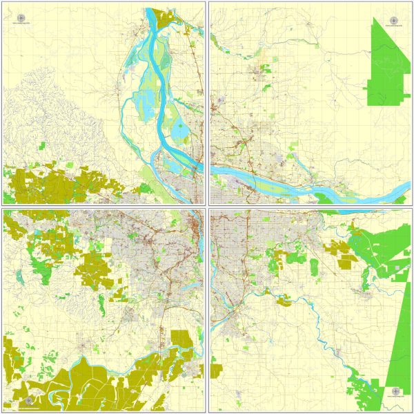
A general overview of the districts, communities, and street system in Portland, Oregon, and Vancouver, Washington.
Vectormap.Net provide you with the most accurate and up-to-date vector maps in Adobe Illustrator, PDF and other formats, designed for editing and printing. Please read the vector map descriptions carefully.
Portland, Oregon:
Districts:
- Downtown Portland: The central business district with skyscrapers, retail, and cultural institutions.
- Pearl District: Known for its trendy atmosphere, art galleries, and converted warehouses.
- Northwest Portland (Nob Hill): Features historic architecture, upscale boutiques, and dining options.
- Alberta Arts District: A vibrant neighborhood with art galleries, unique shops, and a diverse culinary scene.
- Division/Clinton: A popular area with a mix of boutiques, cafes, and food carts.
Communities:
- Irvington: A historic residential neighborhood with well-preserved early 20th-century homes.
- Hawthorne: Known for its eclectic and bohemian vibe, offering unique shops and cafes.
- Lloyd District: A commercial and entertainment district with the Moda Center and Oregon Convention Center.
Street System: Portland has a grid-like street system in many areas, making it relatively easy to navigate. The city is divided into five quadrants: Northwest (NW), Southwest (SW), Northeast (NE), Southeast (SE), and North (N). Streets are numbered and named, with avenues running north-south and streets running east-west.
Vancouver, Washington:
Communities:
- Downtown Vancouver: The central area with a mix of historic and modern buildings, shops, and restaurants.
- Felida: A residential neighborhood with a suburban feel and parks.
- Cascade Park: A commercial and residential area with shopping centers and schools.
Street System: Vancouver also has a grid-based street system, and its streets are often laid out in a more straightforward pattern. The city is divided into quadrants: Northeast (NE), Southeast (SE), Northwest (NW), and Southwest (SW). Main arterial roads facilitate easy access across the city.
For the most up-to-date and detailed information, it’s recommended to check with local resources, city planning departments, or official city websites.


 Author: Kirill Shrayber, Ph.D. FRGS