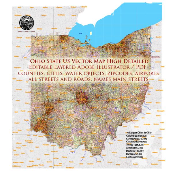
A general overview of some of the main cities, towns, and roads in Ohio.
Vectormap.Net provide you with the most accurate and up-to-date vector maps in Adobe Illustrator, PDF and other formats, designed for editing and printing. Please read the vector map descriptions carefully.
Main Cities and Towns in Ohio:
- Columbus:
- Capital and largest city of Ohio.
- Home to Ohio State University.
- A major economic and cultural hub.
- Cleveland:
- Located on the shores of Lake Erie.
- Known for its cultural attractions, including the Rock and Roll Hall of Fame.
- Cincinnati:
- Situated on the Ohio River.
- Known for its historic architecture and vibrant arts scene.
- Dayton:
- Known for its aviation history, including the Wright brothers’ bicycle shop.
- Toledo:
- Located on the western side of the state, along the border with Michigan.
- Has a significant industrial and shipping presence.
- Akron:
- Known for its history in rubber and tire production.
- Home to the University of Akron.
- Youngstown:
- Historically known for its steel production.
- Located in the northeastern part of the state.
Major Roads and Highways:
- Interstate Highways:
- I-70: Runs east-west, connecting Columbus, Dayton, and Cincinnati.
- I-71: Connects Cleveland, Columbus, and Cincinnati.
- I-75: Runs north-south, passing through Toledo, Dayton, and Cincinnati.
- I-80/I-90 (Ohio Turnpike): Connects the Indiana state line to the Pennsylvania state line, passing through major cities like Toledo, Cleveland, and Youngstown.
- US Highways:
- US-23: Runs north-south, connecting Toledo and Columbus.
- US-35: Connects Cincinnati and Dayton.
- US-33: Connects Columbus and Toledo.
- US-50: Runs east-west, passing through Cincinnati.
Toll Roads:
The Ohio Turnpike (I-80/I-90) is a major toll road in the state. It spans from the Indiana state line to the Pennsylvania state line, providing a fast east-west route across northern Ohio. Toll rates and policies may change, so it’s recommended to check for the latest information on tolls and any new developments.
Free Roads:
Most other state and U.S. highways in Ohio are toll-free, and there are numerous local roads and streets in cities and towns across the state.
For the latest and most accurate information on roads, it’s advisable to check with the Ohio Department of Transportation (ODOT) or use a reliable navigation tool or map application.


 Author: Kirill Shrayber, Ph.D. FRGS