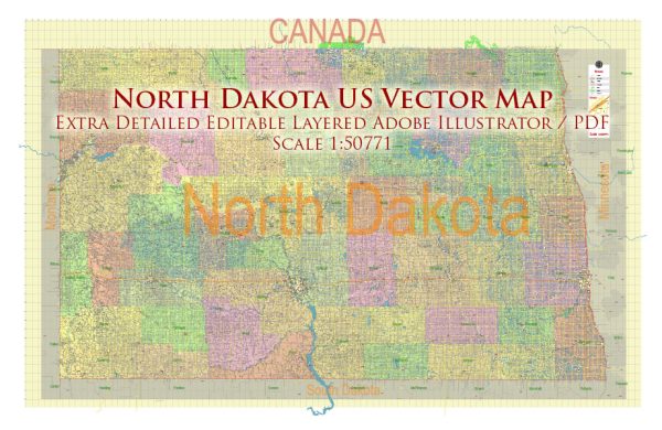
A general overview of some main cities and roads in North Dakota.
Vectormap.Net provide you with the most accurate and up-to-date vector maps in Adobe Illustrator, PDF and other formats, designed for editing and printing. Please read the vector map descriptions carefully.
Main Cities:
- Fargo: Located in the eastern part of the state, Fargo is the largest city in North Dakota. It serves as a major economic and cultural hub, with a growing population and diverse amenities.
- Bismarck: The state capital, situated in the central part of North Dakota on the Missouri River. Bismarck is known for its government institutions, historic sites, and outdoor recreational opportunities.
- Grand Forks: Found in the northeastern part of the state along the Red River, Grand Forks is home to the University of North Dakota and is an important center for education, healthcare, and commerce.
- Minot: Located in the north-central part of the state, Minot is known for its Air Force base and agricultural activities. It’s a regional center for trade and transportation.
- Williston: Situated in the northwestern part of North Dakota, Williston has experienced significant growth due to the oil boom in the Bakken Formation. It’s a key center for the energy industry.
Major Roads:
- Interstate Highways:
- I-29: Runs north-south along the eastern border of the state, connecting cities like Fargo and Grand Forks.
- I-94: Crosses the state from the east near Fargo to the west near Bismarck, providing a major east-west route.
- U.S. Highways:
- US-2: Runs east-west through the northern part of the state, passing through cities like Minot.
- US-52: Travels diagonally across the state from the southeast to the northwest, passing through Fargo and Minot.
- US-83: Runs north-south through the western part of North Dakota, connecting cities like Bismarck and Minot.
- State Highways:
- North Dakota has an extensive network of state highways connecting various towns and cities. Some important ones include ND-13, ND-23, and ND-200.
Toll Roads:
North Dakota does not have toll roads. The state primarily relies on fuel taxes and other funding sources to maintain its road infrastructure.
Free Roads:
The vast majority of roads in North Dakota are free for use, including the interstate, U.S., and state highways. Travelers can typically move across the state without encountering tolls on the roadways.
To get the most up-to-date and accurate information, consider checking with the North Dakota Department of Transportation or other official sources for any changes in road infrastructure or new developments in the state.


 Author: Kirill Shrayber, Ph.D. FRGS