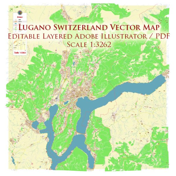
Lugano, located in the Italian-speaking canton of Ticino in Switzerland, has a rich political and transportation history that reflects the broader developments in the region and the country.
Vectormap.Net provide you with the most accurate and up-to-date vector maps in Adobe Illustrator, PDF and other formats, designed for editing and printing. Please read the vector map descriptions carefully.
Here’s a detailed overview:
Political History:
Early History:
- The area around Lugano has a history dating back to Roman times when it was part of the Roman Empire.
- Over the centuries, Lugano was influenced by various rulers, including the Lombards and the Franks.
Medieval and Renaissance Periods:
- In the medieval period, Lugano was a center of trade and commerce, with its strategic location along the Gotthard trade route.
- The town was part of the Duchy of Milan in the 15th century, but it came under Swiss control after the Swiss Confederacy defeated the Duchy in 1512.
Swiss Confederacy and Helvetic Republic:
- Lugano became a part of the Old Swiss Confederacy and later the Helvetic Republic during the Napoleonic era.
- The Congress of Vienna in 1815 confirmed Lugano as part of the Swiss Confederacy and established the modern boundaries of Switzerland.
Federal State of Switzerland:
- In the 19th century, Switzerland underwent significant political and constitutional changes, culminating in the establishment of the modern federal state.
- Lugano continued to develop as an important economic and cultural center within the Swiss context.
20th Century:
- Lugano played a role in the economic development of Switzerland, particularly in the finance and banking sectors.
- Switzerland’s policy of neutrality during World War I and II also impacted Lugano, which remained uninvolved in the conflicts.
Recent Years:
- Lugano continues to be an integral part of Switzerland, contributing to the country’s economic and cultural landscape.
- It has maintained its status as a financial center, and its political structure aligns with the Swiss federal system.
Transportation History:
Early Transportation:
- Lugano’s strategic location made it a crucial hub for transportation, especially during medieval times with the Gotthard trade route connecting northern and southern Europe.
- The introduction of railways in the 19th century further enhanced Lugano’s connectivity.
Railways:
- The construction of the Gotthard Railway in the late 19th century played a pivotal role in connecting Lugano with the rest of Switzerland and Europe.
- The railway facilitated the movement of goods and people, contributing to Lugano’s economic growth.
Roadways:
- The development of road networks, including the Swiss autobahn system, improved road transportation in and around Lugano.
- Lugano is connected to major cities in Switzerland and neighboring countries through well-maintained roads.
Air Transportation:
- While Lugano itself doesn’t have a major airport, the region is served by airports in Zurich and Milan, with good transportation links connecting Lugano to these hubs.
In summary, Lugano’s political history reflects its journey from being part of various states to becoming an integral part of the Swiss Confederacy. Its transportation history highlights the city’s role as a key hub, especially with the development of railways and road networks that facilitated economic growth and connectivity with the broader region.


 Author: Kirill Shrayber, Ph.D. FRGS