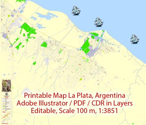
La Plata, Argentina, is the capital city of the Buenos Aires Province and is situated on the eastern shore of the Paraná River estuary, about 34 miles (55 km) southeast of the city of Buenos Aires. The political and transportation history of La Plata is closely tied to the broader history of Argentina.
Vectormap.Net provide you with the most accurate and up-to-date vector maps in Adobe Illustrator, PDF and other formats, designed for editing and printing. Please read the vector map descriptions carefully.
Political History:
- Foundation and Planning:
- La Plata was founded in 1882 as the planned capital of the Buenos Aires Province, replacing the city of Buenos Aires as the provincial capital.
- The decision to establish a new capital was driven by concerns about the centralization of power in Buenos Aires, and La Plata was envisioned as a modern and well-planned city.
- Architectural Development:
- The city was designed by architect Pedro Benoit and urban planner Carlos Thays, following a strict grid pattern with a central square (Plaza Moreno) and diagonal avenues.
- Notable architectural landmarks include the neo-Gothic Cathedral of La Plata and the Teatro Argentino, both of which contribute to the city’s cultural and historical significance.
- Political Significance:
- La Plata became the political center of the Buenos Aires Province, hosting the provincial government institutions.
- The city played a role in the political and social changes in Argentina, serving as a hub for educational and cultural activities.
Transportation History:
- Railways:
- The late 19th and early 20th centuries saw significant developments in the railway system, connecting La Plata with other parts of the country.
- Railways facilitated the transportation of goods and people, contributing to the economic growth of the region.
- Port and Waterways:
- La Plata has a strategic location on the Paraná River estuary, and its port has been historically important for trade and commerce.
- The Paraná River connects La Plata to inland areas, facilitating the transportation of goods to and from the interior of Argentina.
- Road Infrastructure:
- Over the years, road infrastructure has been developed to connect La Plata with neighboring cities and regions.
- Highways and roads play a crucial role in the transportation network, facilitating the movement of people and goods.
- Public Transportation:
- La Plata has a public transportation system, including buses and taxis, to serve the local population.
- The city has seen efforts to improve and expand public transportation to address the growing urban population and traffic challenges.
- Airport:
- La Plata has an airport, La Plata Airport (Aeropuerto La Plata), providing air connectivity for the region.
In summary, La Plata’s political history revolves around its role as the capital of the Buenos Aires Province, while its transportation history reflects the city’s strategic location and the development of infrastructure to support economic activities and connectivity within Argentina. The city continues to evolve, with ongoing efforts to enhance its urban development and transportation networks.


 Author: Kirill Shrayber, Ph.D.