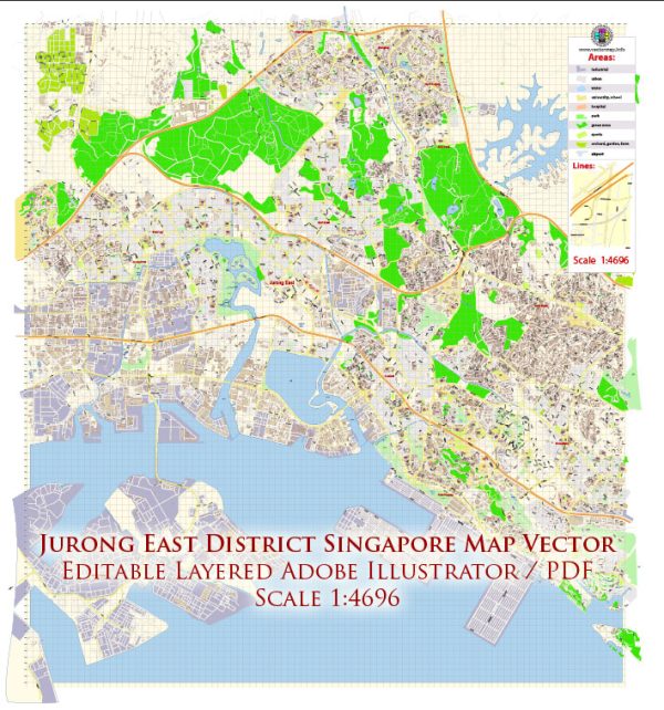
Jurong East is a planning area and district located in the western part of Singapore.
Vectormap.Net provide you with the most accurate and up-to-date vector maps in Adobe Illustrator, PDF and other formats, designed for editing and printing. Please read the vector map descriptions carefully.
Here is a detailed description of the economic and transport connections in Jurong East:
Economic Overview:
- Industrial and Commercial Hub: Jurong East is a significant industrial and commercial hub in Singapore. It is part of the larger Jurong Lake District, which is slated to be developed into a second Central Business District (CBD). The area houses numerous business parks, industrial estates, and commercial spaces.
- Jurong Gateway: Jurong Gateway is a key precinct within Jurong East, characterized by high-rise commercial and residential developments. It includes shopping malls like JCube, Westgate, and JEM, making it a retail and entertainment hub.
- Science and Technology Parks: The district is home to science and technology parks, fostering innovation and research activities. These include the Biopolis and Fusionopolis, which are part of Singapore’s push towards becoming a global biomedical and research hub.
- Educational Institutions: Jurong East is in proximity to various educational institutions, including Nanyang Technological University (NTU) and the National Institute of Education (NIE).
Transport Connections:
- Public Transportation:
- Jurong East MRT Station: A major transportation hub, Jurong East MRT Station serves as an interchange for both the East-West Line and the North-South Line. This provides residents and workers with easy access to various parts of the island.
- Bus Interchange: Jurong East Bus Interchange is located adjacent to the MRT station, facilitating bus services to different parts of Singapore.
- Expressways:
- Pan Island Expressway (PIE): Jurong East is well-connected by the PIE, allowing for convenient travel by car to other parts of Singapore.
- Ayer Rajah Expressway (AYE): The AYE also provides a direct route for motorists to access the western and southern parts of the island.
- High-Speed Rail (HSR):
- While plans for a high-speed rail link between Singapore and Kuala Lumpur, Malaysia were initially proposed, as of my last update, there might have been developments or changes in the status of this project.
- Cycling Infrastructure:
- Singapore has been investing in cycling infrastructure, and Jurong East has seen developments in this regard. There are cycling paths and facilities to promote sustainable and active transportation.
- Connectivity to Jurong Island:
- Jurong Island, a major industrial hub for the petrochemical and chemical industries, is nearby. Connectivity to Jurong Island is crucial for businesses in these sectors.
- Future Developments:
- The Singapore government has outlined plans for the Jurong Lake District to become a second CBD, further enhancing economic and transport connections in the area.


 Author: Kirill Shrayber, Ph.D. FRGS