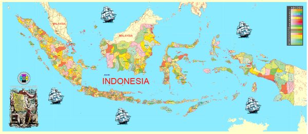
Indonesia is an archipelagic country located in Southeast Asia and consists of thousands of islands. The country has several main cities and a developing railroad network.
Vectormap.Net provide you with the most accurate and up-to-date vector maps in Adobe Illustrator, PDF and other formats, designed for editing and printing. Please read the vector map descriptions carefully.
Main Cities in Indonesia:
- Jakarta:
- The capital and largest city of Indonesia.
- Located on the island of Java.
- A major political, economic, and cultural hub.
- Home to various landmarks, government offices, and commercial centers.
- Surabaya:
- The second-largest city in Indonesia.
- Situated on the island of Java.
- A significant industrial and business center.
- Has a busy port and plays a crucial role in trade.
- Bandung:
- Located in West Java.
- Known for its universities, technology, and creative industries.
- A popular destination for its cool climate and historical architecture.
- Medan:
- The largest city in Sumatra.
- A major economic and commercial center in the region.
- Known for its diverse cultural heritage and culinary offerings.
- Semarang:
- Located in Central Java.
- A port city with a mix of historic and modern architecture.
- An important center for trade and industry.
- Makassar:
- The largest city in Sulawesi.
- A major port and economic hub in eastern Indonesia.
- Known for its cultural diversity and historical sites.
- Denpasar:
- The capital city of Bali.
- A popular tourist destination with beautiful beaches and vibrant nightlife.
- Known for its rich Hindu culture and traditions.
Railroads in Indonesia:
As of my last update, Indonesia has been investing in expanding its railway network. Some key aspects include:
- Java Island:
- Java has a well-developed railway network connecting major cities like Jakarta, Bandung, Surabaya, and Semarang.
- The high-speed rail project between Jakarta and Bandung is under development.
- Sumatra Island:
- Sumatra has railway lines connecting cities like Medan, Pekanbaru, and Padang.
- The railways primarily serve transportation of goods and passengers.
- Sulawesi Island:
- Sulawesi is developing its railway infrastructure, connecting cities like Makassar and Palu.
- The railway network is expected to enhance connectivity and economic development.
- Kalimantan Island:
- Plans have been proposed to develop railway lines in Kalimantan (Borneo), focusing on connecting key cities and supporting the transportation of natural resources.
- Bali:
- Bali does not have a railway network as of my last update, and transportation primarily relies on roads.
Indonesia is working on expanding and improving its railway infrastructure to enhance connectivity, support economic growth, and provide efficient transportation options. It’s essential to check for the latest updates and developments in both city infrastructure and railway projects for the most current information.


 Author: Kirill Shrayber, Ph.D. FRGS