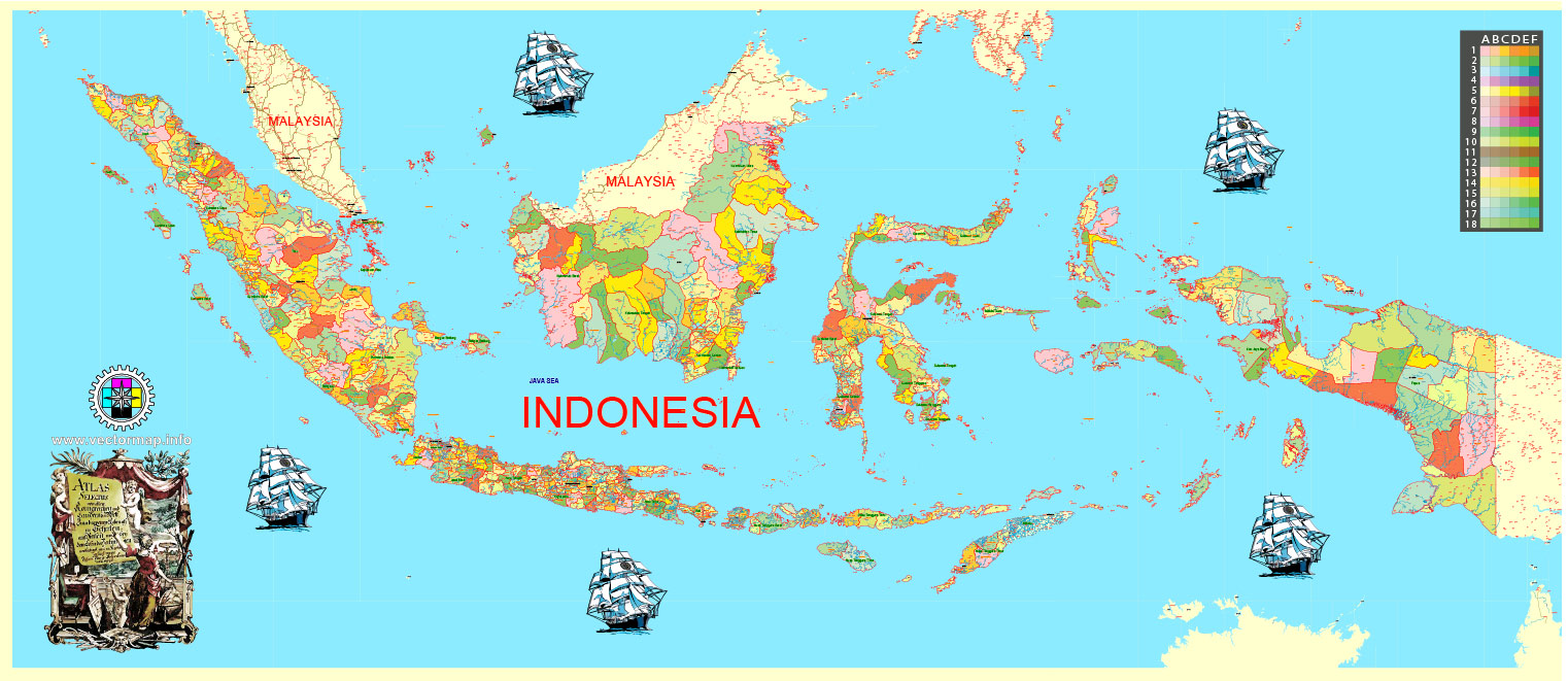
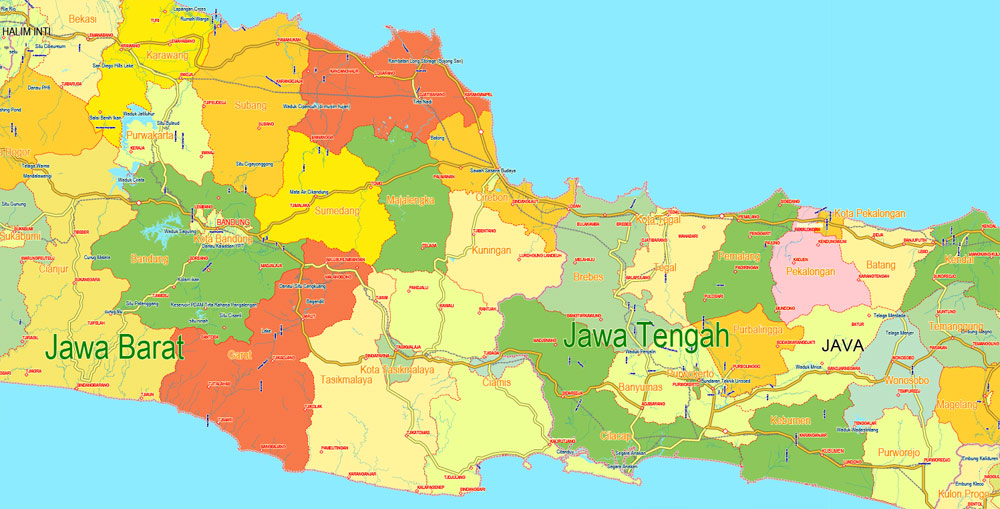
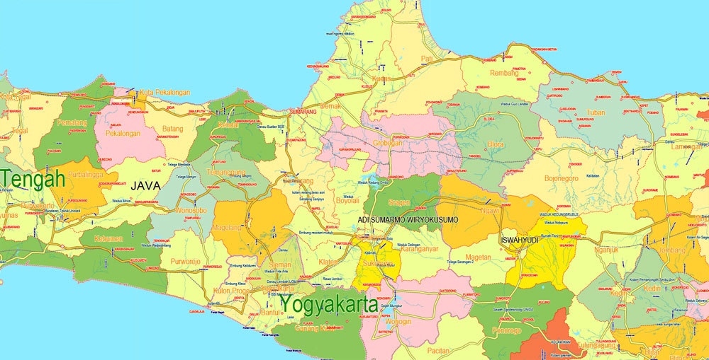
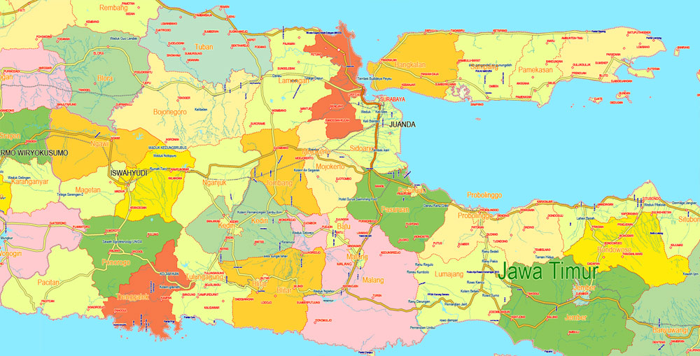
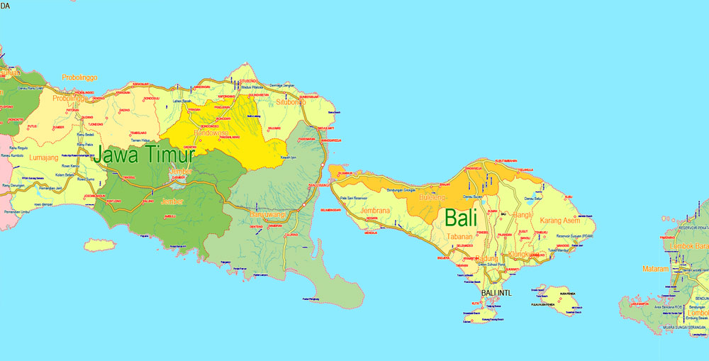
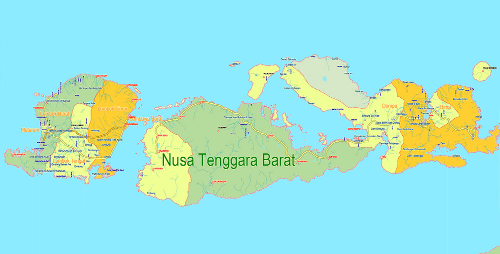
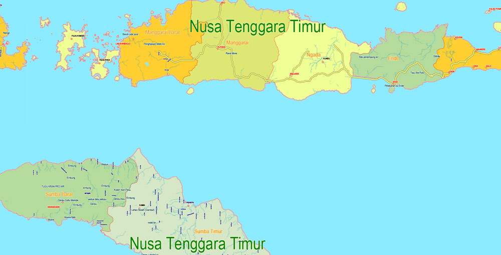
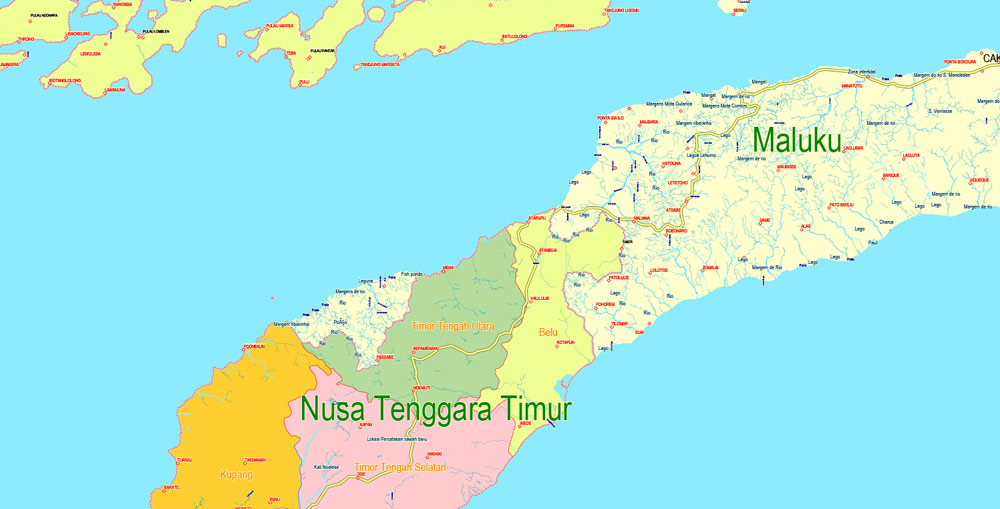
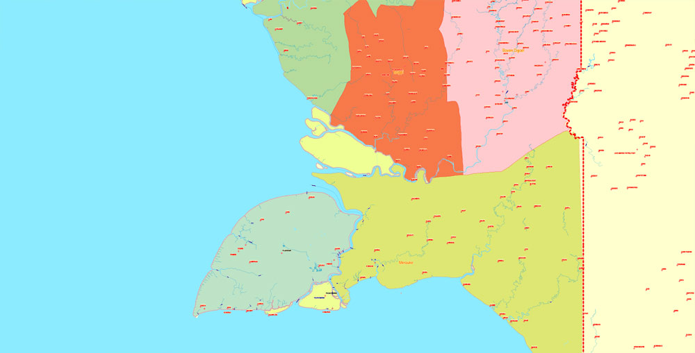
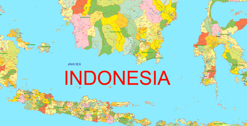
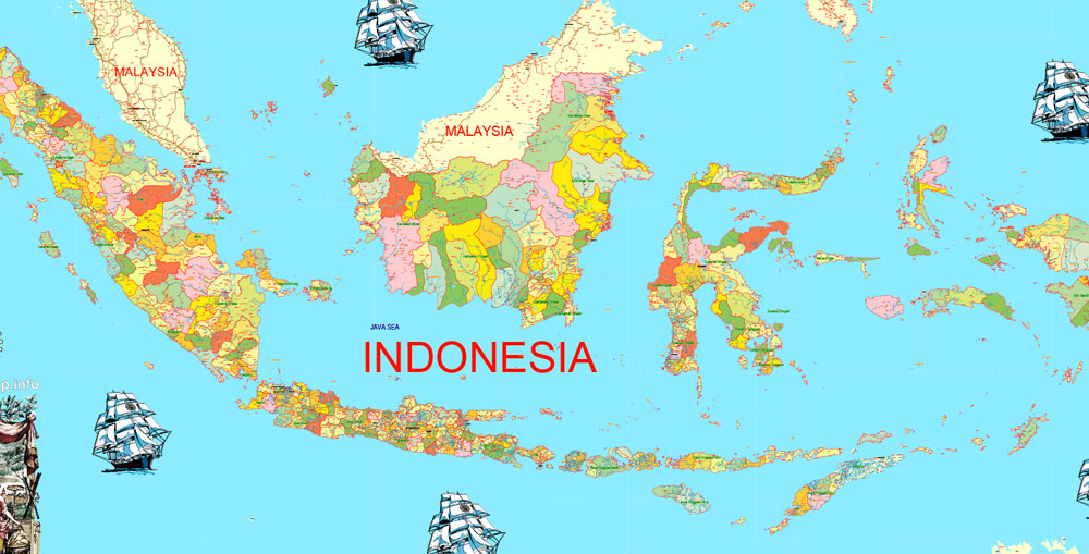
Printable Admin Map Indonesia, exact vector Map full editable Layered Adobe Illustrator, full vector, scalable, editable text format all names, 68 mb ZIP
Main roads and railroads, waterways, all Cities, all Provincies and admin zones . Map for design, printing, arts, projects, presentations, for architects, designers and builders, business, logistics. Mercator projection.
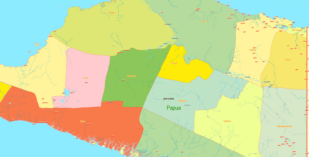
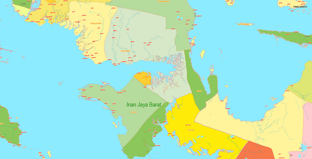
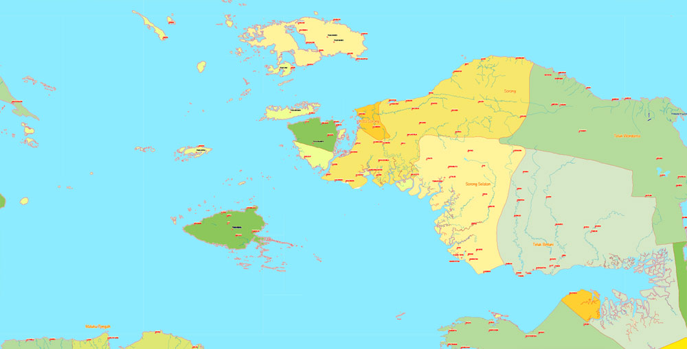
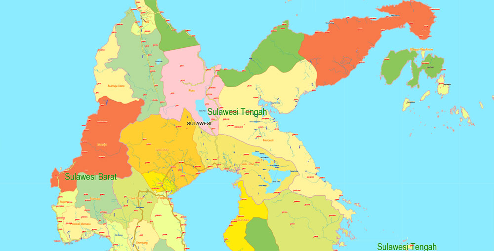
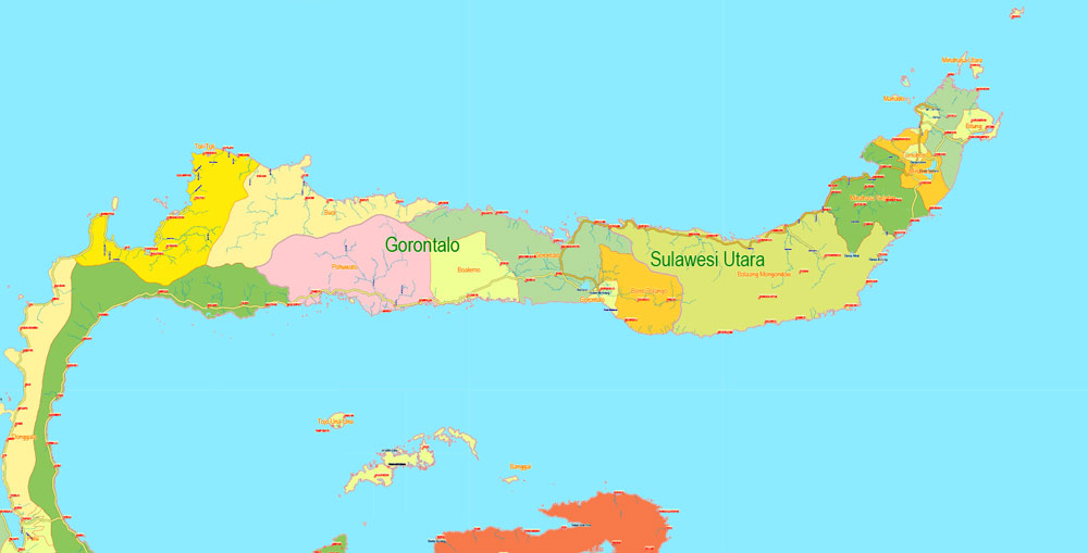
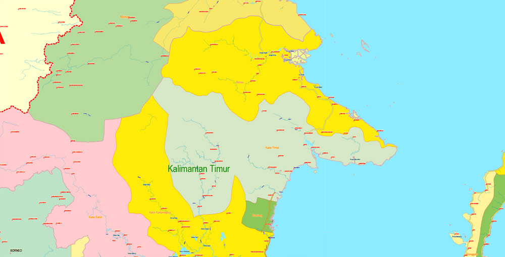
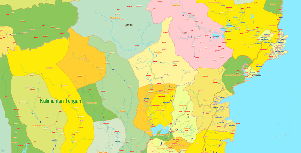
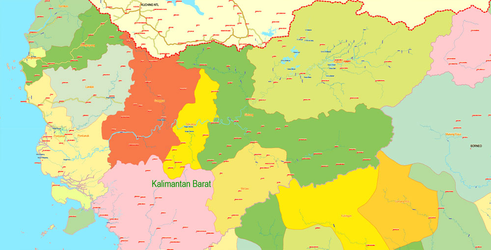
Included layers: roads, waterways, colored admin zones, provincies bordres, country borders, admin borders, names provinces, cities and admin- the separated layers.
CDR, DWG, and other formats – on request, same price, please, contact
Indonesia.
This vector map of Indonesia is used as a basis for design, editing, and further printing.
This is the most detailed, exact map of Indonesia for high-quality printing and polygraphy. You can always clarify the map development date by contacting us.
For your convenience, all objects on Indonesia vector map are divided into layers. And the editing is very easy – colors, lines, etc.
You can easily add any objects needed (e.g. shops, salons, sale points, gas station or attraction) on any layer of Indonesia vector map.
Indonesia is a country in Southeast Asia, between the Indian and Pacific oceans. It is the world’s largest island country, with more than seventeen thousand islands, and at 1,904,569 square kilometres (735,358 square miles), the 14th largest by land area and the 7th largest in combined sea and land area. With over 261 million people, it is the world’s 4th most populous country as well as the most populous Muslim-majority country. Java, the world’s most populous island, contains more than half of the country’s population.
One of the advantages of Indonesia vector maps of our production is the relevance of cartographic data, we constantly update all our products.
This vector map of Indonesia is used by:
designers, layout designers, printers, advertisers and architects. Our product – vector maps – is designed for further editing and printing in large formats – from @Wall format (a few meters) to A-0 and A-1, A-2, A-3.
The Indonesia map in vector format is used for design, urban planning, presentations and media visualizations.
The advertising and presentation map of Indonesia (usually the final designer marks the routes, and puts the client’s objects (shops, saloons, gas stations etc.)
The undoubted advantage is that people will NEVER throw out this advertising product – the map. In fact, as an advertising medium, a map is the most “long-playing” of the well-known polygraphic advertising media, with the longest lifespan, and the maximum number of interactions with the customer.
For travelers, maps are sold at the airports and gas stations around the world. Often the source is our vector maps.
Take a look, who purchases our vector maps of Indonesia in “Our Clients and Friends” page – these are large and small companies, from super-brands like Volvo and Starbucks, to small design studios and printing houses.
It’s very easy to work with vector maps of Indonesia city, even for a not very experienced designer who can turn on and off the map layers, add new objects, change the colors of fill and lines according to customer requirements.
The undoubted advantage of Indonesia vector maps in printing is an excellent and detailed visualization, when customer can expand a large paper map and instantly define his location, find a landmark, an object or address on map, unlike using the popular electronic formats of Google and Yandex maps for example.
Printable vector maps of Indonesia are much more convenient and efficient than any electronic maps on your smartphone, because ALL DETAILS are displayed in the entire space of Indonesia map.
The sovereign state is a presidential, constitutional republic with an elected parliament. It has 34 provinces, of which five have special status. Jakarta, the country’s capital, is the second most populous urban area in the world. The country shares land borders with Papua New Guinea, East Timor, and the eastern part of Malaysia. Other neighbouring countries include Singapore, Vietnam, the Philippines, Australia, Palau, and India’s Andaman and Nicobar Islands. Despite its large population and densely populated regions, Indonesia has vast areas of wilderness that support a high level of biodiversity. The country has abundant natural resources like oil and natural gas, tin, copper and gold. Agriculture mainly produces rice, palm oil, tea, coffee, cacao, medicinal plants, spices and rubber. Indonesia’s major trading partners are China, United States, Japan, Singapore and India.
Useful tips on working with vector maps of cities and countries in Adobe Illustrator.
«V» – launches the Selection tool (cursor, black arrow), which makes active any vector line.
«А» – launches the Direct Selection tool (white cursor), allows you to select curve elements and drag them to the desired place.
«R» – activates the Rotate tool, which helps you rotating selected objects around the center point by 360 degrees.
«E» – gives you the opportunity to use the Eraser tool and erase unnecessary parts.
«X» – switches between Fill and Stroke in the Tools section. Try to get used to this hot key and
you will quickly understand that you can’t live and work without it.
Guides are not limited to vertical and horizontal in Adobe Illustrator. You can also create a diagonal guide for example. Moreover, you can turn any contours into guides. Select the outline and go to View > Guides > Make Guides (Create Guides), or simply press Cmd/Ctrl + 5. You can also turn the guides back into an editable object. Go to menu, View > Guides > Unlock Guides (Release Guides), select the guide you want to edit and select View > Guides > Release Guides (Reset Guides), or just press Cmd/Ctrl + Option / Alt + 5).
You will probably want to change the color scheme used on our Indonesia vector map.
To quickly and effectively play with colors.
Of course, you can do it manually, all objects in our Indonesia vector map are divided according to types and layers, and you can easily change the color gamma of vector objects in groups and layers.
But there is more effective way of working with the whole VECTOR MAP of Indonesia and all layers:
The overview dialog «Edit colors»/«Repaint Graphic Object» (this dialog box name can change depending on the context):
If you have selected a part or a layer of Indonesia vector map and open the dialog box by clicking the icon in the Control panel, on the Samples palette or the Color Catalog, or if you choose Edit > Edit Colors> Repaint Graphic Object, then the «Repaint Graphic Object» dialog box appears, and you get access to «Assign» and «Edit» tabs.
If a picture or a map fragment is not selected, and you open the dialog box by clicking the icon in the Control panel, on the Samples palette or in the Color Catalog, the «Edit Colors» dialog box appears and you can only access the «Edit» tab.
Regardless of the name at the top of the dialog box, the right-hand side always displays the color group of the current document, as well as two default color groups: Print Color and Grayscale. These color groups can be selected and used any time.
Create and edit color groups of Indonesia vector map, and also assign colors using the «Edit Colors»/ а «Repaint Graphic Object» dialog box.
A. Creating and editing of a color group on the «Edit» tab
B. Assigning colors on the «Assign» tab
C. Select a group of colors from the «Color groups» list
The option «Repaint a graphic object» in the lower part of the dialog box allows you to preview the colors on a selected layer of Vector map, or a group of elements, and specify whether its colors will be redefined when the dialog box is closed.
The main areas of the dialog box are:
«Edit»
The «Edit» tab is designed to create a new or edit the existing color groups.
The harmony rules Menu and the Color Wheel are used to conduct experiments with color harmonies. The color wheel shows how colors are related in color harmony, and the color bars allow you to view and manipulate an individual color values. In addition, you can adjust the brightness, add and remove colors, save color groups and view colors on the selected Vector Map of Indonesia or a separated layers.
«Assign»
The «Assign» tab is used to view and control on how the original colors are replaced with colors from the color group like your corporate colors in the Vector Map of Indonesia city.
The assign color ability is provided only if the entire map, layer or fragment is selected in the document. You can specify which of new colors replace the current colors, whether the spot colors should be preserved and how colors are replaced (for example, you can replace colors completely or changing the color tone while maintaining the brightness). The «Assign» tab allows you to redefine colors in the Vector Map of Indonesia city, or in separate layers and fragments using the current color group or reducing the number of colors in the current Vector Map.
Color groups
Is a list of all saved color groups for current document (the same groups appear in the «Samples» palette). You can edit and delete the existing color groups, as well as creating a new ones using the list of “Color Groups” in the dialog box. All changes appear in the «Samples» palette.
The highlighted color group shows, which color group is currently edited.
Any color group can be selected and edited, or used to redefine the colors in the selected vector map of Indonesia city, its fragments or elements.
Saving a color group adds this group to the specified list.
Opening the «Edit Colors»/«Repaint Graphic Object» dialog box.
Open the «Edit Colors»/«Repaint Graphic Object» dialog box using one of the following methods:
«Edit»> «Edit Colors»> «Repaint Graphic object» or «Repaint With Style».
Use these commands if you need to edit the colors in the selected vector map of Indonesia city.
«Repaint Graphic object» button on the «Control» panel.
Use this button if you need to adjust colors of Indonesia vector map using the а «Repaint graphic object» dialog box.
The specified button is available if the selected vector map or its fragment contains two or more colors.
Note. This color editing method is convenient for global color adjustment in a vector map, if global colors were not used when creating a Map of Indonesia.
The «Edit colors» button or «Edit or apply colors» on the «Color Catalog» palette
Click this button if you need to edit colors on the «Color Catalog» palette or edit and then apply them to the selected Vector Map of Indonesia or its fragment.
The «Edit color group» button or «Edit or apply color group» on the «Samples» palette.
Click this button if you need to edit the colors in the specific color group or edit and apply them to the selected Vector Map of Indonesia or a group of its elements, for example, the whole layer “Streets and lines”. You can also double-click the color group in the Samples panel to open the dialog box.
The Indonesian archipelago has been an important region for trade since at least the 7th century, when Srivijaya and then later Majapahit traded with Chinese dynasties and Indian kingdoms. Local rulers gradually absorbed foreign cultural, religious and political models from the early centuries CE, and Hindu and Buddhist kingdoms flourished. Indonesian history has been influenced by foreign powers drawn to its natural resources. Muslim traders and Sufi scholars brought Islam, while European powers brought Christianity and fought one another to monopolise trade in the Spice Islands of Maluku during the Age of Discovery. Indonesia experienced a long period of Dutch colonialism that started from Amboina and Batavia, eventually covering all of the archipelago including Timor and Western New Guinea, and at times interrupted by Portuguese, French and British rule. During the decolonisation of Asia after World War II, Indonesia achieved independence in 1949 following an armed and diplomatic conflict with the Netherlands.
If the map file is too large and your computer freezes or even can’t open it quickly:
1. Try to reduce the color resolution of the video card (display) to 256 colors while working with a large map.
2. Using Windows Task Manager, select all the application you don’t need, while working with map, just turn them off.
3. Launch Adobe Illustrator. (DO NOT OPEN the vector map file)
4. Start the Windows Task Manager using administrator rights > Find the “Illustrator” process > set the «real time» priority,
5. Open the file. When you see the LEGACY FONT popup window – click “OK” (do not update). You can restore the TEXT later.
6. Can also be useful: When file is opened – Edit > Settings > Basic Settings > disable smoothing. /// It looks scary, but works quickly)))
We recommend saving the file in Adobe Illustrator 10 version. It’s much more stable when working with VERY BIG size files.
Indonesia consists of hundreds of distinct native ethnic and linguistic groups, with the largest—and politically dominant—ethnic group being the Javanese. A shared identity has developed, defined by a national language, ethnic diversity, religious pluralism within a Muslim-majority population, and a history of colonialism and rebellion against it. Indonesia’s national motto, “Bhinneka Tunggal Ika” (“Unity in Diversity” literally, “many, yet one”), articulates the diversity that shapes the country. Indonesia’s economy is the world’s 16th largest by nominal GDP and the 7th largest by GDP at PPP. Indonesia is a member of several multilateral organisations, including the UN, WTO, IMF and G20. It is also a founding member of Non-Aligned Movement, Association of Southeast Asian Nations, Asia-Pacific Economic Cooperation, East Asia Summit, Asian Infrastructure Investment Bank and Organisation of Islamic Cooperation.
Geography
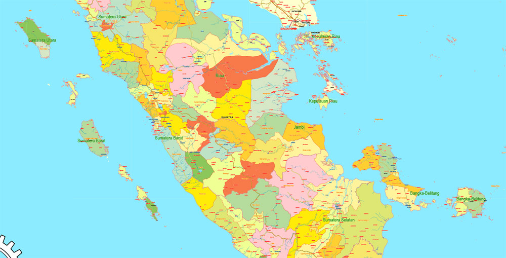
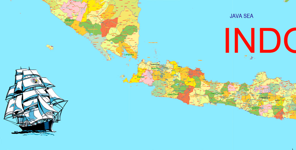
Indonesia lies between latitudes 11°S and 6°N, and longitudes 95°E and 141°E. It is the largest archipelagic country in the world, extending 5,120 kilometres (3,181 mi) from east to west and 1,760 kilometres (1,094 mi) from north to south. According to the country’s Coordinating Ministry for Maritime Affairs, Indonesia has 17,504 islands (16,056 of which are registered at the UN), scattered over both sides of the equator, and with about 6,000 of them are inhabited. The largest are Java, Sumatra, Borneo (shared with Brunei and Malaysia), Sulawesi, and New Guinea (shared with Papua New Guinea). Indonesia shares land borders with Malaysia on Borneo, Papua New Guinea on the island of New Guinea, and East Timor on the island of Timor, and maritime borders with Singapore, Malaysia, Vietnam, the Philippines, Palau, and Australia.
At 4,884 metres (16,024 ft), Puncak Jaya is Indonesia’s highest peak, and Lake Toba in Sumatra is the largest lake, with an area of 1,145 km2 (442 sq mi). Indonesia’s largest rivers are in Kalimantan and New Guinea, and include Kapuas, Barito, Mamberamo, Sepik and Mahakam; such rivers are communication and transport links between the island’s river settlements.
Indonesia is an archipelagic country located in Southeast Asia, lying between the Indian Ocean and the Pacific Ocean. It is located in a strategic location astride or along major sea lanes connecting East Asia, South Asia and Oceania. Indonesia’s various regional cultures have been shaped—although not specifically determined—by centuries of complex interactions with its physical environment.
Indonesia is an archipelagic country extending about 5,120 kilometres (3,181 mi) from east to west and 1,760 kilometres (1,094 mi) from north to south. According to a geospatial survey conducted between 2007 and 2010 by National Coordinating Agency for Survey and Mapping (Bakosurtanal), Indonesia has 13,466 islands. While earlier survey conducted in 2002 by National Institute of Aeronautics and Space (LAPAN) stated Indonesia has 18,307 islands. According to the CIA World Factbook, there are 17,508 islands. The discrepancy between the surveys is likely caused by the earlier different survey method including tidal islands, sandy cays and rocky reefs that surface during low tide and submerge during high tide. There are 8,844 named islands according to estimates made by the government of Indonesia, with 922 of those are permanently inhabited. It comprises five main islands: Sumatra, Java, Borneo (known as Kalimantan in Indonesia), Sulawesi, and New Guinea; two major island groups (Nusa Tenggara and the Maluku Islands) and sixty smaller island groups. Four of the islands are shared with other countries: Borneo is shared with Malaysia and Brunei; Sebatik, located off the northeastern coast of Kalimantan, shared with Malaysia; Timor is shared with East Timor; and the newly divided provinces of Papua and West Papua share the island of New Guinea with Papua New Guinea.
Indonesia has total land area of 1,904,569 square kilometres (735,358 sq mi), Including 93,000 square kilometres (35,908 sq mi) of inland seas (straits, bays, and other bodies of water). The additional surrounding sea areas bring Indonesia’s generally recognised territory (land and sea) to about 5 million km2. The government, however, also claims an exclusive economic zone, which brings the total area to about 7.9 million km2.
Indonesia is a transcontinental country, where its territory consisted of islands geologically considered as part of either Asia or Australia. During the Pleistocene, the Greater Sunda Islands were connected to the Asian mainland while New Guinea was connected to Australia. Karimata Strait, Java Sea and Arafura Sea were formed as the sea level rose at the end of the Pleistocene.
Indonesia
Country in Asia
Indonesia, a Southeast Asian nation made up of thousands of volcanic islands, is home to hundreds of ethnic groups speaking many different languages. It’s known for beaches, volcanoes, Komodo dragons and jungles sheltering elephants, orangutans and tigers. On the island of Java lies Indonesia’s vibrant, sprawling capital, Jakarta, and the city of Yogyakarta, known for gamelan music and traditional puppetry.
Capital: Jakarta
Dialing code: +62
Population: 257.6 million
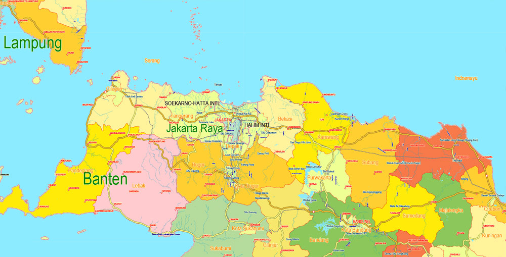
Capital and largest city: Jakarta; 6°10.5′S 106°49.7′E / 6.1750°S 106.8283°E
Small guide: How to work with the vector map?
You can: Mass select objects by type and color – for example, the objects type “building” (they are usually dark gray) – and remove them from the map, if you do not need them in your print or design project. You can also easily change the thickness of lines (streets), just bulk selection the road by the line color.
The streets are separated by type, for example, type “residential road” are usually white with a gray stroke. Highway usually orange with a brown or dark gray stroke.
It is easy to change the font of inscriptions, all or each individually. Also, just can be make and any other manipulation of objects on the vector map in Adobe illustrator format.
Important: All the proportions on the map are true, that is, the relative sizes of the objects are true, because Map is based on an accurate GPS projection, and It transated into the (usual for all) the Mercator projection.
You can easily change the color, stroke and fill of any object on the map, zoom without loss of quality Image Verification.
Select object

Bulk selection the same objects on the vector map

See the bulk selected objects on the vector map

Bulk delete buildungs from the vector map

Select residencial road (small street) on the vector map

Bulk selection the same lines (streets, roads) on the full map

Create fat lines of the streets on the vector maps (bulk action) 1

Create fat lines of the streets on the vector maps (bulk action) 2

Create fat lines of the streets on the vector maps (bulk action) 3

You can easily change the color, stroke and fill of any object on the map, zoom without loss of quality Image Verification.
Free vector map World, Adobe Illustrator, download now maps vector clipart
Map for design, projects, presentation free to use as you like.
See also: TERMS & CONDITIONS: SOFTWARE LICENSE AGREEMENT FOR DIGITAL CARTOGRAPHIC DATA.
Need more USA Vector Maps, printable and editable?

 Author: Kirill Shrayber, Ph.D. FRGS