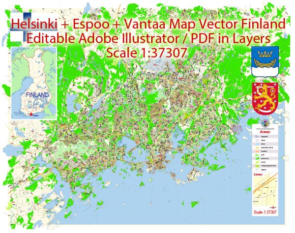
Helsinki, Espoo, and Vantaa are three major cities in the Greater Helsinki metropolitan area, which is the capital region of Finland.
Vectormap.Net provide you with the most accurate and up-to-date vector maps in Adobe Illustrator, PDF and other formats, designed for editing and printing. Please read the vector map descriptions carefully.
Economic Connections:
- Business Environment:
- Helsinki is the capital and the economic center of Finland. It hosts a significant portion of the country’s businesses, financial institutions, and government offices.
- Espoo is one of the largest cities in Finland and is known for its high-tech industry. It houses the Keilaniemi high-tech center and is home to many technology companies and research institutions.
- Vantaa is another major city with a diverse economic base, including industries like logistics, trade, and manufacturing.
- Technology and Innovation:
- The Helsinki metropolitan area, including Espoo, is known for its strong focus on technology and innovation. Otaniemi, located in Espoo, is a hub for technology and research, hosting Aalto University and various tech companies.
- Transportation Infrastructure:
- The cities are interconnected by an extensive transportation network, facilitating the movement of people and goods. This includes highways, railways, and public transportation systems.
Transport Connections:
- Road Network:
- The cities are well-connected by a network of highways and roads. The Ring Road I (Kehä I) encircles the Helsinki metropolitan area, connecting Helsinki, Espoo, and Vantaa.
- Public Transportation:
- Helsinki has an efficient public transportation system, including buses, trams, and the metro. These services extend to Espoo and Vantaa, providing residents and commuters with easy access to different parts of the metropolitan area.
- The Helsinki Metro, for example, extends to Espoo, improving connectivity between the cities.
- Rail Connections:
- The cities are connected by the main railway lines, with Helsinki Central Railway Station serving as a major transportation hub. Efficient train services link Helsinki, Espoo, and Vantaa to other parts of Finland.
- Air Transport:
- Helsinki-Vantaa Airport, located in Vantaa, is the main international airport serving the entire metropolitan area. It is well-connected to various global destinations and plays a crucial role in facilitating business and tourism.
- Water Transport:
- While not the primary mode of transport between these cities, the Gulf of Finland and the nearby waterways have historically played a role in transportation. However, road and rail transport are more prominent in the metropolitan area.
In summary, Helsinki, Espoo, and Vantaa are closely connected economically and have a well-developed transportation infrastructure that facilitates the movement of people and goods. The collaboration between these cities contributes to the overall economic strength and dynamism of the Greater Helsinki metropolitan area. Keep in mind that ongoing developments in infrastructure and economic activities may have occurred since my last update.


 Author: Kirill Shrayber, Ph.D. FRGS