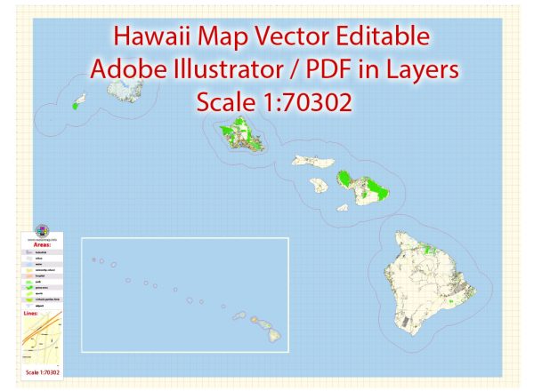
Hawaii is an archipelago in the Central Pacific Ocean and is composed of eight main islands. The four most populous islands are Hawaii (also known as the Big Island), Maui, Oahu, and Kauai. Each of these islands has its own unique cities and road systems.
Vectormap.Net provide you with the most accurate and up-to-date vector maps in Adobe Illustrator, PDF and other formats, designed for editing and printing. Please read the vector map descriptions carefully.
- Honolulu (Oahu):
- As the capital and largest city of Hawaii, Honolulu is located on the island of Oahu. It serves as the political, economic, and cultural center of the state.
- Key roads in Honolulu include the H-1, H-2, and H-3 highways. These highways connect different parts of the island and provide access to major attractions, neighborhoods, and the Daniel K. Inouye International Airport.
- Hilo (Hawaii – Big Island):
- Hilo is the largest city on the Big Island and is known for its rainforests, waterfalls, and the active Kilauea volcano.
- Significant roads in Hilo include the Hawaii Belt Road (Highway 19), which encircles the island and connects Hilo to other towns and attractions.
- Kahului (Maui):
- Kahului is the largest town on the island of Maui and is a major economic and transportation hub.
- The Hana Highway (Hwy 36) is a famous road that starts in Kahului and takes travelers on a scenic journey to the town of Hana, showcasing waterfalls, lush landscapes, and coastal views.
- Lihue (Kauai):
- Lihue is the commercial center of Kauai and is located on the southeastern part of the island.
- The Kuhio Highway (Hwy 56) is a significant road on Kauai, providing access to popular destinations like Hanalei and the Na Pali Coast.
- Other Notable Areas:
- Waikiki (Oahu): A famous beachfront neighborhood in Honolulu, known for its hotels, shopping, and nightlife.
- Kailua-Kona (Hawaii – Big Island): A resort town on the western side of the Big Island, known for its beaches and historic sites.
- Inter-Island Travel:
- Inter-island travel is typically facilitated by air travel, with several airlines providing regular flights between the islands. Honolulu’s Daniel K. Inouye International Airport is a major hub for inter-island flights.
Keep in mind that Hawaii’s road systems are well-developed on the more populous islands, but on some of the less populated islands, roads may be limited, and travel may require careful planning. Always check for the latest road conditions and updates, especially if you plan to explore less-traveled areas.


 Author: Kirill Shrayber, Ph.D. FRGS