Vector Maps of the Florida : shares a land border with only two other states, both along its northern boundary: Georgia (east) and Alabama (west). The nearest foreign territory is the island of Bimini in the Bahamas, some 50 miles (80 km) to the east of the state’s southern tip. Florida is the southernmost of the 48 conterminous United States, its northernmost point lying about 100 miles (160 km) farther south than California’s southern border. The Florida Keys, a crescent of islands that forms the state’s southernmost portion, extend to within about 75 miles (120 km) of the Tropic of Cancer. Florida’s marine shoreline totals more than 8,400 miles (13,500 km), including some 5,100 miles (8,200 km) along the gulf; among U.S. states, only Alaska has a longer coastline.
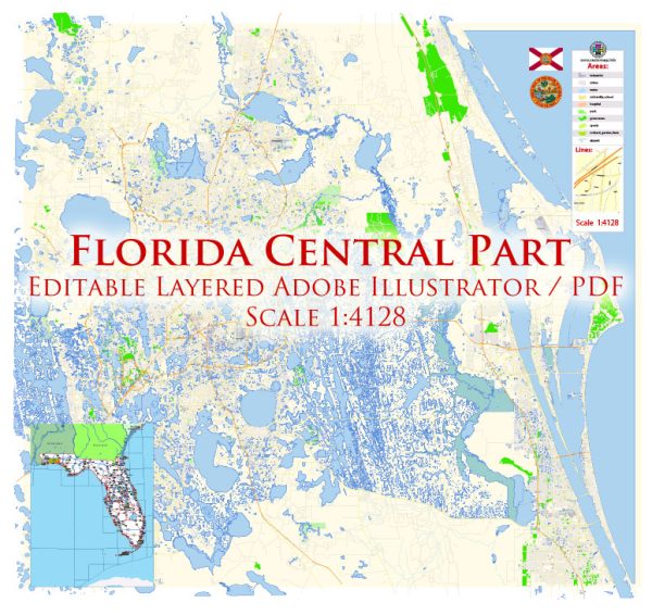
Instant download archives: royalty free, editable vector maps of Florida Central Orlando in high resolution digital PDF and Adobe Illustrator format.
All of our editable Florida Central Orlando vector maps are digital files,
which can be instantly downloaded in editable PDF or Adobe Illustrator format.
Objects on maps are usually divided into layers according to their types – lines, polygons, street names, object names (see map description!!!!)
Each of our Florida Central Orlando digital maps is available in Adobe Illustrator or editable PDF format, (or on request in any other known format for the same price)
which use a vector approach to display images,
you can easily enlarge any part of our maps without compromising text, line or graphic quality,
with any increase or decrease ratio.
Using a vector graphics editor such as Adobe Illustrator, CorelDraw, Inkscape, or Freehand
you can easily crop parts of the map, add custom characters, and change colors and font attributes as needed.
We have a variety of Florida Central Orlando vector maps with different levels of detail, from simple empty paths to highly detailed maps with roads and terrain layers.
Central Florida in the United States has a well-developed transportation infrastructure to support the movement of people and goods.
Vectormap.Net provide you with the most accurate and up-to-date vector maps in Adobe Illustrator, PDF and other formats, designed for editing and printing. Please read the vector map descriptions carefully.
Here is a detailed description of the transportation infrastructure in Central Florida:
- Roads and Highways:
- Interstate Highways: Central Florida is served by several major interstate highways, including I-4, I-75, I-95, and I-595. I-4 is particularly significant, connecting the Tampa Bay area on the west coast to Daytona Beach on the east coast, passing through Orlando in the process.
- State Highways: Florida’s state highway system includes a network of well-maintained roads that connect cities and towns within Central Florida. State Road 408 (East-West Expressway) and State Road 417 (Central Florida GreeneWay) are examples of major toll roads in the region.
- Public Transportation:
- SunRail: SunRail is a commuter rail system serving the Orlando metropolitan area. It connects DeBary to Poinciana, passing through downtown Orlando. SunRail provides a commuter option for those living in the suburbs.
- LYNX: LYNX is the regional public transportation provider, operating buses across Orange, Seminole, and Osceola counties. The LYNX bus system connects residential areas with major employment centers and other essential services.
- Airports:
- Orlando International Airport (MCO): Orlando International Airport is one of the busiest airports in Florida and serves as a major gateway for both domestic and international flights. It is located southeast of downtown Orlando.
- Orlando Sanford International Airport (SFB): While not as large as MCO, Sanford International Airport also accommodates domestic and international flights and is situated to the northeast of Orlando.
- Rail Transportation:
- Amtrak: Amtrak provides passenger rail service through several stations in Central Florida, including Orlando. Services like the Silver Meteor and Silver Star connect the region to cities in the Northeast and South.
- Ports:
- Port Canaveral: While not directly in Central Florida, Port Canaveral is a major cruise and cargo port located on the east coast. It serves as a significant transportation hub for the region, facilitating the movement of goods and people.
- Bicycle and Pedestrian Infrastructure:
- Many cities in Central Florida are working to improve bicycle and pedestrian infrastructure, with dedicated bike lanes, trails, and pedestrian-friendly areas in urban centers.
- Future Developments:
- Various ongoing and planned transportation projects aim to improve connectivity and alleviate congestion in the region. These include road expansions, new transit initiatives, and infrastructure upgrades.
It’s crucial to check for the latest updates from local transportation authorities for the most current information on Central Florida’s transportation infrastructure.
Don’t see exactly what you’re looking for? Contact us to receive a special offer for an individual Florida Central Orlando map for your project.


 Author: Kirill Shrayber, Ph.D. FRGS