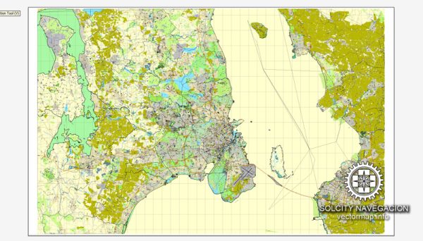
Copenhagen, Denmark, has a well-developed and efficient transportation infrastructure that supports the city’s residents and visitors. The city is known for its commitment to sustainability, with a focus on promoting public transportation, cycling, and pedestrian-friendly urban planning.
Vectormap.Net provide you with the most accurate and up-to-date vector maps in Adobe Illustrator, PDF and other formats, designed for editing and printing. Please read the vector map descriptions carefully.
Here’s a detailed description of the transportation infrastructure in Copenhagen:
1. Cycling Infrastructure:
- Bike Lanes: Copenhagen is renowned for its extensive network of dedicated bike lanes, making it one of the most bike-friendly cities globally. These lanes are physically separated from car traffic, ensuring the safety of cyclists.
- Bike-sharing Programs: The city has implemented successful bike-sharing programs, providing convenient and affordable access to bicycles for both residents and tourists.
- Traffic Signals for Cyclists: Copenhagen features special traffic signals for cyclists, allowing them to navigate intersections more safely.
2. Public Transportation:
- Metro: The Copenhagen Metro is a modern and expanding system that connects various parts of the city. It includes both underground and elevated lines, providing efficient and fast transportation.
- Buses: An extensive bus network complements the metro, covering areas not served by the rail system. Buses are a crucial component of the city’s public transportation system.
- S-Trains: The S-train network connects Copenhagen with its suburbs and neighboring regions, enhancing regional connectivity.
3. Rail Network:
- Main Railway Station: Copenhagen Central Station (København H) is the main railway hub, serving both domestic and international train services. It is a major transportation hub for commuters and travelers.
- Regional and International Connections: The rail network connects Copenhagen to other major cities in Denmark and Europe, contributing to the city’s accessibility.
4. Bridges and Tunnels:
- Øresund Bridge: This iconic bridge connects Copenhagen with Malmö in Sweden. It accommodates both road and rail traffic, fostering cross-border mobility and integration.
- Tunnels: Copenhagen has tunnels, such as the Cityringen Metro Tunnel, which facilitates the efficient movement of trains below the city center.
5. Road Network:
- Ring Roads: The city features inner and outer ring roads that help manage traffic flow around Copenhagen. These roads contribute to the overall efficiency of the transportation system.
- Pedestrian Zones: Some areas in the city center have limited vehicle access, creating pedestrian-friendly zones. Strøget, one of Europe’s longest pedestrian streets, is an example.
6. Airport:
- Copenhagen Airport (CPH): Located on the island of Amager, Copenhagen Airport is a major international airport serving the city. It is well-connected to the city center via public transportation and road networks.
7. Sustainability Initiatives:
- Copenhagen is committed to sustainability, and its transportation infrastructure reflects this commitment. The emphasis on cycling, pedestrian zones, and efficient public transportation contributes to the city’s reputation as an environmentally friendly urban center.
In summary, Copenhagen’s transportation infrastructure is characterized by a comprehensive and integrated network that prioritizes sustainable modes of transportation, contributing to the city’s livability and environmental consciousness.

 Author: Kirill Shrayber, Ph.D. FRGS