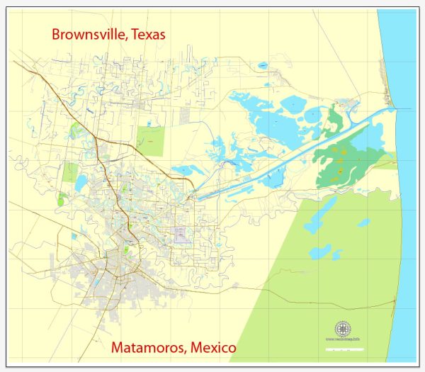
Brownsville, Texas, and Matamoros, Mexico, share a unique economic and transport relationship due to their geographical proximity and shared border. Please note that developments may have occurred since then, and it’s advisable to check more recent sources for the latest information.
Vectormap.Net provide you with the most accurate and up-to-date vector maps in Adobe Illustrator, PDF and other formats, designed for editing and printing. Please read the vector map descriptions carefully.
Here’s a detailed description of their economic and transport connections:
Economic Connections:
- Maquiladora Industry:
- The twin cities are part of the larger cross-border economic region and have a significant presence of maquiladora industries. Maquiladoras are manufacturing plants, often foreign-owned, that import raw materials duty-free for assembly or processing before exporting the finished products.
- Trade and Commerce:
- The Brownsville-Matamoros border crossing is one of the busiest in terms of trade between the U.S. and Mexico. The cities are crucial points for the movement of goods, with numerous businesses engaged in cross-border trade.
- Cross-Border Investments:
- Businesses in both cities often engage in cross-border investments and partnerships, taking advantage of the complementary resources and markets on each side of the border.
- Economic Development Initiatives:
- Both Brownsville and Matamoros participate in economic development initiatives to foster cooperation and growth. This can include joint projects, infrastructure development, and collaborative efforts to attract investments.
Transport Connections:
- Border Crossings:
- The Gateway International Bridge connects Brownsville, Texas, with Matamoros, Tamaulipas. It’s a vital border crossing point for commercial and passenger traffic between the two cities.
- Highway Infrastructure:
- The cities are connected by a network of highways, facilitating the movement of goods and people. These include Mexican Federal Highway 180 and U.S. Route 77.
- Rail Transport:
- The presence of railways contributes to the transportation of goods between the two cities. Rail connections play a crucial role in the movement of cargo, especially for industries located in the region.
- Port of Brownsville:
- The Port of Brownsville serves as a key transportation hub, handling a variety of cargoes, including bulk and breakbulk commodities. Its strategic location facilitates maritime trade with Matamoros and other Mexican ports.
- Airport Connectivity:
- Both cities have airports – Brownsville/South Padre Island International Airport and General Servando Canales International Airport in Matamoros. These airports contribute to air transport connections, supporting business and tourism.
Collaborative Efforts:
- Joint Economic Development Organizations:
- There might be joint economic development organizations or committees that work towards enhancing economic ties, addressing common challenges, and identifying collaborative opportunities.
- Binational Initiatives:
- The U.S.-Mexico border region often sees binational initiatives aimed at improving infrastructure, streamlining border-crossing procedures, and fostering economic growth on both sides.
- Shared Utilities and Services:
- The cities may collaborate on shared utilities and services, ensuring efficient provision and management of resources such as water, electricity, and telecommunications.
In summary, Brownsville, Texas, and Matamoros, Mexico, have deep economic and transport connections driven by their proximity and shared border. The collaboration between these two cities contributes to the economic development and prosperity of the broader region. It’s essential to stay updated on current developments to understand the evolving nature of their relationship.


 Author: Kirill Shrayber, Ph.D.