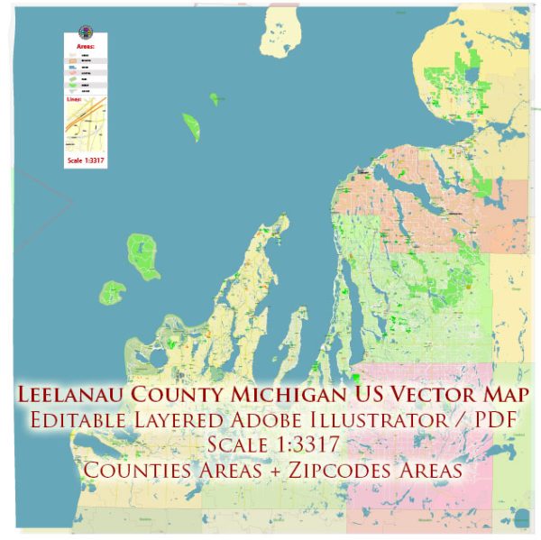
A general overview of the infrastructure in Leelanau County, Michigan. Vectormap.Net provide you with the most accurate and up-to-date vector maps in Adobe Illustrator, PDF and other formats, designed for editing and printing. Please read the vector map descriptions carefully. Here’s a general overview of the infrastructure in Leelanau County:
- Transportation:
- Roads: Leelanau County is primarily served by a network of state and local roads. The major highways include M-22, M-72, and M-204. These roads connect the county to nearby cities and facilitate transportation within the region.
- Public Transportation: Public transportation options in rural areas like Leelanau County may be limited. The primary mode of transportation is private vehicles. Some local services may be available, and there might be community efforts to address transportation needs.
- Utilities:
- Water and Sewer: Many areas in Leelanau County rely on well water and septic systems, especially in more rural parts. In more populated areas and some communities, municipal water and sewer services may be available.
- Electricity: Electrical service is provided by various utility companies operating in Michigan. Rural areas may have co-op services or municipal providers.
- Natural Gas: Availability of natural gas can vary. Some areas may have access to natural gas for heating and other purposes, while others might rely on propane or other alternatives.
- Communication:
- Internet and Broadband: Internet connectivity in rural areas can sometimes be a challenge, but efforts are often underway to improve access. There may be a mix of wired and wireless broadband options, and some areas may still rely on traditional DSL or satellite services.
- Telecommunication: Landline and mobile phone services are generally available, but the reliability and coverage can vary depending on the specific location within the county.
- Healthcare:
- Hospitals and Clinics: Leelanau County may have local clinics and healthcare facilities. Larger hospitals are often found in nearby cities like Traverse City.
- Education:
- Schools: Leelanau County is served by various school districts, providing education from elementary to high school levels. The availability of educational facilities can depend on the specific community within the county.
- Emergency Services:
- Law Enforcement: The county has its law enforcement agencies, and emergency services are coordinated through these agencies.
- Fire and Rescue: Fire protection and rescue services are typically provided by local fire departments and emergency services.
- Recreational Infrastructure:
- Parks and Recreation: Leelanau County is known for its natural beauty, and there are parks and recreational areas for residents and visitors. This includes trails, parks, and access to the Sleeping Bear Dunes National Lakeshore.
- Economic Infrastructure:
- Commercial Areas: Towns within Leelanau County may have commercial districts with local businesses, shops, and restaurants.
- Agricultural Facilities: Given the region’s agricultural focus, there are likely facilities supporting farming activities, including processing and distribution centers for products like cherries and wine.
Please note that the specifics of infrastructure can vary between different townships and communities within Leelanau County. It’s recommended to check with local authorities or recent sources for the most up-to-date information on the county’s infrastructure.


 Author: Kirill Shrayber, Ph.D. FRGS