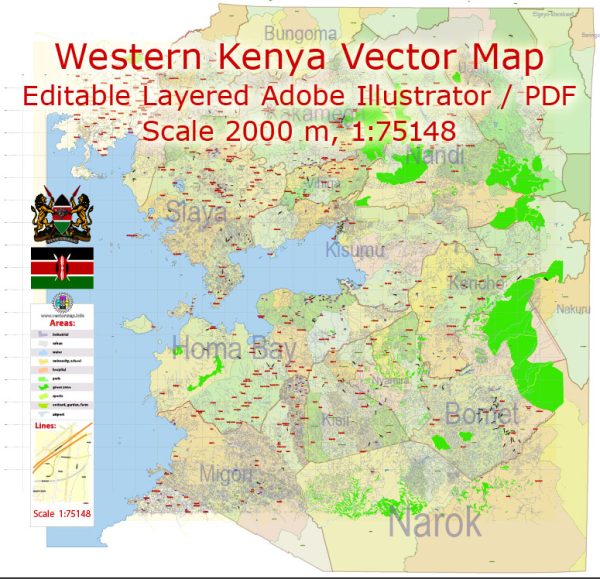
Kenya’s Western region is characterized by diverse landscapes, cultures, and economic activities. This region is primarily composed of the following counties: Kakamega, Bungoma, Busia, Vihiga, and parts of Trans Nzoia, Uasin Gishu, and Nandi counties. The following is a detailed description of the Western part of Kenya:
- Geography:
- Terrain: The Western region is known for its undulating terrain, with a mix of hills, valleys, and plains. The presence of the Rift Valley influences the topography, creating a landscape with fertile soils and suitable for agriculture.
- Water Bodies: The region is dotted with numerous rivers, such as the Nzoia River, Yala River, and Sio River, which contribute to the fertility of the land and support agricultural activities. Additionally, Lake Victoria, one of Africa’s Great Lakes, forms the southwestern border of the region.
- Climate:
- Climate Type: The Western region experiences a tropical climate with temperatures varying based on elevation. The lowland areas tend to be warmer, while the highland areas are cooler. Rainfall is generally well-distributed throughout the year, supporting agricultural activities.
- Flora and Fauna:
- Vegetation: The region is characterized by a mix of savannah grasslands and areas covered with lush vegetation, including forests and swamps.
- Wildlife: While not as renowned for wildlife as some other parts of Kenya, the Western region is home to various species, including birds, small mammals, and reptiles.
- Economic Activities:
- Agriculture: Agriculture is a crucial economic activity in the Western region. The fertile soils support the cultivation of crops such as sugarcane, maize, tea, coffee, and various horticultural products.
- Fishing: Due to the proximity to Lake Victoria, fishing is a significant economic activity in communities along the lake shores.
- Trade and Commerce: Urban centers like Kakamega and Bungoma serve as economic hubs, with markets and trading activities contributing to the regional economy.
- Cultural Diversity:
- Ethnic Groups: The Western region is home to various ethnic groups, including the Luhya, Teso, and Maragoli. Each community has its unique cultural practices, languages, and traditions.
- Cultural Festivals: The region hosts cultural events and festivals that showcase traditional dances, music, and attire, providing a rich tapestry of cultural diversity.
- Infrastructure:
- Transportation: The region is connected by road networks, and major towns are accessible by both public and private transportation. Additionally, there are ongoing efforts to improve infrastructure, including the expansion of roads and the construction of modern facilities.
- Challenges and Opportunities:
- Challenges: Like many other regions, Western Kenya faces challenges such as inadequate infrastructure, healthcare issues, and unemployment. Additionally, there are environmental concerns, including deforestation and soil erosion.
- Opportunities: The region’s agricultural potential, combined with efforts to enhance infrastructure and education, presents opportunities for economic growth and development.
In summary, the Western part of Kenya is a region characterized by a diverse mix of landscapes, cultures, and economic activities, making it a significant and vibrant part of the country.
Vectormap.Net provide you with the most accurate and up-to-date vector maps in Adobe Illustrator, PDF and other formats, designed for editing and printing. Please read the vector map descriptions carefully.


 Author: Kirill Shrayber, Ph.D.