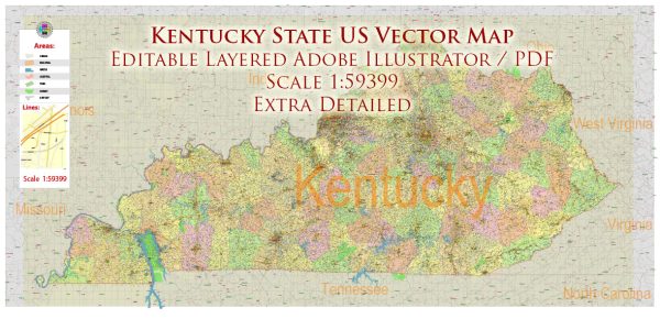
Kentucky has a well-developed transportation infrastructure that includes roadways, railways, air travel, and waterways. Vectormap.Net provide you with the most accurate and up-to-date vector maps in Adobe Illustrator, PDF and other formats, designed for editing and printing. Please read the vector map descriptions carefully. Here’s a general overview of Kentucky’s transportation infrastructure:
- Roads and Highways:
- Interstate Highways: Kentucky is served by several major interstate highways, including I-24, I-64, I-65, and I-75. These interstates connect the state to neighboring regions and facilitate the movement of goods and people.
- Parkways: The state has a network of parkways, such as the Bluegrass Parkway and the Western Kentucky Parkway, which provide efficient transportation within the state.
- State Routes: A comprehensive system of state routes and highways connects various cities and towns, ensuring accessibility throughout Kentucky.
- Rail Transportation:
- Rail Network: Kentucky has an extensive rail network, contributing to the state’s economic development and the transportation of goods. Railways connect major cities and industrial areas.
- CSX Transportation: CSX Transportation, one of the major freight railroads in the United States, has a significant presence in Kentucky.
- Air Travel:
- Airports: Kentucky is served by several airports, with Louisville International Airport (SDF) and Cincinnati/Northern Kentucky International Airport (CVG) being the largest. These airports provide domestic and international flights, supporting both passenger and cargo traffic.
- Water Transportation:
- Ohio River: The Ohio River forms much of Kentucky’s northern border, and its navigable waters play a crucial role in transporting goods. River ports and terminals facilitate the movement of commodities by barge.
- Inland Waterways: Kentucky has a network of inland waterways, including the Ohio River and its tributaries, which contribute to the state’s economic activities such as shipping and commerce.
- Public Transit:
- Urban Transit: Larger cities in Kentucky, such as Louisville and Lexington, have public transit systems that include buses. These systems help residents and visitors navigate within urban areas.
- Bridges:
- Ohio River Bridges: Several bridges span the Ohio River, connecting Kentucky to neighboring states like Indiana. Notable examples include the Abraham Lincoln Bridge and the Lewis and Clark Bridge.
- Future Developments:
- Kentucky continually invests in infrastructure improvements. Projects may include the expansion or enhancement of highways, bridges, and public transit systems to accommodate the growing transportation needs of the state.
It’s advisable to check with local transportation authorities or the Kentucky Transportation Cabinet for the latest information on ongoing projects and developments in the state’s transportation infrastructure.


 Author: Kirill Shrayber, Ph.D. FRGS