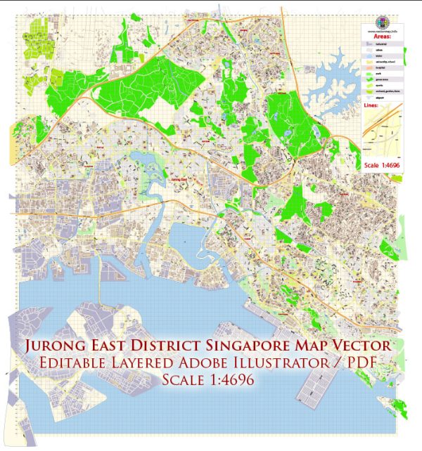
Jurong East is a planning area and residential town located in the western part of Singapore. It is a significant commercial and industrial hub with well-developed infrastructure. Here’s an overview of the infrastructure in Jurong East:
- Transportation:
- Public Transportation: Jurong East is a major transportation hub with the Jurong East MRT Interchange Station connecting the East-West Line and North-South Line. The Jurong Region Line (JRL) is also under construction to enhance connectivity in the region.
- Bus Interchange: Jurong East Bus Interchange serves as a key bus transportation hub for the area.
- Shopping and Entertainment:
- Shopping Malls: Jurong East is home to several large shopping malls, including JCube, JEM, and Westgate. These malls offer a wide range of retail, dining, and entertainment options.
- Entertainment Complexes: The area features entertainment complexes such as IMM, which houses a variety of outlet stores.
- Business and Commercial Centers:
- Jurong Gateway: Known as Singapore’s second Central Business District (CBD), Jurong Gateway is a commercial and business district with office buildings, hotels, and convention centers.
- International Business Park (IBP): Located nearby, IBP is an industrial park with a focus on technology and research-based industries.
- Educational Institutions:
- Educational Hub: Jurong East is home to educational institutions like the National Institute of Education (NIE) and the Canadian International School.
- Healthcare:
- Ng Teng Fong General Hospital: Located in Jurong East, this hospital provides healthcare services to the residents of the area.
- Recreation and Parks:
- Jurong Lake District: The Jurong Lake District is a major project aimed at transforming the area into a regional center for business and leisure. It includes the development of Jurong Lake Gardens, a large green space with gardens and recreational facilities.
- Housing:
- Residential Developments: Jurong East has a mix of public and private housing estates, providing a range of housing options for residents.
- Industrial and Business Facilities:
- Jurong Industrial Estate: Jurong East is part of the larger Jurong Industrial Estate, one of Singapore’s key industrial zones.
Vectormap.Net provide you with the most accurate and up-to-date vector maps in Adobe Illustrator, PDF and other formats, designed for editing and printing. Please read the vector map descriptions carefully.


 Author: Kirill Shrayber, Ph.D. FRGS