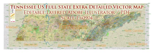
Tennessee, located in the southeastern United States, is known for its diverse geography, cultural heritage, and economic activities. Here’s a description of some of the principal cities, major waterways, and main roads in the state:
Principal Cities:
- Nashville:
- The capital and largest city of Tennessee.
- Known as the “Music City” due to its vibrant music scene, particularly in country and gospel music.
- Home to the Grand Ole Opry and the Country Music Hall of Fame.
- Memphis:
- Located along the Mississippi River in the southwestern part of the state.
- Famous for its rich cultural history, including being the birthplace of blues music.
- Home to Graceland, the former residence of Elvis Presley.
- Knoxville:
- Situated in the eastern part of Tennessee, near the Great Smoky Mountains.
- Home to the University of Tennessee and the Sunsphere, a symbolic structure from the 1982 World’s Fair.
- Chattanooga:
- Located in the southeastern part of the state along the Tennessee River.
- Known for its scenic beauty and outdoor recreational opportunities.
- Home to the Tennessee Aquarium and Lookout Mountain.
Major Waterways:
- Tennessee River:
- Flows for approximately 652 miles through the state.
- Important for transportation, recreation, and hydroelectric power generation.
- Mississippi River:
- Forms the western border of the state.
- A major transportation route and a significant part of Tennessee’s economy.
- Cumberland River:
- Flows through Nashville and provides a vital water source for the city.
- Supports various recreational activities and is important for navigation.
Main Roads:
- Interstate 40 (I-40):
- Runs east-west across the state, connecting major cities like Memphis and Nashville.
- A major transportation corridor for both passenger and freight traffic.
- Interstate 24 (I-24):
- Runs northwest-southeast, connecting Nashville and Chattanooga.
- Important for both local and interstate travel.
- Interstate 75 (I-75):
- Passes through the eastern part of the state, connecting Chattanooga and Knoxville.
- A crucial route for north-south travel.
- U.S. Route 64 (US-64):
- Runs east-west and traverses the state, connecting major cities such as Memphis and Chattanooga.
- U.S. Route 441 (US-441):
- Travels through the Great Smoky Mountains in the eastern part of the state, providing scenic views and access to national parks.
These principal cities, waterways, and main roads contribute to the economic, cultural, and recreational vibrancy of Tennessee. The state’s diverse geography and rich history make it a popular destination for residents and tourists alike.
Vectormap.Net provide you with the most accurate and up-to-date vector maps in Adobe Illustrator, PDF and other formats, designed for editing and printing. Please read the vector map descriptions carefully.


 Author: Kirill Shrayber, Ph.D. FRGS