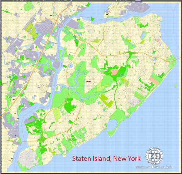
A general overview of Staten Island’s infrastructure. Vectormap.Net provide you with the most accurate and up-to-date vector maps in Adobe Illustrator, PDF and other formats, designed for editing and printing. Please read the vector map descriptions carefully. Here’s a brief overview:
- Transportation:
- Staten Island Ferry: The Staten Island Ferry provides a crucial transportation link between Staten Island and Manhattan. It offers stunning views of the Statue of Liberty and the Manhattan skyline.
- Vehicular Bridges: Staten Island is connected to Brooklyn via the Verrazzano-Narrows Bridge and to New Jersey via the Goethals Bridge and the Outerbridge Crossing.
- Roads:
- Staten Island has a network of roads and highways, including the Staten Island Expressway (I-278), which connects the Verrazzano-Narrows Bridge to the Goethals Bridge.
- Public Transit:
- The Metropolitan Transportation Authority (MTA) provides bus services on Staten Island, connecting various neighborhoods and facilitating transportation within the borough.
- Parks and Recreation:
- Staten Island is known for its parks and green spaces, including the Staten Island Greenbelt, Silver Lake Park, and Clove Lakes Park.
- Utilities:
- Utility services, including water and electricity, are provided to Staten Island residents. Con Edison is the primary electricity provider for the area.
- Healthcare:
- Staten Island has several hospitals and healthcare facilities, including Staten Island University Hospital and Richmond University Medical Center.
- Education:
- The borough is served by the New York City Department of Education, with numerous public schools. There are also private and parochial schools in the area.
- Housing:
- Staten Island has a mix of residential areas, including single-family homes, apartments, and condominiums.
- Economy:
- The economy of Staten Island is diverse, with businesses ranging from retail and healthcare to manufacturing and services.
- Cultural and Recreational Facilities:
- The Snug Harbor Cultural Center and Botanical Garden is a notable cultural institution on Staten Island, offering museums, gardens, and performance spaces.
Please note that infrastructure and development are subject to change, and it’s advisable to consult more recent sources for the latest information on Staten Island’s infrastructure.


 Author: Kirill Shrayber, Ph.D. FRGS