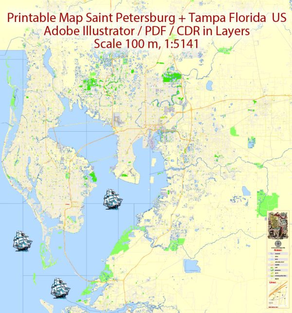
Saint Petersburg and Tampa are neighboring cities located on the west coast of Florida, in the United States. The two cities are connected by various waterways, bridges, and main streets, making them an integral part of the Tampa Bay metropolitan area.
Waterways:
- Tampa Bay: This large body of water separates the two cities and plays a crucial role in the region’s maritime activities. The bay is home to a variety of marine life and is a popular spot for boating and fishing.
- Hillsborough River: Running through the eastern part of Tampa, the Hillsborough River is a significant waterway that eventually flows into Tampa Bay. The Riverwalk, a scenic pedestrian trail, follows the banks of the river in downtown Tampa.
Bridges:
- Howard Frankland Bridge: This bridge spans Tampa Bay, connecting St. Petersburg and Tampa along Interstate 275. It’s a major route for commuters traveling between the two cities.
- Gandy Bridge: Crossing Old Tampa Bay, the Gandy Bridge connects St. Petersburg and Tampa, providing another important link for transportation.
- Courtney Campbell Causeway: This causeway connects Clearwater to Tampa, passing over Old Tampa Bay. While not directly connecting St. Petersburg and Tampa, it is an important bridge in the broader Tampa Bay area.
Main Streets and Roads:
- Central Avenue (St. Petersburg): A prominent east-west thoroughfare in downtown St. Petersburg, Central Avenue is known for its shops, restaurants, and cultural attractions.
- Bayshore Boulevard (Tampa): This scenic road runs along the waterfront in Tampa and is popular for jogging, biking, and enjoying views of the bay. It’s one of the longest continuous sidewalks in the world.
- Dale Mabry Highway: Running through both cities, Dale Mabry Highway is a major north-south route that connects the suburbs with the downtown areas.
- Interstate 275: This interstate highway connects St. Petersburg and Tampa, providing a crucial transportation link for both local and interstate travel.
- Kennedy Boulevard (Tampa): A key east-west street in downtown Tampa, Kennedy Boulevard is known for its businesses, offices, and cultural institutions.
These waterways, bridges, and main streets contribute to the connectivity and vitality of the Saint Petersburg and Tampa Bay area, fostering economic, cultural, and recreational activities.
Vectormap.Net provide you with the most accurate and up-to-date vector maps in Adobe Illustrator, PDF and other formats, designed for editing and printing. Please read the vector map descriptions carefully.


 Author: Kirill Shrayber, Ph.D. FRGS