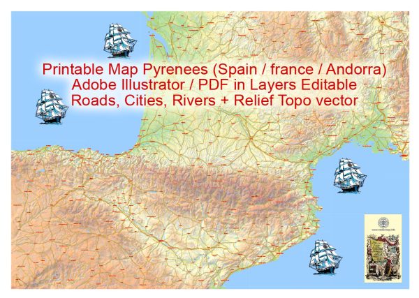
The Pyrenees is a mountain range in southwest Europe that forms a natural border between Spain and France. It extends for about 491 kilometers (305 miles) from the Bay of Biscay to the Mediterranean Sea. The region is known for its stunning landscapes, including rugged mountains, picturesque valleys, and charming towns. While the Pyrenees themselves are primarily a mountainous area, there are several notable cities, waterways, and main roads in the vicinity. Vectormap.Net provide you with the most accurate and up-to-date vector maps in Adobe Illustrator, PDF and other formats, designed for editing and printing. Please read the vector map descriptions carefully.
Principal Cities:
- Pau (France): Pau is a historic city located in the foothills of the Pyrenees. It has a rich architectural heritage, including the Château de Pau, and serves as a gateway to the mountain range.
- Lourdes (France): Lourdes is famous for the Sanctuary of Our Lady of Lourdes, a major Catholic pilgrimage site. The city attracts millions of visitors each year.
- Andorra la Vella (Andorra): While not directly in the Pyrenees but in the neighboring country of Andorra, the capital city, Andorra la Vella, is in close proximity to the mountain range. It’s known for its duty-free shopping and ski resorts.
- Tarbes (France): Tarbes is another city in the region, known for its gardens, museums, and the Massey Garden and Museum.
Waterways:
- Garonne River: The Garonne River has its source in the Spanish Pyrenees and flows through the region, eventually reaching the Atlantic Ocean. It is a significant waterway in the area.
- Ariège River: Rising in the Spanish Pyrenees and flowing through both France and Spain, the Ariège River is another notable watercourse in the region.
Main Roads:
- E7 (European Route): The E7 is a major European route that traverses the Pyrenees. It connects major cities and regions from the Atlantic coast to the Mediterranean, passing through the mountain range.
- A63 and A64 Motorways: In France, the A63 and A64 are important motorways that provide access to and through the Pyrenees. The A64, in particular, connects Pau to Toulouse and passes through the mountain range.
- N-260 and N-230 (Spain): These are important national roads in Spain that traverse the Pyrenees. The N-260 runs through the eastern part of the range, connecting with the N-230 near the town of Vielha.
- D-618 (France): The D-618 is a scenic road that crosses the Pyrenees, providing breathtaking views of the mountains. It passes through towns like Saint-Jean-Pied-de-Port.
These cities, waterways, and main roads collectively contribute to the accessibility and charm of the Pyrenees region, making it a destination for both nature enthusiasts and those interested in cultural and historical experiences.


 Author: Kirill Shrayber, Ph.D. FRGS