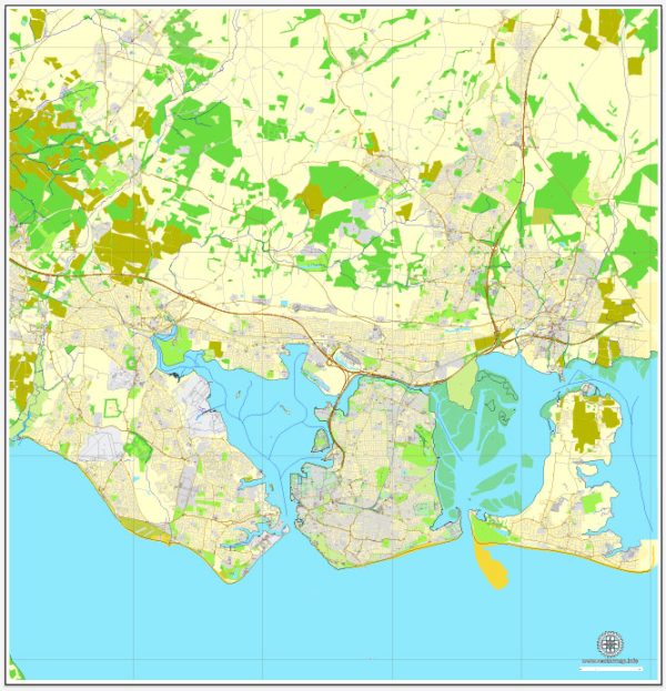
Portsmouth is a historic city on the southern coast of England, known for its maritime heritage and naval history. The city is situated on Portsea Island, and its principal waterways, bridges, and main streets contribute to its unique character. Vectormap.Net provide you with the most accurate and up-to-date vector maps in Adobe Illustrator, PDF and other formats, designed for editing and printing. Please read the vector map descriptions carefully.
Principal Waterways:
- The Solent: Portsmouth is located on the northern shore of The Solent, a strait that separates the Isle of Wight from the mainland of England. The Solent is a significant waterway for maritime activities, including ferry services and recreational boating.
- Portsmouth Harbour: This natural harbor is one of the best-known harbors in the world. It has played a crucial role in the naval history of the United Kingdom. The historic dockyard and several naval installations are located along the shores of Portsmouth Harbour.
Bridges:
- M275 Motorway Bridge: This bridge connects Portsea Island to the mainland and provides a vital transportation link for vehicles traveling to and from Portsmouth.
- Fratton Bridge: Situated in the northern part of Portsmouth, Fratton Bridge is an important road bridge connecting different neighborhoods.
- Gosport Ferry: While not a traditional bridge, the Gosport Ferry provides a convenient water link between Portsmouth and Gosport. It offers stunning views of the harbor and the city skyline.
Main Streets:
- Commercial Road: This is one of the main shopping streets in Portsmouth, lined with a variety of shops, restaurants, and cafes. It runs through the heart of the city and is a popular destination for both locals and visitors.
- High Street: Another significant street in Portsmouth, High Street is known for its historic architecture, including the iconic Guildhall. It is also a hub for shopping and dining.
- Queen Street: Connecting the Historic Dockyard to the city center, Queen Street is a key thoroughfare with shops, businesses, and cultural attractions.
- Gunwharf Quays: While not a street in the traditional sense, Gunwharf Quays is a waterfront area featuring a mix of retail outlets, restaurants, and entertainment venues. It’s a popular destination for shopping and leisure.
Portsmouth’s layout reflects its maritime history and offers a mix of historical sites, modern amenities, and scenic waterfront views. The city has undergone development and regeneration projects in recent years, enhancing its appeal to residents and tourists alike.


 Author: Kirill Shrayber, Ph.D. FRGS