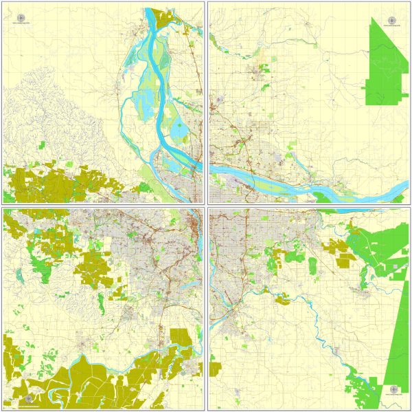
a general overview of the principal roads and railroads in the Portland, Oregon, and Vancouver, Washington areas. Vectormap.Net provide you with the most accurate and up-to-date vector maps in Adobe Illustrator, PDF and other formats, designed for editing and printing. Please read the vector map descriptions carefully.
Portland, Oregon:
Principal Roads:
- Interstate 5 (I-5): The major north-south interstate highway running through the heart of Portland, connecting the city with Seattle to the north and California to the south.
- Interstate 84 (I-84): An east-west interstate that connects Portland with the inland states, including Idaho and Utah.
- U.S. Route 26 (US-26): Also known as the Sunset Highway, it runs west from Portland to the Oregon Coast.
- U.S. Route 30 (US-30): Follows the Columbia River and provides a route through the northern part of the city.
- Oregon Route 217 (OR-217): A key north-south highway in the western suburbs.
Railroads:
Portland is a major transportation hub with several rail lines. The Union Pacific and BNSF Railway are two major freight railroads serving the area. Amtrak provides passenger rail service with the Amtrak Cascades route connecting Portland to Seattle and Eugene.
Vancouver, Washington:
Principal Roads:
- Interstate 5 (I-5): The primary north-south interstate, connecting Vancouver with Portland to the south and Seattle to the north.
- State Route 14 (SR-14): An east-west highway along the Columbia River, connecting Vancouver with communities in southwest Washington.
- SR-500: An east-west highway that connects I-5 with Vancouver and the surrounding areas.
- I-205: A bypass route east of I-5 that provides an alternative north-south route.
Railroads:
Similar to Portland, Vancouver has rail connections, primarily served by the BNSF Railway and Union Pacific. Freight traffic is significant in this region.
Please note that urban planning and infrastructure projects may lead to changes in roadways and transportation systems over time. For the latest and most accurate information, it is recommended to consult local transportation authorities or online mapping services.


 Author: Kirill Shrayber, Ph.D. FRGS