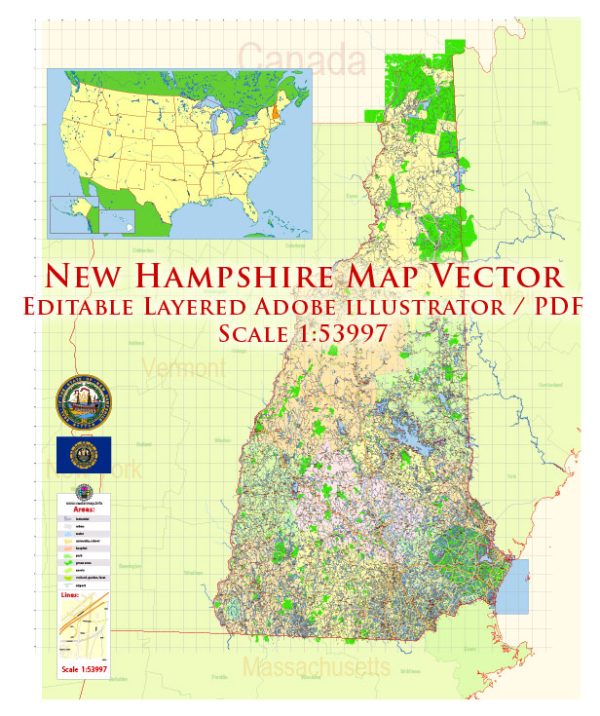
New Hampshire, a state in the New England region of the United States, is known for its picturesque landscapes, charming small towns, and a mix of urban and rural areas. Here’s a description of some of its principal cities, prominent waterways, and main roads:
Principal Cities:
- Concord:
- Description: Concord is the capital city of New Hampshire. It is located in the central part of the state and is known for its historic architecture, including the New Hampshire State House. The Merrimack River flows through Concord, adding to the city’s scenic beauty.
- Manchester:
- Description: As the largest city in New Hampshire, Manchester is a major economic and cultural hub. It has a rich industrial history, and today, it is known for its vibrant arts scene, museums, and diverse culinary offerings.
- Nashua:
- Description: Situated in the southern part of the state, Nashua is the second-largest city in New Hampshire. It is known for its high-tech industries, excellent schools, and a variety of recreational opportunities along the Nashua River.
Waterways:
- Merrimack River:
- Description: The Merrimack River is one of the major waterways in New Hampshire, flowing south to north through the central part of the state. It plays a significant role in the geography and history of the region, providing scenic beauty and recreational opportunities.
- Connecticut River:
- Description: Forming the western border of New Hampshire, the Connecticut River is a vital watercourse in the state. It offers opportunities for boating, fishing, and enjoying the natural beauty of the surrounding areas.
Main Roads:
- Interstate 93 (I-93):
- Description: I-93 is a major north-south interstate highway in New Hampshire, connecting the Massachusetts border to the Vermont border. It passes through cities like Concord and Manchester, serving as a crucial transportation route.
- Interstate 95 (I-95):
- Description: Running along the eastern border of the state, I-95 is an important interstate highway that connects New Hampshire to other New England states. It provides access to coastal areas and serves as a major route for regional travel.
- Route 101:
- Description: Route 101 is a key east-west highway, connecting the seacoast region to the western parts of the state. It is a major route for both local commuters and travelers passing through New Hampshire.
These principal cities, waterways, and main roads contribute to the diverse and scenic character of New Hampshire, making it a popular destination for both residents and visitors. The state’s combination of urban centers, natural beauty, and historical significance creates a unique and appealing atmosphere.


 Author: Kirill Shrayber, Ph.D. FRGS