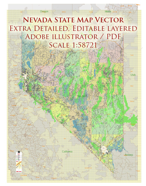
Nevada, located in the western part of the United States, is known for its vast deserts, mountain ranges, and vibrant cities. Here’s a description of some of the principal cities, notable waterways, and main roads in the state:
Principal Cities:
- Las Vegas:
- Known as the “Entertainment Capital of the World,” Las Vegas is famous for its vibrant nightlife, world-class casinos, and entertainment shows. The Las Vegas Strip is a globally renowned resort area.
- Reno:
- Often referred to as the “Biggest Little City in the World,” Reno is known for its casinos, outdoor recreational activities, and the annual National Championship Air Races.
- Henderson:
- Located near Las Vegas, Henderson is the second-largest city in Nevada. It offers a mix of suburban and urban living, with parks, shopping, and cultural attractions.
- North Las Vegas:
- A city adjacent to Las Vegas, North Las Vegas has experienced significant growth and development in recent years. It is known for its residential communities and proximity to Nellis Air Force Base.
Notable Waterways:
- Colorado River:
- The Colorado River forms part of Nevada’s southern border with Arizona. It is a major water source for the state and has played a crucial role in the development of the region.
- Truckee River:
- Flowing through Reno, the Truckee River is a key waterway in northern Nevada. It provides recreational opportunities and contributes to the overall natural beauty of the area.
Main Roads and Highways:
- Interstate 15 (I-15):
- Running through the southern part of the state, I-15 connects Las Vegas to other major cities like Los Angeles and Salt Lake City.
- Interstate 80 (I-80):
- Spanning the northern part of Nevada, I-80 is a major east-west route connecting cities like Reno and Elko. It is a vital transportation corridor.
- U.S. Route 95:
- This highway runs north-south through the state, connecting Las Vegas to cities in northern Nevada, such as Reno. It is a key route for both commercial and recreational travel.
- State Route 375 (Extraterrestrial Highway):
- Located in the rural areas of southern Nevada, this highway gained fame for its proximity to Area 51, a top-secret U.S. military facility. It has become a popular route for those interested in UFO lore.
These descriptions provide a snapshot of the diverse features that make up the state of Nevada, from the bustling entertainment centers to the scenic waterways and important transportation routes.
Vectormap.Net provide you with the most accurate and up-to-date vector maps in Adobe Illustrator, PDF and other formats, designed for editing and printing. Please read the vector map descriptions carefully.


 Author: Kirill Shrayber, Ph.D. FRGS