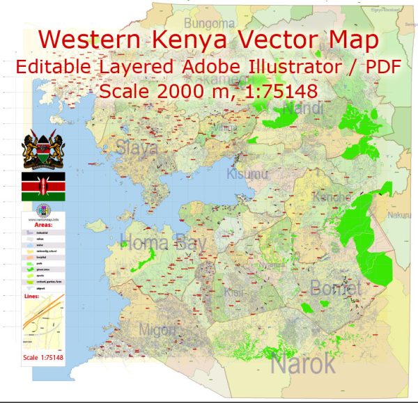
Some of the main cities and roads in the western part of Kenya. We provide you with the most accurate and up-to-date vector maps in Adobe Illustrator, PDF and other formats, designed for editing and printing. Please read the vector map descriptions carefully.
Main Cities:
- Kisumu:
- Kisumu is the third-largest city in Kenya and the largest in the western part of the country.
- It is situated on the shores of Lake Victoria, which is the largest freshwater lake in Africa.
- Kisumu is an important economic and trade hub in the region.
- Kakamega:
- Kakamega is a town in western Kenya and the headquarters of Kakamega County.
- It is known for the Kakamega Forest, one of the last remaining rainforests in the country.
- Eldoret:
- While Eldoret is generally considered part of the Rift Valley region, it is in close proximity to the western region.
- Eldoret is a major urban center and the principal town of Uasin Gishu County.
Main Roads:
- Kisumu-Busia Road (A1):
- This is a major road that connects Kisumu to the eastern border town of Busia, passing through towns like Kakamega.
- It is part of the Great North Road, which extends from Cape Town in South Africa to Cairo in Egypt.
- Kisumu-Kakamega-Webuye Road (A1):
- This road connects Kisumu to Kakamega and further to Webuye. It is an important route for transportation and trade.
- Eldoret-Kakamega Road:
- Eldoret is connected to Kakamega through a well-traveled road, facilitating transportation between these two major towns.
- Kakamega-Webuye Road:
- This road connects Kakamega to Webuye, enhancing connectivity in the western part of Kenya.
- Kakamega-Kitale Road:
- This road links Kakamega to Kitale, a town in the Rift Valley region, contributing to regional transportation networks.
It’s important to verify this information with more recent sources, as developments and infrastructure projects may have taken place since my last update. Additionally, road numbering and classifications might have changed.


 Author: Kirill Shrayber, Ph.D. FRGS