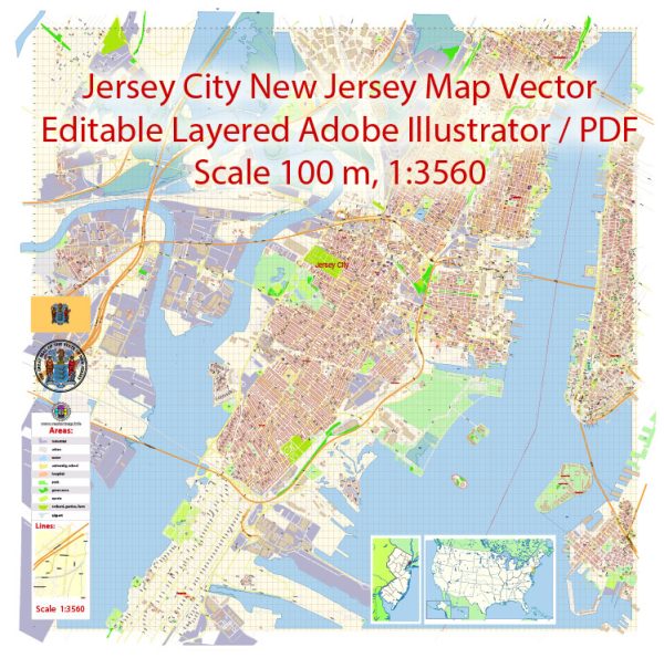
Jersey City, New Jersey, is a diverse and vibrant city with a well-developed network of streets and roads. We provide you with the most accurate and up-to-date vector maps in Adobe Illustrator, PDF and other formats, designed for editing and printing. Please read the vector map descriptions carefully. Some of the principal streets and roads in different neighborhoods of Jersey City:
- Journal Square Area:
- John F. Kennedy Boulevard: This major boulevard runs through Journal Square and connects various neighborhoods.
- Sip Avenue: A significant east-west street intersecting with JFK Boulevard and serving as a major transportation corridor.
- Downtown Jersey City:
- Newark Avenue: A bustling street with shops, restaurants, and cultural attractions.
- Grove Street: Known for its PATH station, Grove Street is a central hub in downtown Jersey City with shops and dining options.
- Montgomery Street: Another important east-west street in the downtown area.
- Liberty State Park Area:
- Phillip Street: Located near Liberty State Park and provides access to the park and waterfront.
- Greenville:
- Martin Luther King Drive: A major north-south thoroughfare in the Greenville neighborhood.
- Ocean Avenue: Another significant road running through the southern part of Jersey City.
- West Side:
- West Side Avenue: A major north-south avenue on the west side of Jersey City, connecting various neighborhoods.
- The Heights:
- Central Avenue: A prominent commercial street in The Heights with a mix of shops and services.
- Palisade Avenue: Runs along the eastern edge of The Heights, offering scenic views of the Hudson River and Manhattan.
- Bergen-Lafayette:
- Garfield Avenue: A notable street in the Bergen-Lafayette neighborhood.
- Communipaw:
- Communipaw Avenue: An east-west street that intersects with major north-south roads, providing connectivity.
Remember that Jersey City has an extensive grid pattern, and many streets are part of this well-organized layout. Additionally, transportation options include the Hudson-Bergen Light Rail, PATH trains, and buses, providing connectivity to neighboring areas and New York City. The city’s streets reflect its diverse communities and offer a mix of residential, commercial, and recreational spaces.


 Author: Kirill Shrayber, Ph.D. FRGS