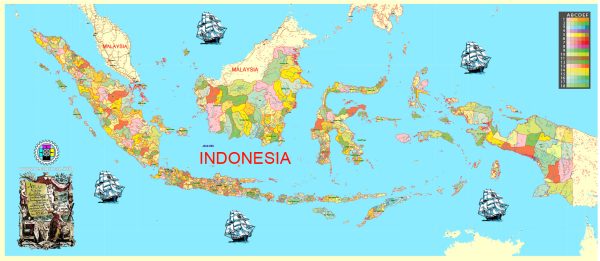
Indonesia is a vast archipelagic country located in Southeast Asia, comprising thousands of islands. The main cities and roads are spread across the various islands, with Java being the most populous and economically developed island. Here are some of the main cities and roads in Indonesia:
Java:
- Jakarta: The capital and largest city of Indonesia, located on the island of Java. It is the economic, political, and cultural center of the country.
- Surabaya: The second-largest city in Indonesia, located in East Java. It is a major port city and industrial hub.
- Bandung: A city in West Java known for its universities, technology, and creative industries.
- Semarang: Located in Central Java, it is a port city and a hub for trade and industry.
- Yogyakarta: Known for its cultural heritage, including the ancient temple of Borobudur and Prambanan. It is also a center for education and the arts.
Sumatra:
- Medan: The largest city in Sumatra, known for its diverse cultures and as a gateway to Lake Toba.
- Palembang: The capital of South Sumatra, located on the Musi River. It is an important center for trade and industry.
Kalimantan (Borneo):
- Banjarmasin: The largest city in South Kalimantan, known for its floating markets and river-based economy.
- Balikpapan: A seaport city in East Kalimantan, important for the oil and mining industries.
Sulawesi:
- Makassar: The largest city in Sulawesi, known for its port and trade activities.
- Manado: Located in North Sulawesi, known for its coral reefs and marine biodiversity.
Bali:
- Denpasar: The capital of Bali, a popular tourist destination known for its beaches, temples, and vibrant arts scene.
Main Roads:
- Trans-Java Highway: A major road network that connects Jakarta with cities across Java, facilitating transportation and trade.
- Trans-Sumatra Highway: A network of roads connecting various cities and regions across the island of Sumatra.
- Trans-Kalimantan Highway: A road network connecting cities and regions across the island of Kalimantan (Borneo).
- Trans-Sulawesi Highway: A road network connecting major cities and regions across the island of Sulawesi.
- Bali Mandara Toll Road: A toll road in Bali that connects the main tourist areas and facilitates transportation on the island.
We provide you with the most accurate and up-to-date vector maps in Adobe Illustrator, PDF and other formats, designed for editing and printing. Please read the vector map descriptions carefully.


 Author: Kirill Shrayber, Ph.D. FRGS