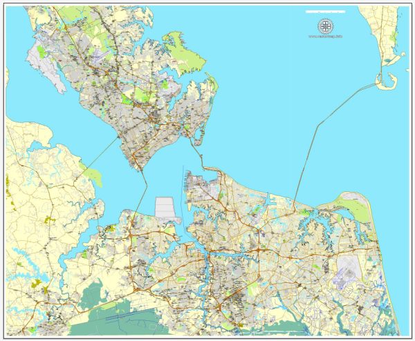
The Hampton Roads region in Virginia is known for its extensive network of waterways and railroads, which play a crucial role in the transportation and economic activities of the area. Here’s a brief description of the principal waterways and railroads in the Hampton Roads area, which includes the cities of Hampton, Newport News, Norfolk, Chesapeake, Portsmouth, and Virginia Beach:
Waterways:
- Hampton Roads Harbor:
- This is a large natural harbor located at the confluence of the Chesapeake Bay and the James River.
- It is one of the largest natural harbors in the world and serves as a major port for the region.
- James River:
- Flows through the heart of the Hampton Roads region, providing a significant water route.
- The river is navigable and has played a crucial role in the transportation of goods and people.
- Elizabeth River:
- Another important waterway in the area, flowing through Norfolk and Portsmouth.
- The Elizabeth River is navigable and has several branches, contributing to the maritime activity of the region.
- Chesapeake Bay:
- While not directly within the Hampton Roads cities, the Chesapeake Bay is a massive estuary that influences the region’s maritime trade and economy.
Railroads:
- Norfolk Southern Railway:
- Norfolk Southern operates major rail lines in the Hampton Roads area, connecting it to the broader rail network in the United States.
- The railroad plays a crucial role in transporting goods, including coal, manufactured products, and containers.
- CSX Transportation:
- CSX operates rail lines that serve the Hampton Roads region, providing freight transportation services.
- The rail network facilitates the movement of goods between the region’s ports and inland destinations.
- Amtrak:
- Amtrak provides passenger rail service in the Hampton Roads area, connecting it to other cities and regions in the United States.
- Passengers can travel to and from Hampton Roads by rail, enhancing regional connectivity.
The combination of these waterways and railroads makes Hampton Roads a vital transportation hub on the East Coast, supporting trade, commerce, and the movement of people. The port facilities, in particular, contribute significantly to the economic development of the region by facilitating the import and export of goods. The railroads complement these maritime activities by providing efficient transportation links to and from the area.


 Author: Kirill Shrayber, Ph.D. FRGS