Ottawa, the capital city of Canada, is not a major hub for water transportation due to its inland location. However, it has a well-developed air transportation system. Here’s a general description of water and air transportation in Ottawa:
Air Transportation:
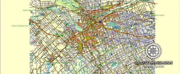
- Ottawa Macdonald-Cartier International Airport (YOW): This is the primary airport serving Ottawa and the surrounding region. Located about 10 kilometers south of downtown Ottawa, YOW is a major transportation hub with both domestic and limited international flights. It provides connections to various Canadian cities and select destinations in the United States and other countries.
- Airlines: Several major airlines operate at Ottawa International Airport, including Air Canada, WestJet, and various regional carriers. These airlines offer a range of flights catering to both business and leisure travelers.
- Facilities: The airport is equipped with modern facilities, including multiple terminals, lounges, shopping, and dining options. Ground transportation to and from the airport is available through taxis, buses, and private transportation services.
Water Transportation:
- Rideau Canal: While Ottawa is situated on the Ottawa River, which is not a major route for commercial water transportation, the city is known for the Rideau Canal. The Rideau Canal is a UNESCO World Heritage Site, and during the warmer months, it serves as a recreational waterway for boating and kayaking. In the winter, the canal becomes the world’s largest naturally frozen skating rink.
- Ottawa River: The Ottawa River does not function as a significant water transportation route for large vessels serving the city. However, the river and its surrounding areas offer opportunities for recreational activities such as boating, fishing, and other water-based sports.
It’s important to note that Ottawa’s significance in terms of transportation is primarily focused on its role as the national capital. While it does not have a major port for commercial shipping, the city is well-connected by air and road networks. For any recent developments or changes in transportation infrastructure, it’s recommended to check with local authorities or the relevant transportation agencies for the most up-to-date information.

 Author: Kirill Shrayber, Ph.D. FRGS