Columbus, Ohio, is known for its diverse urban amenities. Here’s a general overview:
- Cultural and Arts Scene:
- Columbus Museum of Art: Featuring a diverse collection of American and European art.
- Ohio Theatre: A historic venue hosting Broadway shows, concerts, and other performances.
- Short North Arts District: Known for its galleries, boutiques, and vibrant art scene.
- Parks and Recreation:
- Goodale Park: A popular urban park in the Short North neighborhood.
- Scioto Mile: A scenic park along the Scioto River, offering trails, fountains, and recreational activities.
- Franklin Park Conservatory and Botanical Gardens: A beautiful botanical garden and conservatory.
- Sports and Entertainment:
- Nationwide Arena: Home to the NHL’s Columbus Blue Jackets and a venue for concerts and events.
- Ohio Stadium (The Horseshoe): Home to the Ohio State Buckeyes football team.
- Huntington Park: Baseball stadium hosting the Columbus Clippers, the Triple-A affiliate of the Cleveland Indians.
- Dining and Culinary Scene:
- North Market: A historic public market with a variety of local vendors and eateries.
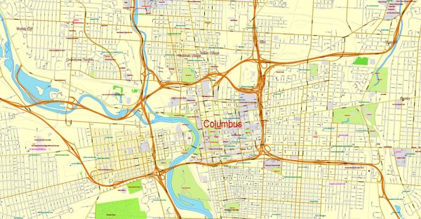
- German Village: Known for its charming brick houses and a variety of dining options.
- Short North: Offers a mix of upscale and casual dining options.
- Education and Innovation:
- The Ohio State University: A major research university with a significant impact on the city’s culture and economy.
- Tech and Innovation Hubs: Columbus has been growing as a tech hub, with various innovation centers and startups contributing to its technological landscape.
- Shopping:
- Easton Town Center: A large shopping and entertainment complex with a mix of retail stores, restaurants, and entertainment options.
- Polaris Fashion Place: Another popular shopping destination in the northern suburbs.
- Transportation:
- COTA (Central Ohio Transit Authority): The public transportation system connecting various parts of the city.
- Bike-Friendly: Columbus has made efforts to become more bike-friendly, with bike lanes and trails throughout the city.
- Community Events:
- Columbus Arts Festival: An annual event showcasing visual and performing arts.
- Ohio State Fair: Held in Columbus, featuring agriculture, entertainment, and various attractions.
Columbus is a dynamic city with a mix of historical and modern elements, offering residents and visitors a diverse range of cultural, recreational, and culinary experiences. For the most current and detailed information, it’s advisable to check more recent sources or local websites.

 Author: Kirill Shrayber, Ph.D. FRGS