Tampere, located in southern Finland, is the third-largest city in the country and has a rich history of urban development. The city’s growth and development have been influenced by its geographical location, natural resources, and industrialization. Here is an overview of Tampere’s history of urban development:
- Early Settlement:
- The area around Tampere has been inhabited for thousands of years. The first signs of human activity date back to the Stone Age.
- The Tammerkoski rapids, connecting two lakes (Näsijärvi and Pyhäjärvi), played a crucial role in the city’s development. These rapids provided hydropower, which later fueled the growth of the city’s industries.
- Industrialization:
- The 19th century marked a significant period of industrialization for Tampere. The Tammerkoski rapids were harnessed to power mills and factories, making Tampere a major center for the textile industry.
- The industrial growth attracted a large influx of people to the area, leading to the expansion of the city. Workers’ housing and industrial buildings were constructed along the riverbanks.
- Development of Public Services:
- As the city grew, there was a need for improved infrastructure and public services. Tampere saw the development of schools, hospitals, and other essential services to meet the needs of the expanding population.
- Cultural and Educational Institutions:
- Tampere has a strong cultural and educational heritage. The city is home to institutions such as the University of Tampere (now part of Tampere University), which contributed to the intellectual and cultural development of the region.
- Expansion and Modernization:
- In the mid-20th century, Tampere continued to expand, and urban planning became a key focus. The city underwent modernization efforts, with the construction of new residential areas, infrastructure, and commercial spaces.
- Post-Industrial Era:
- Like many industrial cities, Tampere faced challenges as traditional industries declined. However, the city successfully transitioned into a hub for technology, services, and education.
- The historic industrial sites were repurposed for cultural and recreational use, contributing to the preservation of the city’s heritage while adapting to new economic realities.
- Contemporary Development:
- In recent years, Tampere has continued to evolve as a dynamic and innovative city. Urban development projects focus on sustainability, technology, and creating vibrant public spaces.
- The city has invested in public transportation, parks, and cultural initiatives to enhance the quality of life for its residents.
Overall, Tampere’s history of urban development reflects a journey from an industrial powerhouse to a modern, diverse city with a strong emphasis on technology, education, and cultural richness. The integration of historical elements with contemporary developments has contributed to Tampere’s unique identity in Finland.

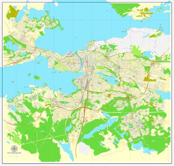
 Author: Kirill Shrayber, Ph.D. FRGS