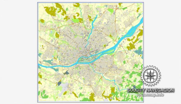
Nantes, a city located in western France, has a rich history of urban development that spans centuries. Here is an overview of key periods and aspects of Nantes’ urban development:
- Roman Period (1st Century BC – 5th Century AD): Nantes, known as Condevincum during the Roman era, was an important port and trading center. The city benefited from its strategic location along the Loire River, which facilitated commerce and communication. Roman infrastructure, such as roads and bridges, played a significant role in shaping the early urban landscape.
- Medieval Nantes (5th Century – 15th Century): During the medieval period, Nantes experienced growth as a trading hub. The construction of the Castle of the Dukes of Brittany, starting in the 13th century, marked a significant architectural development. The city’s medieval architecture and narrow streets reflect its historical importance as a commercial and political center.
- Renaissance and Enlightenment (15th Century – 18th Century): The Renaissance brought about changes in architectural styles, and Nantes saw the construction of elegant buildings and squares. The city continued to prosper through trade and maritime activities. The Enlightenment period influenced urban planning, with an emphasis on rational design and public spaces.
- Industrial Revolution (19th Century): The Industrial Revolution had a profound impact on Nantes, transforming it into an industrial and economic powerhouse. The city expanded along the riverbanks, and industrial infrastructure, such as factories and warehouses, reshaped the urban fabric. The population grew, and there was an increased demand for housing and amenities.
- 20th Century: Nantes faced challenges during World War II, with some parts of the city suffering damage. Post-war reconstruction efforts and urban planning initiatives aimed to modernize the city. In the latter half of the 20th century, Nantes experienced suburbanization and the development of new residential areas.
- Contemporary Period: In recent decades, Nantes has undergone significant urban revitalization projects. The city has invested in cultural facilities, public spaces, and sustainable development. The conversion of former industrial areas into modern spaces, such as the Île de Nantes, reflects a commitment to blending historical heritage with contemporary urban design.
- Transportation and Infrastructure: Nantes has also seen improvements in transportation infrastructure. The development of tram networks, pedestrian zones, and cycling infrastructure contributes to a more sustainable and accessible urban environment.
- Cultural and Educational Hubs: Nantes has established itself as a cultural and educational center. The presence of universities, museums, and cultural institutions contributes to the city’s vibrancy and attractiveness.
In summary, Nantes’ urban development is a tapestry woven with threads of historical, industrial, and cultural influences. The city’s commitment to preserving its heritage while adapting to modern needs has contributed to its dynamic and diverse urban landscape.


 Author: Kirill Shrayber, Ph.D.