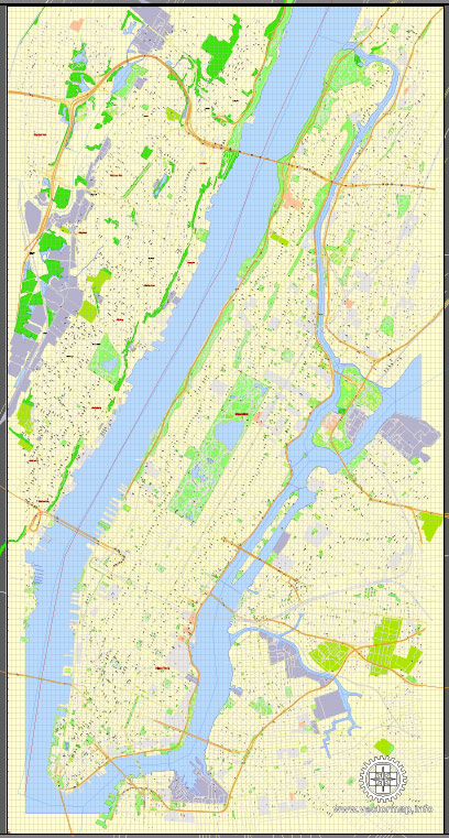
The history of urban development in Manhattan, New York City, is a fascinating journey that spans centuries and reflects the evolution of urban planning, architecture, and social dynamics. Here’s a brief overview:
- Colonial Era (1600s-1700s): Manhattan’s urban history began with the arrival of Dutch settlers in the early 17th century. The Dutch established New Amsterdam at the southern tip of the island in 1624. After the English seized control in 1664, the city was renamed New York. During this period, the city’s layout was characterized by narrow streets and a fortification wall, with development concentrated in the southern part of the island.
- 19th Century:
- Growth and Expansion: The 19th century saw significant population growth, industrialization, and immigration, leading to a surge in demand for housing and infrastructure. The Commissioners’ Plan of 1811 laid out the gridiron street pattern that largely defines Manhattan’s layout today, creating a system of numbered streets and avenues.
- Skyscrapers and Vertical Expansion: As the population increased, so did the need for space. The construction of tall buildings began in the late 19th century, with the Home Insurance Building (1870) often considered the first skyscraper. The introduction of elevators and steel frame construction revolutionized urban architecture.
- Early 20th Century:
- City Beautiful Movement: Inspired by the City Beautiful Movement, urban planners aimed to improve the aesthetic and functional aspects of the city. Projects like the construction of the Beaux-Arts Grand Central Terminal (1913) and the development of Central Park influenced the city’s design.
- Mid-20th Century:
- Post-War Development: After World War II, urban development shifted towards modernist architecture. Large-scale projects, such as the United Nations Headquarters (1952) and the construction of public housing, reshaped the cityscape.
- Urban Renewal: The mid-20th century also saw urban renewal projects like the construction of the Lincoln Center for the Performing Arts and the revitalization of Times Square.
- Late 20th Century:
- Financial District and Skyscraper Boom: The Financial District continued to be a focal point for development, with the construction of iconic skyscrapers like the World Trade Center towers (1973). However, tragedy struck on September 11, 2001, leading to a shift in focus towards redevelopment and the construction of the new One World Trade Center.
- 21st Century:
- Sustainable Development: The 21st century has witnessed a focus on sustainability and mixed-use developments. Efforts have been made to enhance public spaces, pedestrian zones, and green areas. The High Line, a former elevated railway turned park, is an excellent example of adaptive reuse.
- Contemporary Challenges:
- Gentrification: Like many urban areas, Manhattan faces challenges related to gentrification, with some neighborhoods experiencing rapid changes in demographics and rising property values.
- Infrastructure Upgrades: Ongoing infrastructure projects, such as the Second Avenue Subway expansion, aim to address the city’s growing population and improve transportation.
Manhattan’s history of urban development is a complex tapestry that reflects the dynamic interplay between social, economic, and architectural forces. The island continues to evolve, embracing its rich history while adapting to the changing needs of its residents and visitors.


 Author: Kirill Shrayber, Ph.D. FRGS