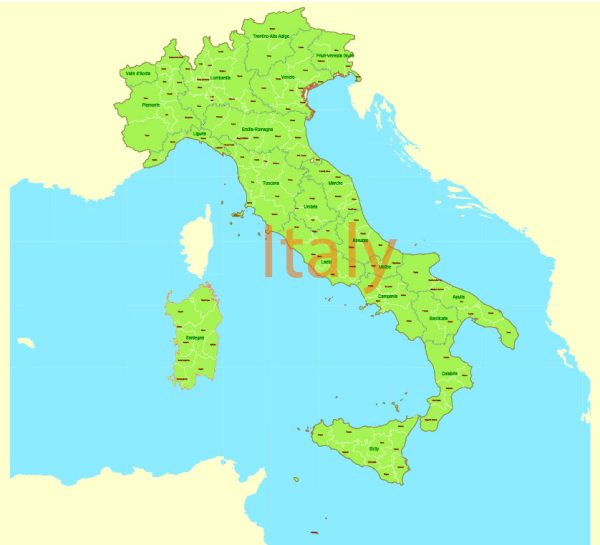
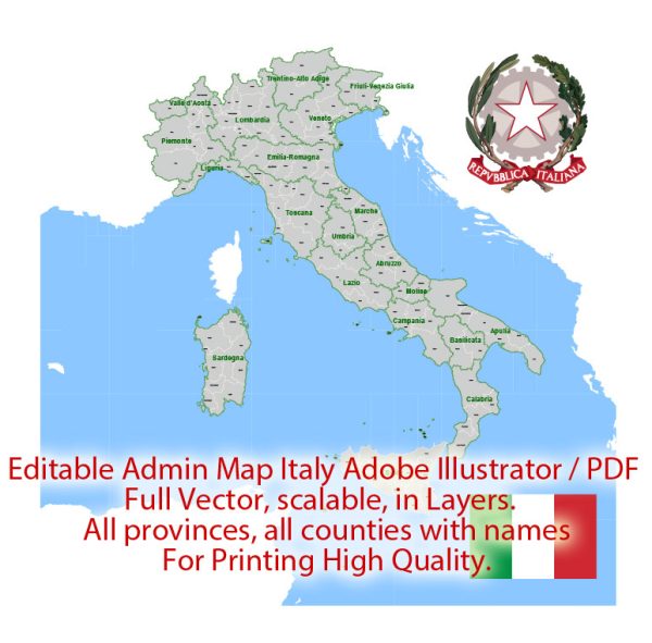
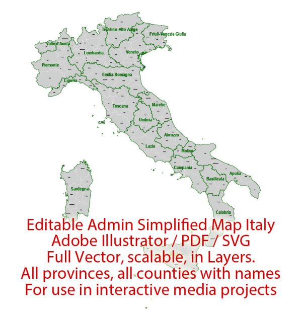
Italy is divided into various administrative territories, each with its own level of autonomy and responsibility. The administrative structure of Italy is characterized by a combination of regions, provinces, and municipalities. Here is an overview of Italy’s administrative divisions:
- Regions (Regioni): Italy is divided into 20 regions, each with its own regional government. These regions have varying degrees of autonomy, with some having special autonomous status, such as Sicily and Sardinia. The regional governments have authority over areas like education, healthcare, transportation, and economic development. Examples of Italian regions include Lombardy, Tuscany, Veneto, and Campania.
- Provinces (Province): Each region is further divided into provinces, which are administrative units responsible for various local services, including road maintenance, civil registration, and certain cultural activities. In 2015, Italy underwent a significant reform that reduced the number of provinces from 110 to 107.
- Municipalities (Comuni): Provinces are composed of multiple municipalities, which are the smallest administrative divisions in Italy. There are over 8,000 municipalities in the country, ranging from small villages to large cities. Municipalities are responsible for local governance and services, such as local policing, waste management, and urban planning.
- Metropolitan Cities (Città Metropolitane): Some of the most populous areas of Italy have been designated as metropolitan cities. These areas, which include Rome, Milan, and Naples, have a slightly different administrative structure from traditional provinces and greater responsibilities for urban planning, transportation, and other services.
- Autonomous Regions (Regioni Autonome): Italy has five autonomous regions with special autonomy arrangements: Sicily, Sardinia, Trentino-Alto Adige (South Tyrol and Trentino), Friuli-Venezia Giulia, and Valle d’Aosta. These regions have additional powers and legislative authority, particularly over cultural and language matters, education, and healthcare.
- Special Statute Regions (Regioni a Statuto Speciale): Apart from the five autonomous regions, there are two regions with a “special statute”: Molise and Abruzzo. These regions have a level of administrative and legislative autonomy that lies between regular regions and autonomous regions.
- Provincial Capitals: Each province has a capital city, which is typically the largest and most significant city within that province. These capital cities often serve as the economic, cultural, and administrative centers of their respective provinces.
The administrative structure of Italy can seem complex due to the varying degrees of autonomy and the presence of autonomous regions and special statute regions. These divisions are meant to accommodate Italy’s regional diversity and historical factors, while ensuring that essential services and governance are provided at the local level.

 Author: Kirill Shrayber, Ph.D. FRGS