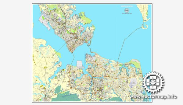
Hampton Roads, located in southeastern Virginia, is a significant hub for the maritime industry and transportation in the United States. This region encompasses several cities, including Norfolk, Newport News, Chesapeake, and Portsmouth. Here’s a description of the maritime industry and transportation in this area:
- Ports and Harbors:
- Norfolk is home to the Port of Virginia, one of the largest and busiest container ports on the East Coast of the United States. The port facilities in Norfolk include the Virginia International Gateway and Norfolk International Terminals, which handle a vast amount of containerized cargo.
- Newport News has the Newport News Marine Terminal, which is an important hub for breakbulk and roll-on/roll-off cargo, especially for military shipments and manufacturing equipment.
- Portsmouth hosts several smaller maritime facilities, contributing to the region’s overall maritime capacity.
- Shipbuilding and Repair:
- Newport News Shipbuilding is one of the most prominent shipbuilding and repair facilities in the United States. It specializes in constructing and maintaining nuclear-powered aircraft carriers and submarines for the U.S. Navy.
- The region is also home to various other shipyards and repair facilities that support commercial and military vessels.
- Maritime Transportation:
- The Hampton Roads area boasts an extensive network of waterways, including the Chesapeake Bay and its tributaries, which make it a vital location for maritime transportation and trade.
- A well-developed network of bridges, tunnels, and highways connects the various cities in the region, facilitating efficient transportation of goods to and from the ports.
- Military Presence:
- The presence of several major military bases in the Hampton Roads region, such as Naval Station Norfolk, Naval Air Station Oceana, and Joint Base Langley-Eustis, contributes significantly to the maritime industry. These bases support naval, air, and ground forces, enhancing the area’s strategic importance.
- Economic Impact:
- The maritime industry in Hampton Roads plays a crucial role in the local and national economies. It generates substantial employment opportunities and contributes to the economic well-being of the region. The Port of Virginia alone is a key driver of trade and commerce in the area.
- Maritime Education and Research:
- Hampton Roads is also home to educational institutions and research facilities focused on maritime and ocean-related studies, such as the Virginia Institute of Marine Science (VIMS) and the Virginia Maritime Association.
- Environmental Concerns:
- Given its location on the coast and its significant maritime industry, the Hampton Roads region faces environmental challenges related to sea-level rise and climate change. Efforts are being made to address these concerns through infrastructure improvements and resilience planning.
In summary, Hampton Roads is a vital center for the maritime industry and transportation, with its extensive port facilities, shipbuilding capabilities, military presence, and strategic location on the East Coast. This region plays a crucial role in both domestic and international trade, making it a key driver of economic activity in the United States.


 Author: Kirill Shrayber, Ph.D. FRGS