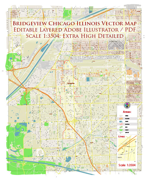
Vector Maps of the Bridgeview : a village in Cook County, Illinois, United States. It is located approximately 15 miles (24 km) southwest of the Chicago Loop. The earliest settlement in Bridgeview occurred in the 1830s, when the area was still populated by Native American groups. By the 1870s German and Italian settlers began moving into the area for farming purposes. Dutch migrated to the area by the 1920s, at which time farming began to decline; real estate and industry began to develop the area considerably. After Lake Michigan water became available to the area, the population grew significantly. The Bridgeview Community Club was founded in 1938 and became the center of local activities.
Instant download archives: royalty free, editable vector maps of Bridgeview Illinois Chicago in high resolution digital PDF and Adobe Illustrator format.
Bridgeview IL geographical dataCity Name: Bridgeview |
Small towns nearby:Alsip IL |
Large cities nearby:Chicago IL street map |
All of our editable Bridgeview Chicago Illinois vector maps are digital files,
which can be instantly downloaded in editable PDF or Adobe Illustrator format.
Objects on maps are usually divided into layers according to their types – lines, polygons, street names, object names (see map description!!!!)
Each of our Bridgeview Chicago Illinois digital maps is available in Adobe Illustrator or editable PDF format, (or on request in any other known format for the same price)
which use a vector approach to display images,
you can easily enlarge any part of our maps without compromising text, line or graphic quality,
with any increase or decrease ratio.
Using a vector graphics editor such as Adobe Illustrator, CorelDraw, Inkscape, or Freehand
you can easily crop parts of the map, add custom characters, and change colors and font attributes as needed.
We have a variety of Bridgeview Chicago Illinois vector maps with different levels of detail, from simple empty paths to highly detailed maps with roads and terrain layers.
Don’t see exactly what you’re looking for? Contact us to receive a special offer for an individual Bridgeview Chicago Illinois map for your project.


 Author: Kirill Shrayber, Ph.D. FRGS