Richmond, California
Motto(s): The City of Pride and Purpose
Location in Contra Costa County
Location in Contra Costa County
Richmond, California is located in San Francisco Bay AreaRichmond, CaliforniaRichmond, California
Coordinates: 37°56′09″N 122°20′52″WCoordinates: 37°56′09″N 122°20′52″W
Incorporated August 7, 1905
Named for Richmond, Virginia, United States
Area
• City 52.51 sq mi (136.00 km2)
• Land 30.05 sq mi (77.84 km2)
• Water 22.46 sq mi (58.16 km2) 42.71%
Elevation 46 ft (14 m)
Population
• City 103,701
• Estimate 110,567
• Rank 2nd in Contra Costa County
54th in California
• Density 3,678.94/sq mi (1,420.43/km2)
• Urban 28,038
• Metro 4,335,391
Time zone UTC−8 (Pacific)
• Summer (DST) UTC−7 (PDT)
ZIP codes
94801, 94802, 94804, 94805, 94807, 94808, 94850
Area code 510, 341
FIPS code 06-60620
GNIS IDs 1659507, 2410939
Richmond is a city in western Contra Costa County, California, United States.
The city was incorporated on August 7, 1905, and has a city council.
Located in the San Francisco Bay Area’s East Bay region, Richmond borders San Pablo, Albany,
El Cerrito and Pinole in addition to the unincorporated communities of North Richmond,
Hasford Heights, Kensington, El Sobrante, Bayview-Montalvin Manor, Tara Hills,
and East Richmond Heights, and for a short distance San Francisco on Red Rock Island
in the San Francisco Bay. Richmond is one of two cities, the other being San Rafael,
that sits on the shores of both San Francisco Bay and San Pablo Bay.
During Gayle McLaughlin’s mayoralty, Richmond was the nation’s largest city with a
Green Party mayor. Its population was 116,448 as of the 2020 census.
Source: https://en.wikipedia.org/wiki/Richmond,_California
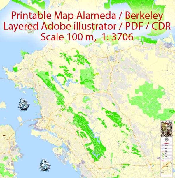
Vector Maps of the Oakland Berkeley Richmond Alameda San Leandro Albany California US for design and printing, royalty free
Instant download archives: royalty free, editable vector maps of Oakland Berkeley Richmond Alameda San Leandro Albany California US in high resolution
digital PDF and Adobe Illustrator format.
All of these editable Oakland Berkeley Richmond Alameda San Leandro Albany California US vector maps are digital files,
which can be instantly downloaded in editable PDF or Adobe Illustrator format.
Objects on maps are usually divided into layers according to their types – lines, polygons,
street names, object names (see map description!!!!)
Each of these Oakland Berkeley Richmond Alameda San Leandro Albany California US digital maps is available in Adobe Illustrator or editable PDF format,
(or on request in any other known format for the same price)
which use a vector approach to display images,
you can easily enlarge any part of these maps without compromising text, line or graphic quality,
with any increase or decrease ratio.
Using a vector graphics editor such as Adobe Illustrator, CorelDraw, Inkscape, or Freehand
you can easily crop parts of the map, add custom characters, and change colors and font attributes as needed.
We have a variety of Oakland Berkeley Richmond Alameda San Leandro Albany California US vector maps with different levels of detail,
from simple empty paths to highly detailed maps with roads and terrain layers.


 Author: Kirill Shrayber, Ph.D. FRGS